Day 64: Wellington to Island Bay

Distance travelled today: 16 km

Total TA distance covered: 1700 km

Check list: North Island ✔️

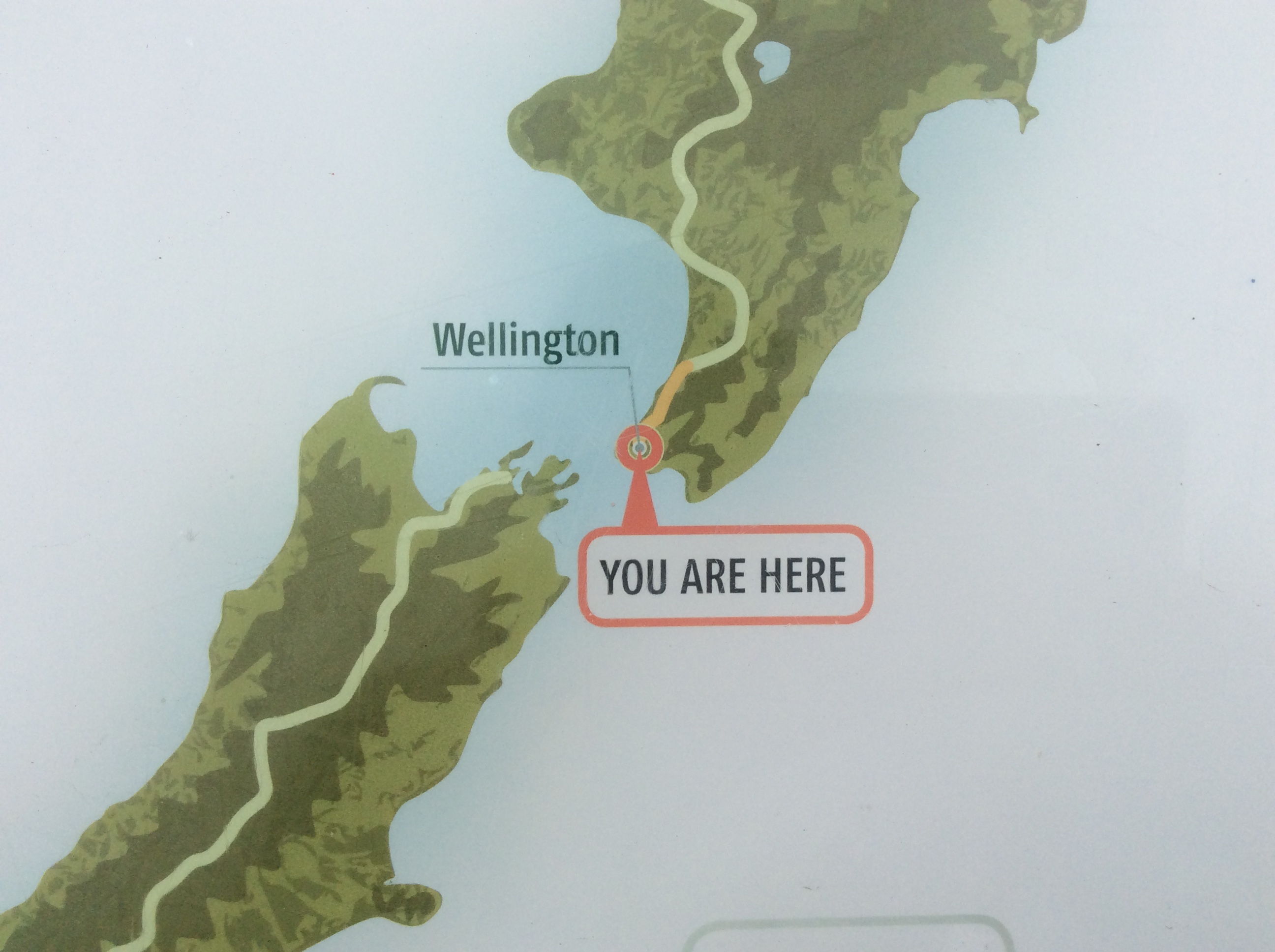
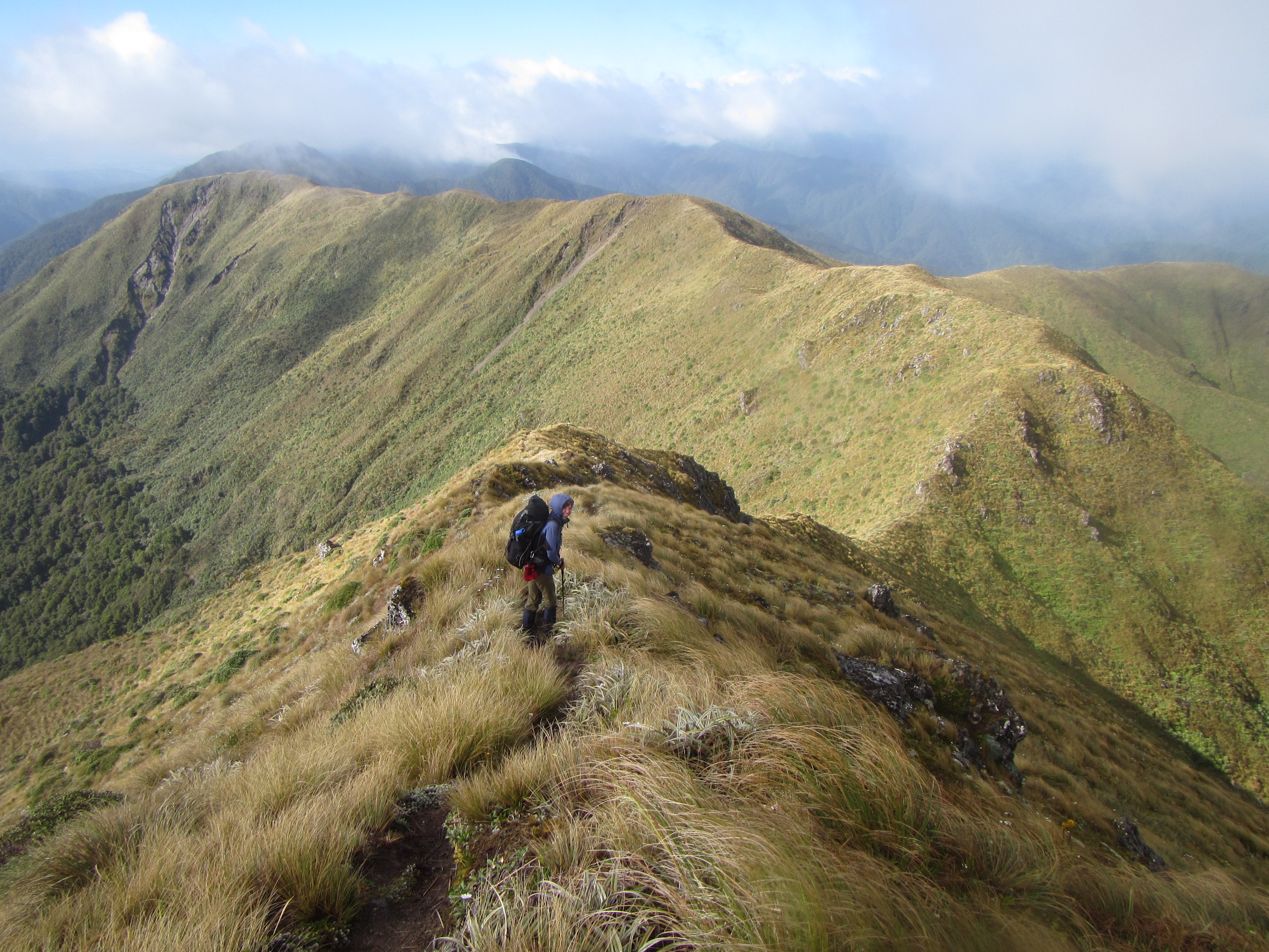
What a day! After 64 days on the trail and some 1700 km on foot (with some paddling) I’ve made it the bottom of the north island. I still remember the first day walking Te Araroa, strolling down Twilight Beach, happy to be there but thinking “OMG I’ve just walked a few kilometers and I have 3000 more to go! How am I going to do this?” The simple answer was just keep putting one foot in front of the other and you’ll get there eventually. Think big but don’t focus on the end, break it down into sections and take each day as it comes. And it was worked. One island complete and another to go. Early on in this trip I had some faint but lingering doubts about my ability to actually see this walk right through to the end but they have long since vanished and I know that barring injury I will finish Te Araroa. Reaching Wellington is a major milestone and has cemented in my mind that I will reach Bluff.  Anything is possible if you dream big and take steps, ah hum, excuse the pun, to make your dreams reality.

So back to the trail. I had 16 km to complete today to get to the official end of the North Island. A short day and I had all the time in the world so took it really easy. Leaving to hotel around 8am it was into the botantic gardens. These were really nice. Paths and gardens of every description forming a patch work of colour right in the heart of the city.

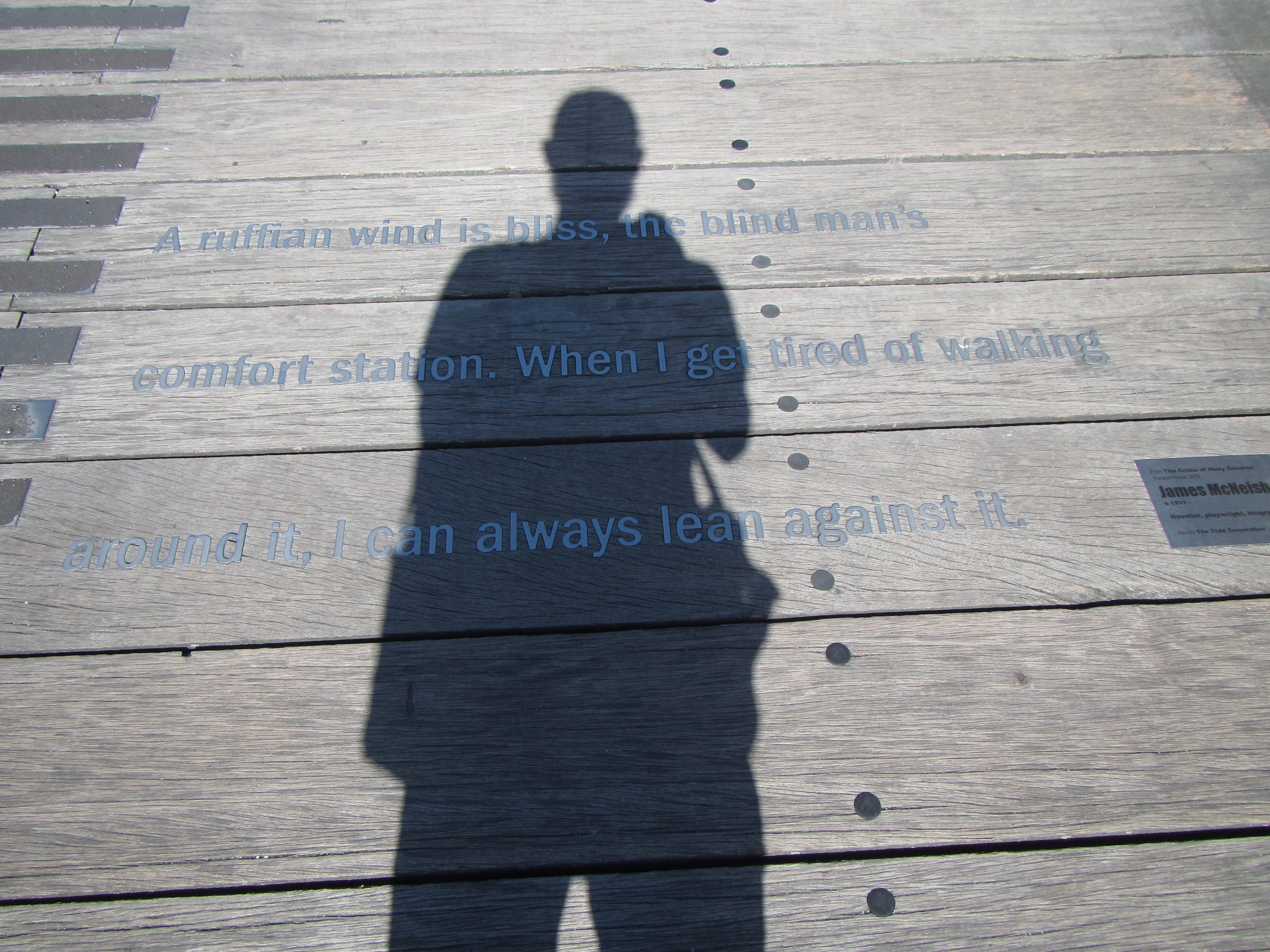
The trail moved through the city centre itself and followed newly placed plaques set into the foot paths. I wonder how many city folk walk over these each day and either have no idea what they mean or who dream of one day being able to do it themselves but have to press on into the daily grind.

image

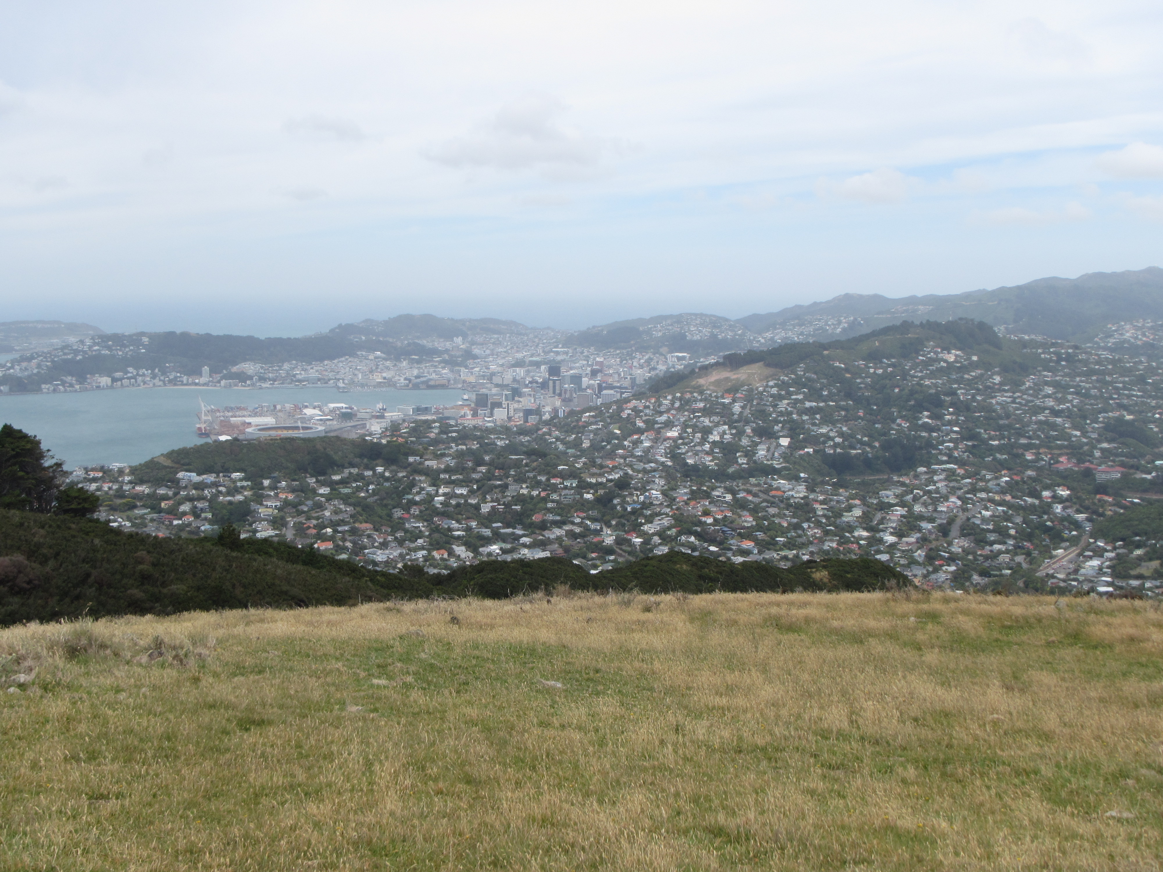
Through some of the major city streets Te Araroa leads out to the water front towards the Southern Walkway. Of all the people in Wellington who should I run into as I made my way around the water front but Sarah. I had a double take when we first saw each other. Having parted ways a few days ago in Waikanae she is staying with a friend just around the corner. Crazy. With a quick catch up and well wishes for just about finishing the north island we parted company again. There were a few words of encouragement on the pavement for me as well.

image

From the water front the trail picks up and follows the Southern Walkway all the way the end at Island Bay. It was difficult to follow at times and I lost the trail on a couple of occassions in the jungle of arrows across the Southern Walkway. There were the main Southern Walk arrows, the same coloured arrows for numerous mountain bike tracks, the same arrows again for different varients or sections leading off the walkway; as well as the usual black and white Te Araroa arrows.

I had to consult the trail notes regularly and had to look on the Viewranger app a couple of times to work out where I was after taking a wrong turn onto a mountain bike track. Viewranger has really accurate mapping of the just about all walking paths and mountain bike tracks so it didn’t take too long to get back on track.

One interesting section of the trail is right behind the zoo. You come straight out of suburban streets and onto a rugby field to be met with massive fences and signs stating “Do not climb fence. Wild animals.” with a nice picture of a lion! The trail passed straight behind the baboon enclosure as well with great views to the animals but difficult to focus photos through the double fences.

Finally, just before 12:30 pm I reached the southern coast and the last couple of kilometres to the end of the north island. I walked quick and was keen to get this over with so I could start to think and move onto the south island.

Just before 1pm I reached Te Ahumairangi Park and the plaque signalling the end of the north island. Ecstatic to say the least. I gave a big woohoo to the amusement of a few people watching over their children play in the park. One women walked over to congratulate me. She had seen the plaque many times on visiting the park but had never come across any trampers as they arrived. She had often wondered what it was all about and we had a great conversation. I never did catch her name but she was lovely and took my thumbs up photo of the end point.

Bring on the south island!!!

image


image

Day 63: Plimmerton to Wellington

Distance travelled today: 37 km (plus 2km)
Total TA distance covered: 1684 km
On a mission.
Wellington was in my sights today. I didn’t think I’d make it all the way in to town and was originally planning to get to Mt Kaukau, the highest point just outside Wellington, and stealth camp just before reaching the capital.
I woke early this morning and was out the door by 6:30am. It was looking to be a big day and I didn’t want to muck around so hit the road straight away. From Moana Lodge I had a 2km walk to get back onto the trail.

An uneventful 7km road section from Plimmerton to Porirua was straight up and the usual grumbles about road walking. I reached Porirua around 8:30am and grabbed some breakfast as the shops started opening for the day. Porirua was a bit bleak. The trail lead straight through a shopping mall precinct and the hustle and bustle of the morning motorist commute. I lost the path through the city a couple of times trying to pick up the Raiha Walkway but soon found it skirting around the back of factory buildings.

This lead out towards Camp Elsdon and the start of a major climb up to Colonial Knob. The climb was tough. Ascending hundreds of stairs and gaining around 470m from sea level soon got the sweat pouring out and I was well saturated on reaching the top. But I couldn’t really stop. A stiff breeze was blowing from the west cost straight off the  ocean and soon chilled me. Quite a bit different from the climb up, it was cold. The wind soon had me dry and I needed to pull another layer on.

Views from the top of Colonial Hill were nice. I could see all the way back to Plimmerton, Porirua below and the suburbs of Wellington down to the south. Mount Kaukau, my next major landmark was also prominent to the south but a few hours off.

Following the ridge tops down from Colonial Hill to Stirling forest was a battle against the wind. It didn’t look like easing up any. Hitting Stirling Forest it was back into the trees and bit of shelter from the wind. But very unpleasant on the nose as the stench from a major landfill below the forest kept wafting through the trees. The positive was the nicely benched and constructed trail down through the pines, with numerous switch backs to help save the knees. I took a quick drink break half way down the hill and Emily & Simon came along the trail. We played leap frog a bit as I over took them when they were having a break.

Out of Stirling Forest it was back onto the roads. Another 6km dodging traffic on the narrow and relatively busy little roads.

I was feeling peckish and needed some energy before the steep climb back up hill towards Mt Kaukau so  stopped for lunch as I reached the start of Old Coach Road.

Old Coach wound its way up onto the hill tops, following underneath the major power lines feeding Wellington. The wind was really roaring now and it at times it was a battle to stay up right.

Just before reaching the summit, I came around a corner and caught my first glimse of Wellington below. This spurred me on and I reached the summit in the early afternoon. On a windless day I imagine spending some time up here overlooking the capotal and out to seas would be time well spent, but with near gale winds it wasn’t that great.

image

At least the winds made decision making easy. At the start of the day I was intending to find a camp up here and walk into town tomorrow but the winds would have made it extremely uncomfortable. I think actually seeing the city also helped make the call to push on into town.

I still had another 13km to reach the city centre and wasn’t sure I could make it but was determined to press on and see how far I could get. First though, I had another 2km on the exposed ridge tops before descending. The wind was horrific and I reckon I could have leaded back and it would have kept me upright. It was a battle for sure. Stronger than what we had experienced over the Taraua’s. It was knocking my walking poles about and a couple of times blew me right off the track into the scrub. Great decision not to stay up here.

Finally at the end of the end of ridgeline the trail continued straight down into the outer suburbs of Wellington. Meandering through suburban streets was wierd and there were quite few odd looks at the silly bloke walking through streets with a backpack and walking poles. One fella asked me if I was going skiing.  The 4 kilometres or ao through suburbs and urban parks was playing games with me, climbing up high then straight down and climbing up steep roads again as Te Araroa followed the Northern Walkway. The trail wound all over the place and it was difficult to get my bearings in relation to what direction of the compass I was on but I guess this is Te Araroa giving us a feel for the nature of the streets and housing in suburban Wellington. It wouldn’t be an easy place to navigate in a car either.

Soon enough I reached Trelissick Park just to the north of the city centre and continued on the Northern Walkway. By now time was getting away and my feet were feeling the 34 kms already walked. Seeing the city up close and from a high vantage point spurred me on. There would be no camping tonight and I definatley had another 3km in me to reach the city limits.

image

I kept plugging away for the final 3 km until hitting the wall and St Mary’s road, just outside the botantic gardens. I was spent and realised I wouldn’t make it all the way into the city today. As it happened though I found a nice pub 100m off trail which had a vacancy and I grabbed it.

It was a massive day but I was eleated. I’d reached Wellington a day earlier than expected. I now had plenty of time to complete the trail to the bottom of the north island tomorrow and wouldn’t have to cram in the walk and trying to get food drops organised for the south island, on what was supposed to be a two day break in Wellington, my first two day break since beginning in mid November. I would finish the north island tomorrow.

image


Day 62: Waikanae to Plimmerton

Distance travelled today: 37 km (15 km by train, 22km walked)

Total TA distance covered: 1647

One day closer to Wellington.

Easy day today. I woke early. I can’t help it these days. Try as I might, I just can’t seem to sleep in past 6:30am. I got up trying to be quiet and not disturb Sarah. Having packed last night all I needed to do was jump in the shower get dressed and get going, grabbing breakfast on the way. But Sarah woke after a well earned rest and make me a farewell coffee. Thanks matey. You took on an awesome challenge in the Tararua’s and came out on top. You should be chuffed at tackling one on NZ’s toughest ranges in the company of seasoned campaigners who thought it was hard.

There are never goodbyes on the trail, only see you laters. So with a quick send off it was time to hit the road again. It was really quick walking today. From town I followed the trail onto a well formed and treaded walking/cycleway along the bank of the Waikanae River towards the coast. A few runners, cyclists and dog walkers were about.

This lead out through an estuary walkway out towards Paraparaumu Beach. The last beach to walk until nearly reaching Bluff some 1400km away on trail. Kapiti Island loomed large on the horizon as I walked through the estuary, emerging onto the black sands of the beach.

image

image

The tide was out and again made for easy, fast walking. Not much to tell of this section though. I was getting peckish by the time I reached Raumati Beach, 5km down the sand and headed inland to find a coffee shop and breakfast. The first one I walked into I met up with Emily & Simon and joined them in tucking into a tasty helping of bacon, eggs and latte.

Parting ways I continued on. By this time the tide was coming in and walking along the beach proved difficult. Too much rock hoping on large boulders for my liking so I followed the nearby roads around.

image

My aim for the day was reaching Paekakarik with a view to staying at the only backpackers in town. I had cell reception and phoned ahead, receiving only message bank. I left a message and my number and pressed on, walking through several coastal parks towards town. It was around 1:30pm when I reached town but getting to the backpackers it looked to closed up for Christmas. Decorations still hanging on the door, the grass long, no body was around.

So what to do? Too early in the day to finish walking and I wasn’t going to back track to the holiday park. The problem was the next section between towns was mostly on roads, State Highway 1 for the most part and I wasn’t prepared to walk this. I found a coffee shop, ordered some lunch, a nice smoked chicken salad, and pulled out the ipad to assess my options. It seemed to be all road walking or paths next to major roads all the way to Porirua. A train line ran between the towns and I knew there to be a nice backpackers at Plimmerton, the Moana Lodge. The train option looked good.

Soon after ordering Emily & Simon arrived and we regrouped to enjoy more food. Trampers hey… always hungry. I’ve lost a lot of weight already on Te Ararua. I haven’t weighed myself so not sure how much but I think I need to buy new pants.

A quick train ride later and I found myself at Plimmerton and booked in at Moana. 22 km by foot and 15km by train and I’m one more day closer to Wellington. Nothing for it but to enjoy my chip n chups while watching the setting sun nose dive over the calm waters of Karehane Bay. The simple pleasures….

image

Day 61: Otaki Forks (Parawai Lodge) to Waikanae

Distance travelled today: 24 km

Total TA distance covered: 1610 km

Out of the Tararua’s.

Distance wise, another long day. Not much to write though. I don’t think I even took any photos. Today was just going through the motions to get off the range and into town.

It was just us at the hut last night. A major land slip blocked car access into this area quite a while ago and this usually popular summer holiday destination was deserted. Access has not yet been restored.

From Parawai Hut we had to cross over the Waiotauru River on another swing bridge and follow the road for a couple of kilometres before climbing. A steep climb that got the heart pumping and had me saturated in sweat by the top. 350 metre gain over 800 metres. At least the track was switch backed and not straight up and down.

The major feature of the day was Pukeatua, an 800m hill that we had to climb over, some 5 kilometres away. Most of the major climbing was done for the day and the trail lead up and down along the main ridge line. I think Sarah was determined to make town today and she set a cracking pace. The ridge was ok. Quite a bit a of mud to get through but not too steep.

On reaching Pukeatua I found 3G reception and had a look at what accommodation was available in town on my ipad as wecwere yet uncertain wherecwe might be staying. There wasn’t a lot. No hostels, a property to pitch a tent a couple of kilometres out of town and a holiday park about 4 kilometres out of town. If we reached town today, which was the intention, we would be staying in town itself, close to food and beer, and transport for Sarah tomorrow, not staying out of town and having to walk in and out.  I found a hotel an booked a twin room.

On top, Hokey Pokey & Slips met up with us and we all started the descent down. Those two are always chatty and it was great walking together. Conversation always makes the walking easier.

The climb down was steep and starting to bring back memories yesterday but it wasn’t as long. A section passed through private property and was really well constructed. The private was a muxture of native bush and some pine plantation. I could smell the pines before we got to them. This trail stood out as the perfect descent trail for mountain bikes, pity we were on foot.

Just after 1pm we finally reached the end of the trail and came out at a river, where we had lunch, sitting in the shade. Having walked 15km already there was another 10 km to go on bitumen into town. Just across the other side of the river was a carpark with quite a few cars, indicating that lots of people use the local area and many of them would we travelling back into town.

We unanimously decided that if we could get a hitch in we would take it but it would difficult with four. Hokey Pokey & Slips went on ahead and managed to score a ride in the first 100m from the car park. Lucky. For Sarah and I it was the road at least for now.

Around 500m down we road an old fella pulled up and offered us a ride for 4k down the road to a property he was visiting. We took it. 4 kilometres closer. Turns out the old fella was a beekeeper off to collect his hives. He is also the property owner of the section of trail that we passed through with the pines. I thanked him for allowing access and he was more than happy. Having constructed the track he was happy that it was being used. I told him, without a lie, that it was some of the best trail we have walked on.

Dropping us off we still had quite a ways to go, another couple of hours walking on bitumen roads to Waikane. I couldn’t get a ride and just walked.

Reaching town we were buggered. I desperately wanted a coffee but it didn’t look like there was much around. Dropping packs under the shade of a tree in a park I pulled out the ipad to locate where out hotel was and saw that there was meant to be a coffee shop close by. Where was it? Apparently right acrosss the right. And so it was, a car parked in front covering our view of the sign on the fence. No decision making required, we picked up packs and headed straight over.

Coffee’s done we walked up the main drag on the way to the hotel scoping what might be open for dinner. There was talk right through yesterday and today of burgers, chips and a dark porter beer. We saw a pizza place and passing it ran into Slips & Hokey Pokey inside waiting on there order. We would come back here later for dinner and run into Jurgen walking back to his camp with fresh groceries for a big cook up. The priority for now was a hot shower. On to the hotel it was.

Day 60: Nichols Hut to Otaki Forks (Parawai Lodge)

Distance travelled today: 18km (11 hours)

Total TA distance covered: 1586 km

One foot in front of the other.

Thankfully the rain ceased overnight and the wind dropped considerably. When we all woke, which was early, given the long rest yesterday, the wind had virtually disappeared. As was bound to happen though, on gearing up for the day, it picked up again was people started to exit the hut and commence the day. No where near what we experienced yesterday but a stiff breeze carrying a chill through the air.

There is nothing quite like putting on clammy, damp clothes on a cold morning. I’ll never get used to it, especially wet socks. Nothing dried overnight and there was no choice. I needed to keep my thermals packed well and dry, so damp everything it was. Once on though it didn’t take long for them to at least warm up with some body heat trapped beneath the shell layer. Merino clothing is awesome for retraining some warth when damp and I was thankful that I’d taken my Icebreaker’s along for the ride (un-apologetic sponsor plug, Icebreaker clothing is awesome).

On leaving Nicols hut there was some cloud about but it looked to be breaking up. As we climbed from the hut to the main ridge line the wind was cold and I found I needed my gloves for the first time on this trip. Perhaps an indication of what the south island may bring and dually noted for my gear changes coming up in Wellington. Views of the climb up the ridges to the summit of Mt Crawford came and went in the cloud.

image

We had a long day ahead and were straight into it with the 200m climb up to Mt Crawford across exposed ground. The climb looked big viewing it from below but I found the trail climbed at a nice easy grade. Sometimes its hard to gauge such things, as everything looks big over here, and without anything to give perspective it all looks grand. Occasionally we could see the pairs of the other TAers silhouetted on the ridges and it became clear that the climb up wasn’t so bad after all.

Battling the wind we made our way up, eventually topping out on the summit to stunning views down to the hut, across the main range and the ridge line we needed to follow down to the Otaki River. Of course we took the customary selfie on top and tucked into a snack to keep energy topped up but the wind was cold on the summit and was no place to linger for long. With sweat on the way up stopping for more than a few minutes was asking to be chilled. The views were grand and we could see McKayla and Shania about 15 minutes starting to descend.

image

image


Now the climb down was going to be steep but I had no idea just how long and protracted it would be. A knee killer to be sure. We started down, entered back into the trees, took of shell layers and continued down and down and down. Forever it seemed. We had around 1000 metres to descend over 4 kilometres. It pained Sarah and brought back memories of Pirongia for me, although without the shin deep mud to content with. The grade was harsh. I can’t quite remember how long it took but somewhere close to 2.5 to 3 hours.

image

By the time we reached the bottom of the valley we were both knackered. Walking along the flat of the river was heaven but short lived. We had a swing bridge to cross to get over the Otaki River and still had a ways to go to reach Waitewaewae Hut (pronounced YTYY) for lunch. How thankful we were to reach the hut. A pity we were not staying. I fell in love with YTYY Hut. The perfect little hut in a great location. I thought I could easily move in and live it.

image

But the day wasnt over. We had continue on to reach the Otaki Forks. After lunch with McKayla (Hokey Pokey) and Shania (Slips) we had a look at the trail notes and they seemed to indicate that there was a lengthy section where the trail was in Saddle Creek itself. We were looking forward to this and it would give Sarah some exposure to all the different types of terrain that the Te Araroa traversed. But as it happened, on approaching the creek we ran into a trail sign indicating that there had been some major slips along the creek and we were to follow a newly cut track to get around this section to the south. This was the first any of us had heard about this and the new trail was not indicated on any maps we had. The hand written sign indicated Otaku forks was still another 3 hours away. Great. Just what we needed.

The new track was a sidle track and was terrible. Over rough ground, rocks, longs and it climbed. We have no idea where it was going to take us other than eventually to Otaki. It took us uphill, down hill, across multiple streams and seemed to take forever. The bonus was that stream crossings were all great. Perfect little mountain streams with clear running water in shaded gullies.

This section of trail was wearing thin on me and I could only imagine what Sarah was thinking. It had my cursing in multiple spots. Eventually it lead back to the original trail, a perfectly graded old tram track running on the contour. Surely the new trail could have brought us back onto this much earlier. Oh well. What is done is done. We had got through but it was turning out to be a big day and the most physically demanding day that Sarah has experienced. She confided that there was some major inner dialodge occuring along this section trail involving all of the swear words you can think of.

Along the tram track we still had a good 3 km to reach our destination for the day Parawai Lodge. Not sure what the difference between a DOC hut and a lodge is. None it would seem. We resolved to smash it out and just get the day done with finding some reserve energy to put one foot in front of the other. It is amazing what the body can do. We walked fast on the tram track where it was flat. Passing some of the slip damage I could appreciate why a new track was cut. The slips were massive and would have washed away thousands of tonnes of soil. The final descent down to the river lead us to another swing bridge over the Otaki River again. From here we had another long kilometre to the hut. Glade to have the day over and done with. Phew!!

Day 59: Dracophyllum Hut to Nichols Hut

Distance travelled today: 5 km

Total TA distance covered: 1568 km

Gale wind and torrential rains.

It rained overnight. We knew it would and had a good grasp on the forecast. The day was to start with winds around 30km quickly rising to gales around noon and severe gales in the vacinity of 140km/hr in the afternoon on exposed alpine peaks; a drizzle of rain in the morning and expectng up to 80mm of rain by midnight; before clearing tomorrow morning.  There was absolutely no chance of even dreaming of crossing the high ridges of Mount Crawford today. We would have to wait until the rain stopped and the wind died down.

Dracophyllum Hut was no place to linger. A tiny two bunk hut with very little room to move. A day holed up in there and we would go stir crazy. Besides staying here for an extra day would ajust dd additional distance onto the alpine crossing making for a massive day tomorrow when we did get a chance to cross. We made the easy decision for a very short day and travel onwards to Nichols Hut, 5 km away.

The wind was up but nothing, near gale. Still strong enough. Perhaps 30km an hour. Under the trees it wasn’t too bad and by the time we were on the move the rain had all but ceased. Rain drops fell think from the tree canopy knocked down by the wind.

For the most part the four hour walk from hut to hut was in amongst the trees. A tangled mess of beech, thickly coated in moss from ground level, up trunk and covering every limb. I have never seen so much moss. A huge variety of types covering everything on the ground. Thick mats sprawled over rocks, root and fallen trees. This is the forest setting for all childhood fairytales. Dark but fascinating all the same.

image

The trail stayed true to the major ridgelines, dropping down into saddles and ascending up again. We were making good time which was great as today was no day to dawdle.  While the forecast showed 50mm of rain by 3pm this was the total up until 3pm and it was bound to start sooner or later. As we walked the wind increased. You could hear it pick up as it funnelled up gullies from the west, sending streams of clouds bolting between the trees in front of us.

We had one open section of ground to cover enroute to Nichols Hut, across Kelleher Hill, where the trail left the shelter of the trees and crosses an exposed alpine peak. It was here we first really felt the wind. Exiting the trees it belted into us like a freight train from the side. It was nasty business and had both Sarah and I scrambling to stay upright. We knew it was only a short section before diving back into the trees and pushed on every so carefully trying to keep both feet on the ground and not be knocks off the top. Exhilarating stuff to be sure.

Back into the relative safety of the trees for the next 3km for now. I say relative safety as we were half expecting the trees to start uprooting as their canopies were buffeted by the now extremely high winds, threatening to tear the shallow rooted trees from the ground. We’d walked through quite a bit of wind fall yesterday. I’d estimate the winds now 60km/hr plus, doubled from this morning. Walking over a coule of rooty sectioms you could feel the ground move under foot.

As we neared Nichols Hutt with less than 1/2 a kilometre to go the rain started. Easy at first but by the time we left the trees for the final push to the hut we were well out in the open. No tree over. The rain came in side ways thick and fast. Painful as it hit the hands and face, pummelled in on the gale winds. Immediately drenched from head to toe, wet weather gear made no difference. Too late now to even contemplate putting on water proof pants. To stop now and open a pack was to invite a drenching of anything left exposed. We couldn’t stop and charged for the hut. Fighting the wind to stay upright with every step over the last hill top. It was easier for me to see without my glasses on as the rain spattered glass and fogged lenses clouded my vision, and I can’t see shit without them normally. Shouting over the wind, Sarah spied the roof of the hut a short distance away. By this stage the track had turned into a river.

We reached the shelter of the hut to find 6 other TAers bunkered down – Jurgen, McKalya, Shania, Steffen, Emily and Simon. Aiming to keep the inside of the hut dry we had no option but turn our backs to each other outside the hut door and strip to the bone to change into warm, dry clothes.

Reachng the hut was well timed. We spent maybe 15 minutes in full rain and wind. I would not want to experience the upper reaches of this range in such condition. To do so would be putting your life at risk. On entering the comfort and safety of the hut, the wind and rain increased to crazy levels. Rain smashing down sideways into the hut and at times the wind rocking the hut sideways, easily felt through the floor boards and walls, threatening to send it off its foundations. Quite a few times during the afternoon all 8 of us would simultaneous say “Whoo!” as the wind buffered the hut from all flanks, half expecting some of the roof to lift or windows be blown inwards.

Nothing to do but settle in, get comfortable and sit it out. So the rest of the day was spent killing time; catching up the other hikers to see how their adventures had been going, reading and writing. A long half day in a crowded hut, on a wet day, trying to make the time go by is no easy feat.

All the bunk space was taken and I secured a corner of floor space to call home for the night.

Day 58: Waiopehu Hut to Dracophyllum Hut

Day 58: Waiopehu Hut to Dracophyllum Hut

Distance travelled today: 12 km
Total TA distance covered: 1563 km

Ups and downs.

Over breakfast there was more talk of gear with Don and Jane. As I was packing up my gear there were a lot of questions about what I was carrying for such a long walk. Being the gear junkie that I am, I was more than happy to oblige. With a farewell photo we were off.

The cloud rolled in early this morning, racing up the hills from the coast below. The views we were treated to yesterday had all but disappeared so off into the clouds we climbed. Straight away there was a steep climb up to a memorial beacon dedicated to a tramper who had perished here some time ago.

image

The terrain continued to follow the ridge line, continually taking us uphills and down to small saddles before continuing the climb up. Taking out time we walked through more awesome beach forest, heavily covered in moss, ticking off the major points on the track including Gable Track junction, climbing Dora Ridge, Butcher Saddle and another track junction. All junctions were signed, pointing us in the right direction.

Just before noon we got to Te Matawai Hut and decided on an early lunch. The trail register was full of other TA trampers I knew who has passed through in previous days and quite a few who stayed here last night.

From Te Matawai Hut we had a fair climb ahead, exiting the trees and climbing into the open alpine ridges, the highest point Pukematawai sitting at 1440 metres. Out of the trees the cloud started to clear and by the time we were half way up the ridge we had awesome views. The wind was out in force. We passed a couple travelling in the opposite direction and they informed us that our destination for the day was a very small hut with only two bunks. I had read this in the trail notes but it didn’t really click that two bunks equals exactly that, enough space for two people to stay. Sounded more like a bivouac that a hut. Hears hoping that no one else was there as there is generally not many good sites for tents up high; rain and wind were also forecast to increase overnight going into crazy conditions tomorrow.

We hit the top of Pukematawai and had to shelter from the wind on the lee side. It was around maybe 30km/hr and bitterly cold. From the top we had clear views of the climb we had just completed and could see both Waiopehu Hut in the distance and the red roof of Te Matawai Hut down below. We also had a great view of the ridge we needed to follow for the next 4 kilometres, almost 3km to go above the tree line before getting back into the shelter of the trees and to Dracophyllum Hut.

The afternoon was wearing on and we were very keen to reach the hut. More ups and downs and the kilometres seemed to drag on. Day two is always tough on any tramp and I think Sarah was starting to feel it in the legs.

After what seemed like an age we reached the hut and yep, its tiny, one bed and a bunk overhead, not much room to move around. We didn’t care and were just glade to have got there. No one else around so it was all ours for the night. We were both knackered. And I’m thinking if I’m tired, how is poor Sarah feeling? I’m sure she was asking “What have I got myself into. Another 4 days of this? OMG.” She did great.

Once sorted at the hut a bit and changing into warmer clothes all we could manage to do was cook up some dinner, jump in sleeping bags and read for a while before sleep quickly took hold.

image

Day 57: Palmerston North to Waiopehu Hut

Distance travelled today: 74 km (bus to Levin, tramping 19 km)
Total TA distance covered: 1551 km

A little cheating.

We ended up going with the Levin option. With a section of trail closed just after Scotts Road due to logging and wanting to minimise the amount of food that Sarah needed to carry without resupply, we opted for a bus from Palmerston North to Levin. I didn’t want to punish Sarah with 7 or 8 days hard tramping so I skipped a section. It would have been possible to walk a day of trail from Palmetston North but with no exit, I’d have to back track, wasting another day; then there was the closed section; and one day from the next access point to Levin. I knew the Tararua’s would be hard and the weather not looking great, with the possibility of having to wait a day or two on the range for weather to clear. So having Sarah loaded with 7 days of food was enough. We jumped on the bus for the half hour ride to Levin.

It was a bitumen from town towards the trail head and we had around 7 or 8 kilometres to get in before hitting any actual trail. We were making fairly good time having only started walking from the bus at around 10:30am but it was looking to be a long day and our sights were set on Waiopehu hut.

Around 3 or 4 km from the trail head a group of section hikers doing a car shuttle saw us and offered a ride to the trail head. We gladly accepted. The sun was out and it was hard walking on the road.

After a little lunch next to the Ohau River we were on our way, only a kilometre to go from Gladstone Rd along Poads to the carpark. We signed the trail register and were on the way. Initially the trail wound through private paddocks, crossing the odd stile and hitting the forest edge around 1 kilometre in. From here it was mostly uphill, 8 kilometres to the hut gaining 800m in elevation.

It was probably a bit of shock to Sarah’s system, carrying a fully ladened pack for the first time in a long while, having already completed quite a few km on roads and now hitting a trail that looked to go straight up. It was hot, sunny and very humid. But she did really well! Frequent drink breaks were the order of the day and it was good to go at a bit of a slower pace for a change. It also highlighted just how much my fitness has improved and how fast I actually do walk these days.

Once up the slope and hitting a track junction, the grade improved a bit, not quite flat, always climbing, but easier going. The walking was great with the trail picking its way through old beech trees, with the delicate orange leaves littering the path and green all around in the canopy. Many types of ferns, grasses and mosses covering the rest of the ground. The flecks of white of fallen beech limbs being slowly covered by green as the moss encompasses whole logs and branches on the forest floor.

We met a local couple from Levin towards the top, Don & Jane and their dog little Harry. Beth their daughter was ahead and most likely at the hut warming a pot of tea for their arrival. We walked and talked for a little while, before Sarah and I charged ahead to reach the hut and end day 1 in the Tararua Ranges.

As we climbed higher, we came to a sudden change in vegetation, marking the gain in elevation towards more open alpine veg. We walked out of the trees and into stunted shrubs, flax, grasses, alpine flowers and the odd section of mud. Turning around in the now open clearings at head height was a sight to see. Views over looking the ridges we’d just climbed, the township of Levin and the coast near by. Kapiti Island stood out proud and in the far distance the northern extremes of the south island could be seen. Towards the north, the curve in coast line was obvious back up towards Whanganui and the townships I’d passed through in previous days, Fielding, Palmerston North just visible.

image

5 more minutes and we hit the hut, meeting Beth as she waited for her parents and getting settled in with a cup of tea. We spent the night talking a lot about tramping and gear with the Don, Jane and Beth and all manner of things. They were great. Although being local this was their first foray into the Tararua Ranges. They would just be staying at the hut tonight and heading back down tomorrow.

A great nights sleep in a large hut with only a few people.

image

Day 56: Palmerston North Zero

Distance travelled today: O km on trail, plenty of walking about town.

Another restfull day.

Having a rest day today was not scheduled. I had got ahead of myself and arrived in town a day early. That’s all good. I haven’t really had a two day break at all since starting at Cape Reinga so having a day off in Whanganui and another today in short sucession is great. Another opportunity to recharge the batteries, both kinds, my electronics and my body.

It was a quiet day. Another sleep in, lots of reading and eating nice food. Towns are a trap though. Too many tempations to waste money. I got to the movies and saw the new Star Wars. I grew up with the series and had to see it. For any other fans it won’t dissapoint.

Towards the end of the day as shops were starting to close, I got my freashly laundered hiking pants off the line and noticed that the stiching on both rear pockets had come apart making the pockets unless. I was going to try and mend them by hand but shot off down the street and found a clothing alteration store not far from shutting the doors. Lucky for me they were more than happy to fix them on the spot.

Then walking out into the main square of Palmerston North I bumped into McKayla, Shania and Seffen. I haven’t seen these guys since Peach Cove Hut I think, about a month ago. That was awesome. Looks like there will be some other TAers over the Tararua’s to share the adventures with.

Sarah gets into town tonight and we’ll rip into the range tomorrow. Due to logging however there is a section just out of Palmerston North that is closed for 20km. Straight out of town you can walk about 22km along the trail but then need to backtrack as it runs into the closed section and there are no side routes to take to skip around it. So we’ll look at our options tonight and decide what might suit Sarah best. We can get onto the trail via Shannon but there is then no opportunity for resupplying for 6 to 8 days. Thats a lot of food to carry for a fresh tramper. The other option is to head to Levin and get onto Te Araroa and carry 5 to 6 days food. That’s probably a bit more managable. So watch this space.

With a day off today I managed to get some more stuff planned. Accommodation in Wellington is sorted and I have a water taxi arranged from Picton to the start of the Queen Charlotte Track on the south island. This was timed well as it fits in with the Cook Strait crossing times on the Interislander.

Day 55: (Colyton) Fielding to Palmerston North

Distance travelled today: 19 km

Total TA distance covered: 1477 km

Short and sweet.

After a great sleep, generous helping of bacon and eggs and a nice coffee, Arran with the boys in tow drove me the 6 km down their road back to the trail. The kids were keen to see the walking poles come out and put into action; and watched a few minutes from the car as I continued on, turning around to big waves of farewell.

It was a relatively quick walking day today with 12km of road walking to begin the day before getting onto a mixed cycle/walking path south of Palmerston North. The road miles flew by leading out through Bunnythorpe and skirting to the east of Palmerston North. Not really much to report on for this section. The trail mostly used backroads, a short section through private paddocks and along the rail line and there wasn’t much traffic to contend with.

Picking up the walk/cycle way, the trail led around south of Palmerston North following the Manawatu River, the river givining the region its name. It was great to be off the bitumen and onto a nicer surface under foot. The path along the river was very popular with the locals. Many out and about walking dogs, going for a jog or meandering along on bikes.

On reaching the main bridge over the Manawatu it was time to leave Te Araroa and head a couple of kilometres into town. I’d be staying at the Pepper Tree Hostel tomorrow night and was hoping they could accommodate me tonight as well. For all my planning in Whanganui I forget a day somewhere or am walking too fast and found I had an extra day up my sleeve. So I’ll hang around in town tomorrow and just relax, get resupplied for the Tararua Range and maybe even go and see a movie.

Palmerston North is a decent sized town and I’m hoping to pick up some Backcountry Cuisine meals from Bivouac for the Tararua’s. My most recent food resupplies have been really heavy and with 5 to 7 days to the next resupply I’m keen to try and keep the weight down by throwing in some more dehydrated meals for this leg of the trail.

I’ll catach up with Sarah tomorrow and we’ll get her sorted with food before hitting the hills the following day.  The forecast is looking ok but maybe some rain later in the week. This will be one of the biggest true mountain ranges encountered on the trail so far. The weather is notorious for being a bit crazy on top so we’ll see how we go. Might need and extra days food just in case we get caught out up there.