
Distance travelled today: 29 km
Total TA distance travelled: 449 km
Big day today. Punched out 30km and made peace with the road.
It dawned on me today there is not much I can do about the road walking and not much I can do about the weather. I can hitch the road sections but I don’t want to do that as I aim to complete as much of the trail as possible; and I definately have no influence on the weather. The roads will always be there on this trail and the weather is constantly changing. The only thing that is within my span of control is my attitude. So I changed it.
Straight out the door it onto a 9km road walking section and it was raining. I took a deep breath and embraced the situation with open arms. I thanked the road for allowing me to increase my speed a little and thanked the rain that it was cool and that I didn’t need to slather myself with sunscreen just yet.
Most of the day was fairly uneventfull with a bitumen road turning into metalled road as I headed off the main drag and into the pines. Plenty of recent harvesting in these parts and an active logging crew working up Cullen Road. Shortly after it was onto the Brynderwyn Walkway.
I swear the TA maps are ripping us off a few kilometres each day and we awalking more than shown. Like good loggers do, they mark the road sides with kilometre markers to make communication between trucks easier and Cullen Road was no different. From the start of the metal the markers were inplace and the TA maps showed 4 kilometres to the turn off to the Brynderwyn Way. But I reached the 4km sign and my GPS showed another k to go. 1 additional kilometre that will be walked but not recorded on the official mileage. This seems to happen daily. It’s really not that hard to get the markers right in GIS. Rob – if you are reading, I’m fairly handy with GIS, if only you would find me a job with the trust.

Getting to the end of the walkway was good as I knew there were issues last year with one resident not happy with the trail, errecting razor wire and attempting to cover the trail markers. Looks like the route has been resolved as DOC have a nice gravel track that is clearly marked past this particular house. The razor wire is still on the fence but well out of trampers way. Then it down, down, down on a very steep gravel road through what is planned to be a new subdivision. This really worked the knees and feet.
The first half of the day always seems to fly by and I cover quite a bit of ground. By 13:00 I’d knocked out 2/3 of the day but the last of the day always seems to take so long and I feel like I’m going backwards. This is when the body starts to complaint and you can feel the weight of your pack. This is when I just have to slog it out and get the day done.
The trail switched into private land. Moving through paddocks was tough work. The ground is rutted from stock and the surface really uneven making walking down slope really unsteady. Good to take it slow. A few major ups and downs along the way. That’s my other moan for the day, the trail notes. They are so understated in the descriptions of the trail sections. It is much harder than what they make out and makes it difficult to gauge how long a section will actually take.
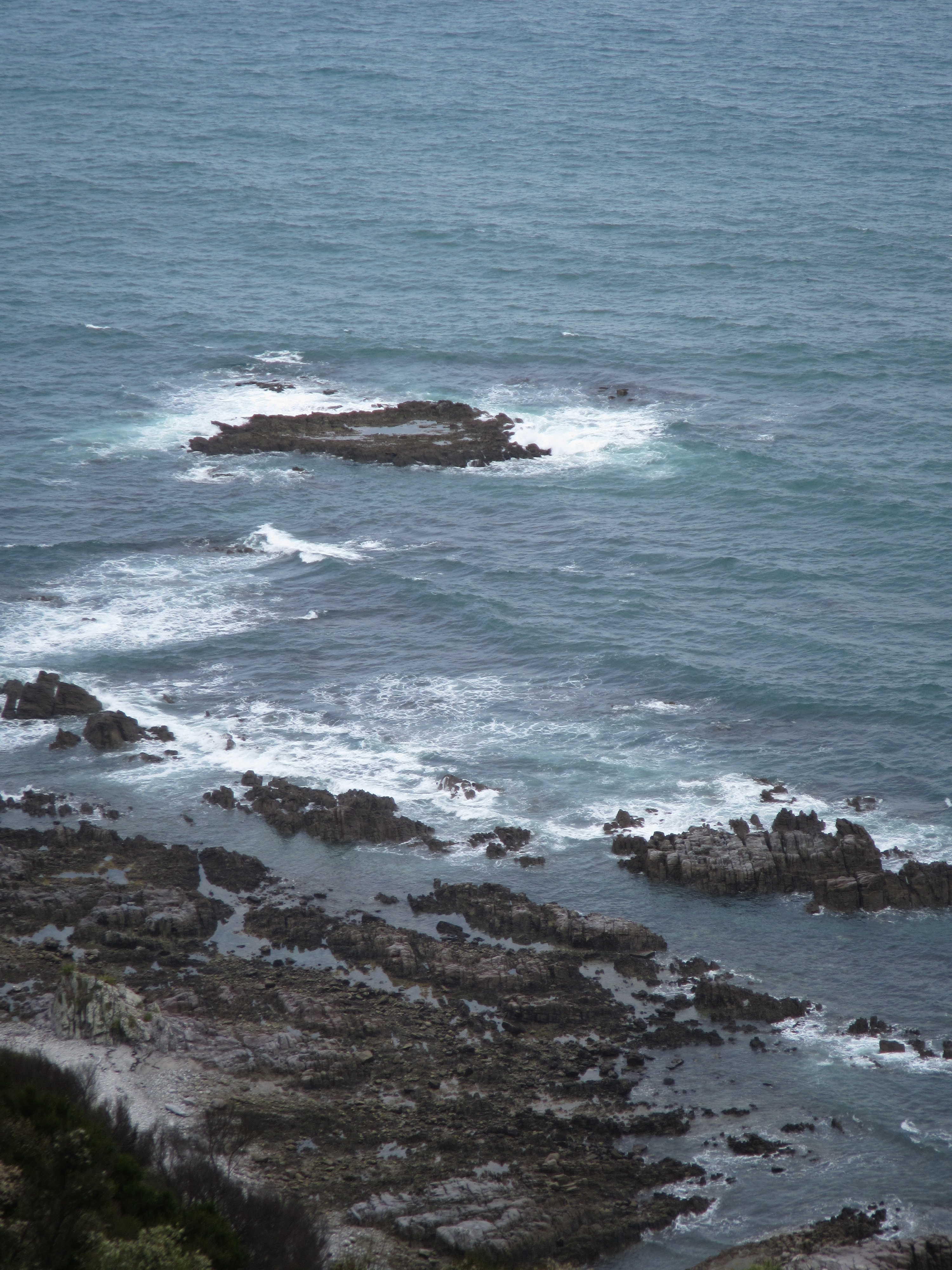
Today held the best for last. Throughout the day there was low misty cloud cover eveywhere and minimal views but getting out of the paddocks and onto the Mangawhai Cliff Walkway that all changed. I guess the sea breeze was enough to push the cloud away and opened by a vista of steep cliffs crashing waves. The walkway it self was the final 5km of the day. It was well benched out, a nice walking grade and gravelled. An another hour and I was in Mangawhai Heads.
I found the Coastal Cow Backpackers and Logan, another TA walker who I hadn’t met yet. While I was at the Four Square resupplying. Sven and Catherine also arrived and Sven offered me a much needed beer.
I found a title for my movie at the end of this journey. You read it here first so I’m lodging copyright “Life at 3k’s – end to end across New Zealand on the Te Araroa”.
