
Distance travelled today: 36 km, officially 23 TA km
Total TA distance covered: 2320 km
Rangitata River – an essay on how not to cross hazard zones.
One of my biggest fears eventuated overnight – it rained. Not heavy but constant through the night. This is not what I needed coming up to a crossing of the Rangitata River. This river is another hazard zone that does not form part of Te Araroa with the trail ending near the Potts River and commencing again on the opposite side. Like the Rakaia River, the Rangitata is a major braided river with constantly changing channels and banks with an unsettled shingle bed that is constantly shifting. The major difference between the two rivers that I can see is the Rangitata has a much wider river flat at over 5 kilometres and more braids, thus the water flows are generally less than the Rakaia. Most trampers I’ve spoken with heading north has successfully negotiated the river in ankle to knee deep waters. I was prepared to give this one a go but did not need the rain to increase the hazard or make a crossing more difficult than it was going to be. The alternative to crossing is a major hitch around on isolated country roads with low traffic flow. Getting around could take several days and back tracking the previous two days would have the same outcome. Time was of the essence and I got going before more rain started and the river had time to collect the water from its large catchment making a crossing impossible.
From my camp site it was easy walking up the river valley to a small saddle, reaching the 2300 km on the way. From the saddle there was a steepish descent along a fence line on red clay that the rain had turned to a slippery mess. Part way down I skidded uncontrollable and landed on my butt, sliding down hill for a couple of metres and ended up covered in red mud. It made the descent quicker but not the way I would have liked. Not far from the bottom of the hill a turn off to Lake Coleridge Village was sign posted only a couple of kilometres away and an hour or so walk. Hmm… fresh coffee or a cooked breakfast would be good right now but I didn’t have the time to waste. I needed to get across the river.
The rain came and went. More a light sprinkle than true rain. The annoying sort of moisture where its too much not to wear a shell layer but hot and sweety walking in a jacket. It was fast walking through open paddocks on a defined track towards Lake Clearwater itself.
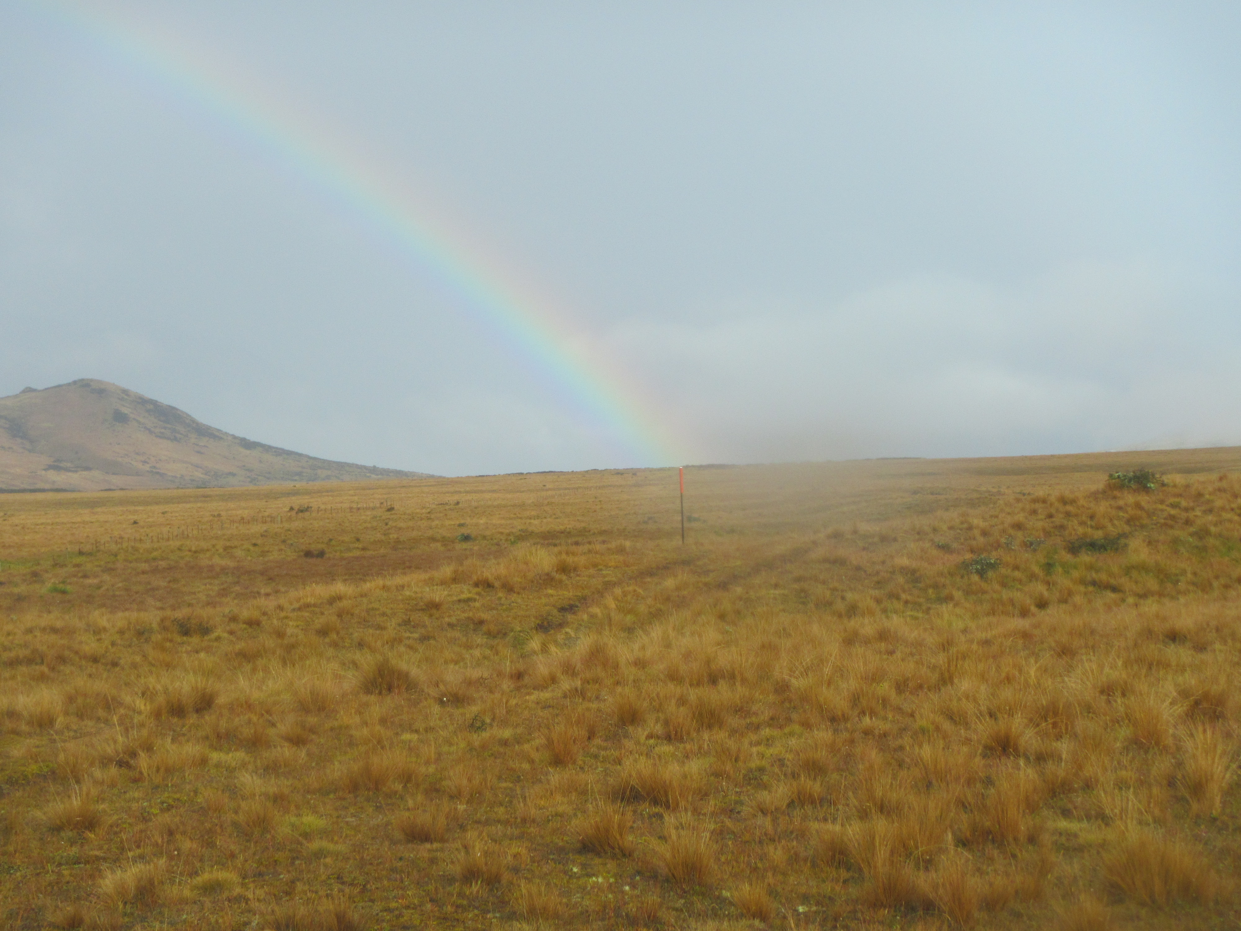
The sun made a brief appearance and I took the rainbow that formed out in front with its end touching down towards the Rangitata as a good sign. I kept moving. Five kilometres or so across undulating paddocks the trail took me high above the banks of the Potts River and great views out across the broad valley of the Rangitata. Spying the Potts River was not a good sign. The water was not clear but a milky grey indicating that the water volume had picked up and was moving sediment about. Fingers crossed.
Te Araroa continued along the high banks adjacent to the Potts River for another 2.5 km, emerging at a small carpark and bridge over the Potts, where the trail ends on this side. I was still determined to cross the Rangitata but fully prepared now for the possibility of having to turn back once I’d assessed the conditions. The problem is that you don’t reach the first braids of the main river to assess until about 3.5 km of walking on old settled rocky flood debris.
I crossed the main Potts River over the bridge but did have to tackle a few small braids. All good. Yes the water was discoloured but was just above the ankles and no problem to cross. Now for the 3.5km of walking old shingle beds. Out along the singles Mount Sunday could be seen a few kilometres to the north. This is the hill top where the city of Edoras was built for filming Lord of the Rings, an isolated hill top in a sea of yellow grass.
I’d mapped out a route across the Rangitata above the major braid confluences and was going to tackle each braid as a separate river, always prepared to turn back. But its difficult plotting a route as what is mapped is constantly changing.
Getting to the first braid the water was the same as the Potts, milky and stirred up, not clear and I couldn’t really see the bottom. Braving the first few tentative steps in I found the water to be just under knees and headed across. So far so good but a long way to go. I wouldn’t recommend this as an option to anyone. If the water is discoloured turn around, don’t risk it.
Continuing on I picked the river apart always moving up stream when coming across a confluence of braids in order to separate the flow and tackle each piece separately. For the most part the crossings were ankle to knee deep but they did get tricker the further across I went. The deepest sections were just at hip height and you could pick the much deeper channels with surging water. I stayed well clear of these.
More than half way across I came to the deepest channel. This looked like a piece of work and it was. The water was ripping through and the shallowest crossing point I could find was just above hip belt deep. Slowly stepping in I could feel the waters surge trying to knock me off my feet. With feet braced and walking poles planted up stream I took it very, very slowly. One foot slowly stepping side ways as the other plus poles were firmly planted. All it would take is to have one leg knocked off balance or step into and unseen hole and I’d be going for a swim. Needless to say for crossing each braid my pack straps were not done up and well loose in the eventuality that I needed to ditch it and make a swim. I repeat – do not try this at home kids. The worst section was just about done but not quite yet.
I see what they mean about unsettled shingle beds. For a few metres in the deepest section of the major braid with the highest flows my footing was constantly shifting under foot. There was nothing firm to stand on. I would describe this like standing in the shallows at the beach in bare feet and having the sand shift under foot was the waves moving in and out. This was the worst section and if anything could go wrong it would go wrong here. I’d like to think that sensible decision making and hardcore outdoorsmanship got me through this but really it was probably just luck that got me to the other side unscathed. I was thankful that I didn’t have to swim and chase my pack down river.
A few more braids to cross at knee depth and I was home and hosed. Nerves shot. Safely on the other side I picked up and old 4wd track and followed this down to the trail head. Here is the route I took across. Do not attempt this under any circumstances if the water is not clear.


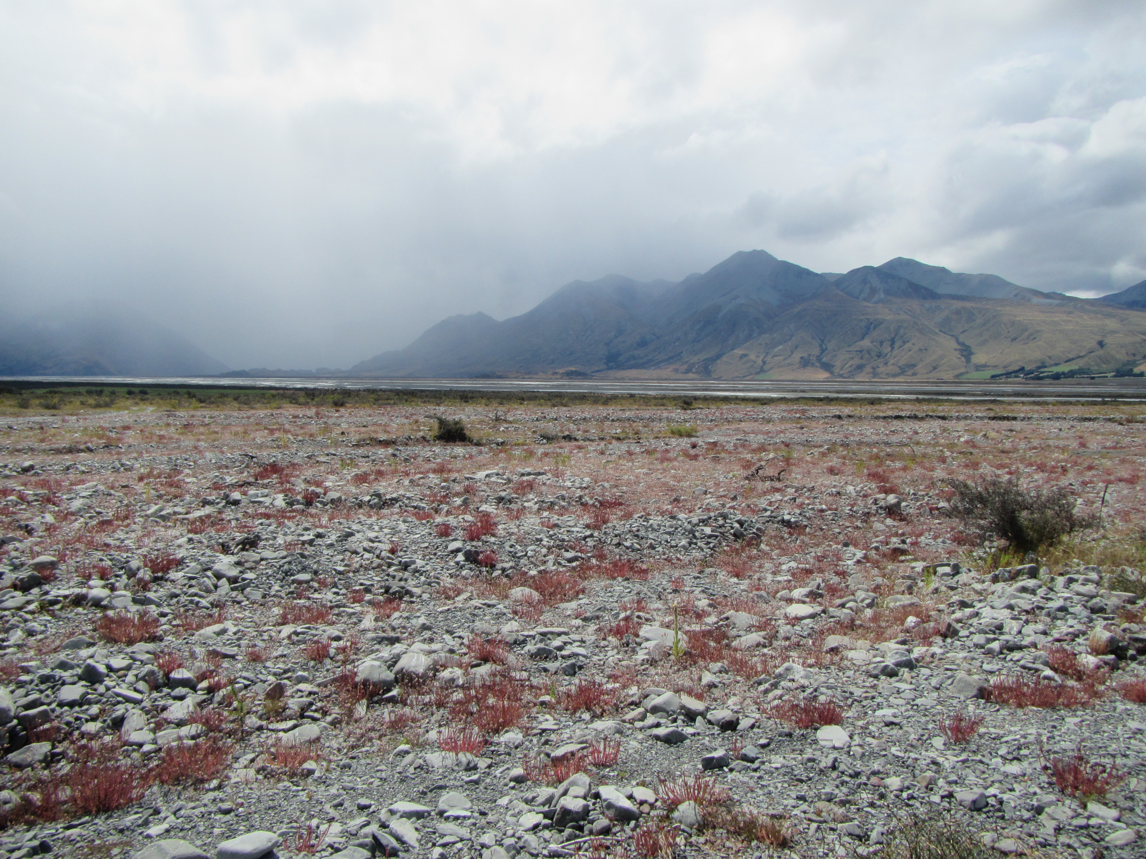
Looking back across the Rangitata River braids

A picture tells 1000 words – the many braids of the Rangitata, Potts River confluence.
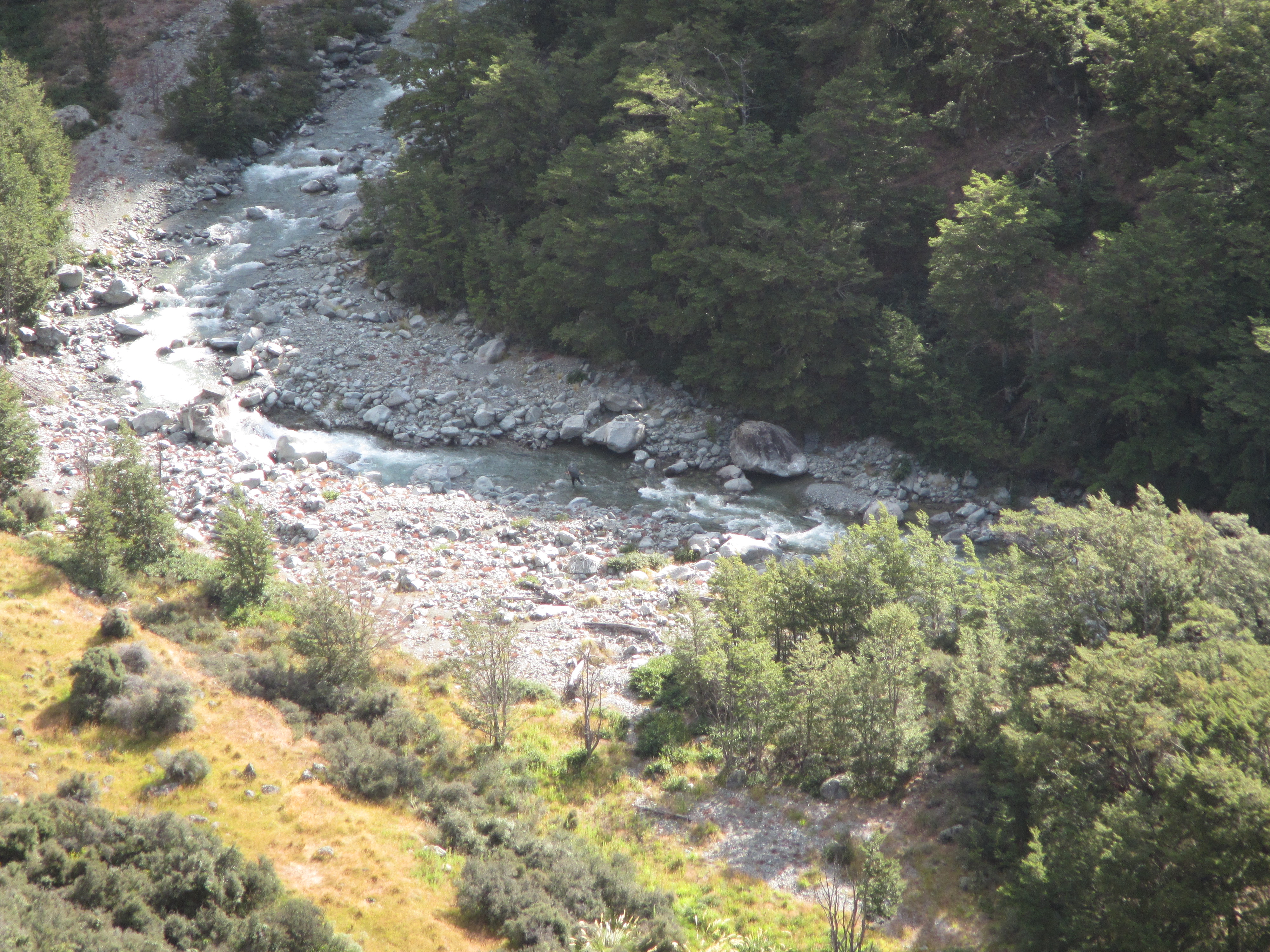
After a major day already, Bush Stream took a good 3 hours to negotiate a path up stream. Eventually a massive orange triangle indicated the route now left the river to climb very steeply up hill on a switched back track. For anyone that is a Lord of the Rings fan this reminded me of the switch back track that the main characters climb above the Rohan camp as the assemble for the battle on Minas Tirith and to the start of the Path of the Dead.
In true kiwi tramping style this trail took me straight up and straight back down to the river again on the other side. I think it climbs around a gorge section of the river too tricky to negotiate otherwise. Just before climbing down again I came across Stefan standing on the high point taking some photos. I haven’t seen him since Wellington, many weeks ago. Chance meetings like this are awesome on the trail. You think your walking solo but you’re not really. It was great to have a quick catch up and we would in more detail at Crooked Spur Hut.
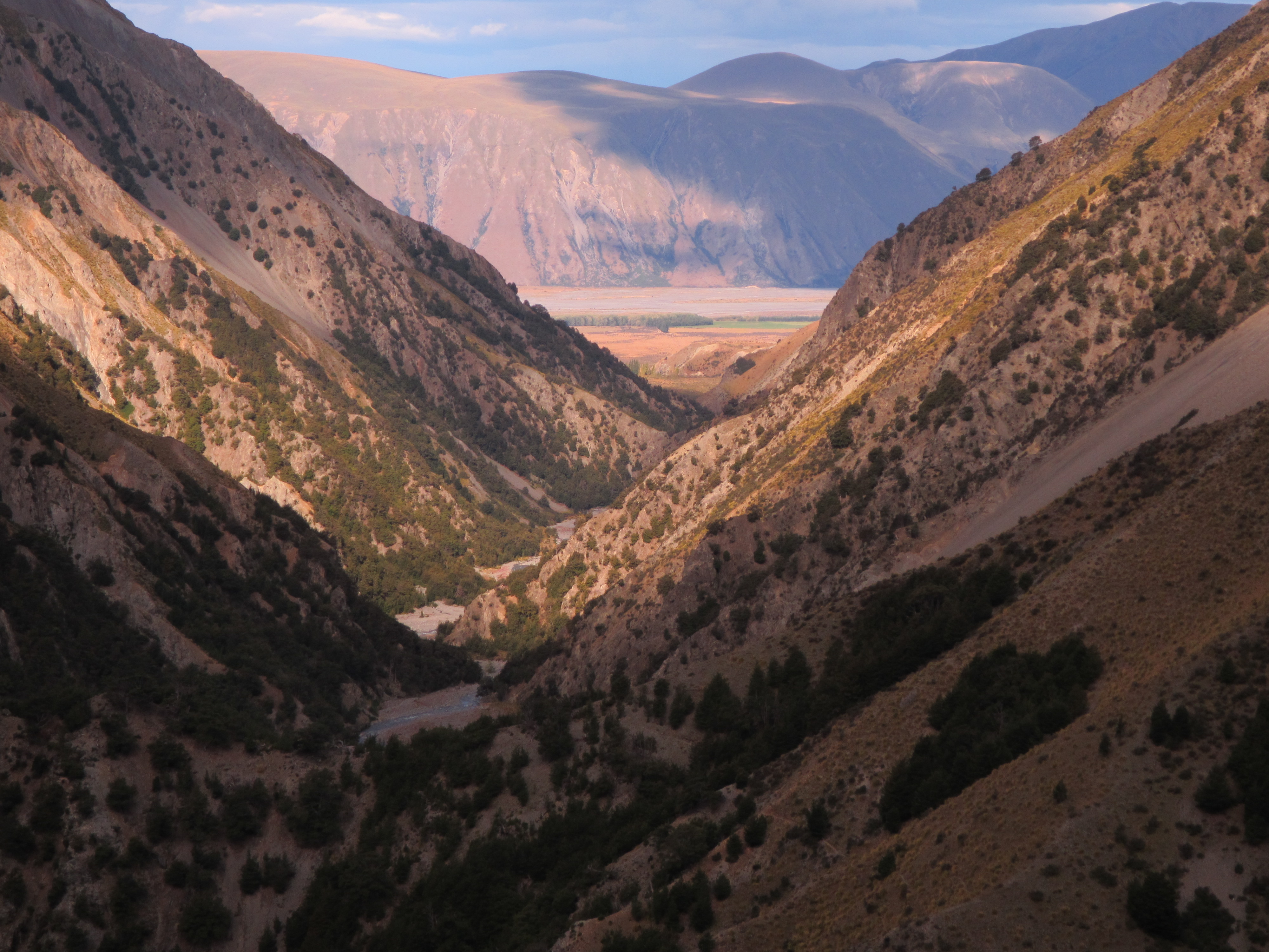
I followed Stefan down the slope to the river, only to cross it and commence up another 250 metre climb towards the hut. What a relief to make it to the hut after a massive day. The pay off was the views offered looking right back down Bush Stream towards the Rangitata River and the surrounding hill sides.


I would be sharing the hut with Stefan’s new companions, Will from Scotland, Liz fron the US and Carlos from Germany; and a couple of NOBO’s. Catching up on everyones adventures and challenges is always great. I found out that Shania, aka Slips, has also had to leave the trail recently – bad luck Slips, hope you can earn a few bucks and get back on trail later in the year.

Mate this time are bloody lucky and thank goodness you are with others just in case. You are doing extremely well, superlatives cannot describe like you write. Well Done. The pictures are great. You should write a book about your ADVENTURE
LikeLike
awesome read, had me on the edge of my (breakfast) seat!
LikeLike