Day 77: Middy Hut to Starveall Hut

Photos to come when in town

Distance travelled today: 24 km

Total TA distance covered: 1855 km

Tuesday is climbing day no matter which country you are in.

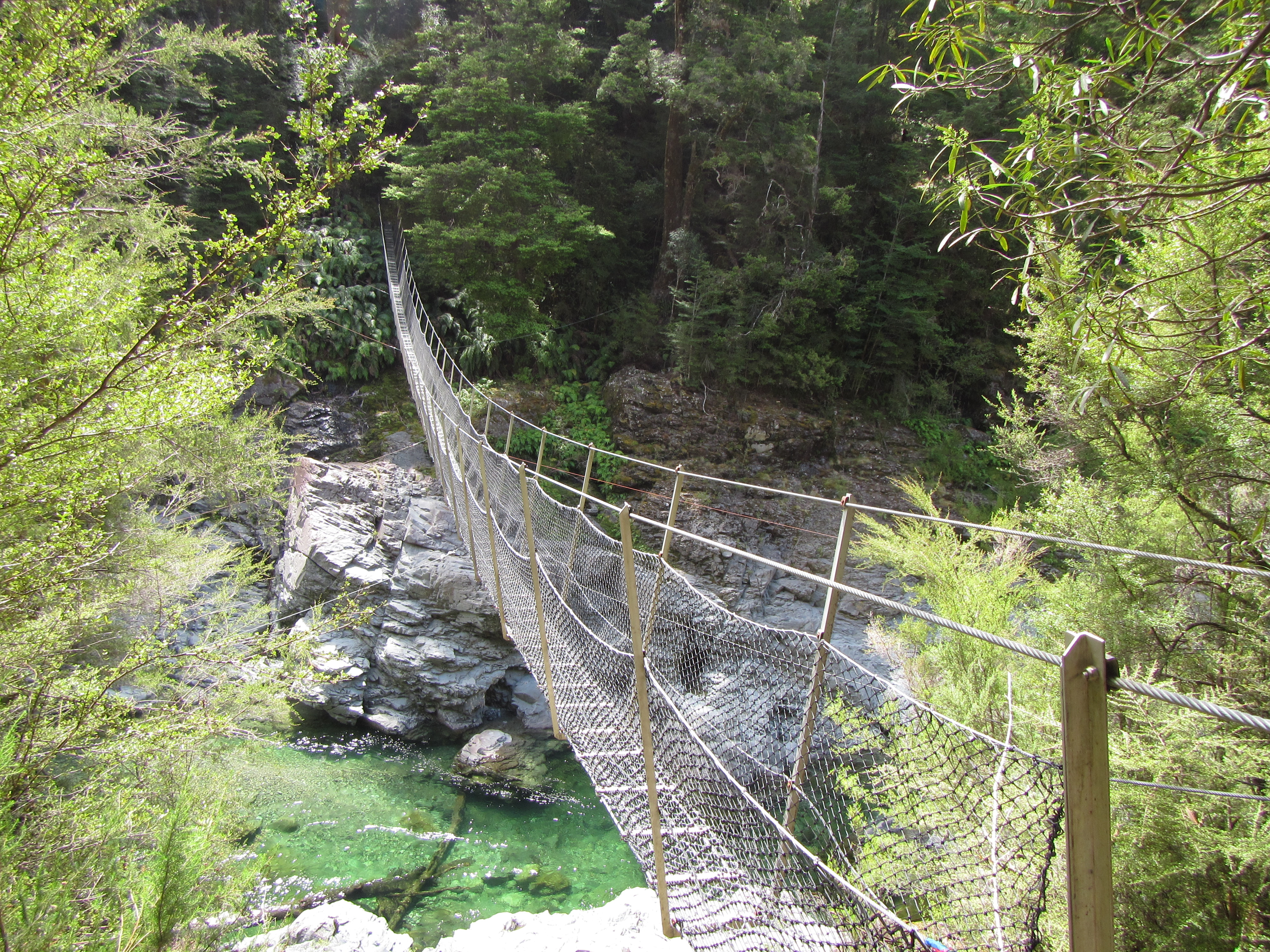
A swing bridge over the Pelorus River started the day, dodging a wasp nest right next to the swing bridge entry where you have to manoeuvre under some wires without getting your pack caught up. The forest is full of wasps, the european variety that we have at home, but they behave more like flies. With some much food around they are not that interested in humans and are easily swatted away, although I was cautious near the nest to be sure.

Once over the river it was up and up and up. This was going to be the theme for the day. It was overcast but hot and humid under the tree canopy with no wind to speak of. The trail lead through another nice beech forest following a ridge line up, always up to Rocks Hut. Lots of roots to act as steps. I reached Rocks hut by 9:30am in 2 hours and well under the estimated DOC time. That was great.

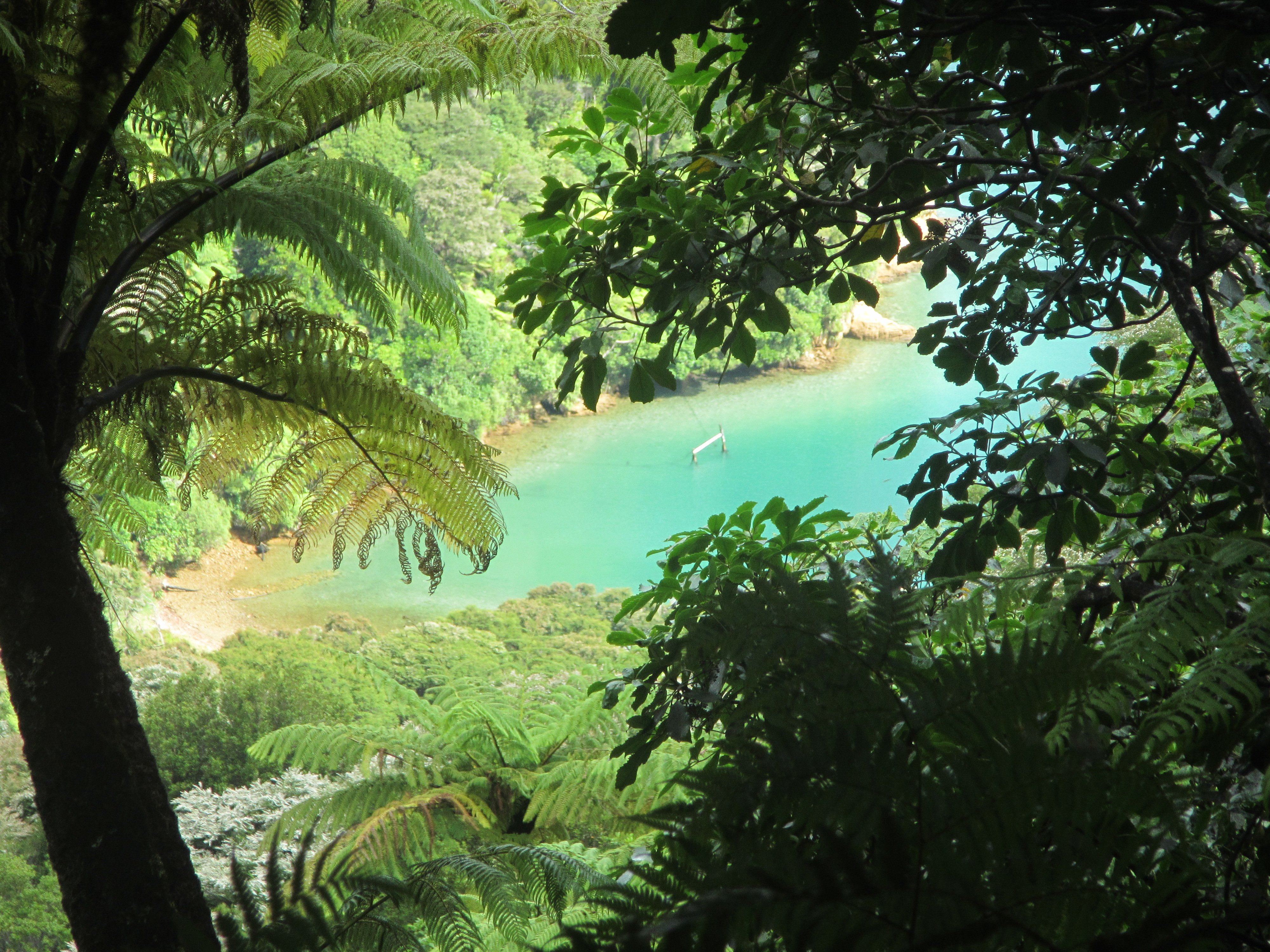
From Rocks Hut the terrain changed to become much more rocky and entered into drier vegetation, lots of heathy type plants and manuka for a good chunk. The trail was undulating, following ridge lines up and down.

Just before a reaching a high point there was a major windfall area. Not quite sure how big but easily close to 100ha in total. Tall beech trees blown out of the shallow shally soil, with massive root balls towering above my head and trees scattered ontop of each other like a giant game of pick up sticks. It looked like a logging coupe. Somehow the good folk at DOC have managed to saw and clear a path through. I must have walked through this area on and off for around 40mins and several sides of the path were 2 to 3 metres high of fallen timber. Hats off to the crew that cut this path – a major undertaking for sure and good chainsaw work.

image

Leaving the wind fall area and climbing again I could see a break in the vegetation ahead. There was a clear line in the ground changing from forest to grassy, stunted plants. This marked the approach into a section of a mineral belt. Obviously the change in soils affecting what would grow there. It was open country. Purple and black rock littering the surface, with grasses and tussocks growing from the few pockets where debris had collected and allowed the formation of soil. From here it was down, very steeply down, to Totara Saddle, and down, down, steeper again to Browning Hut.

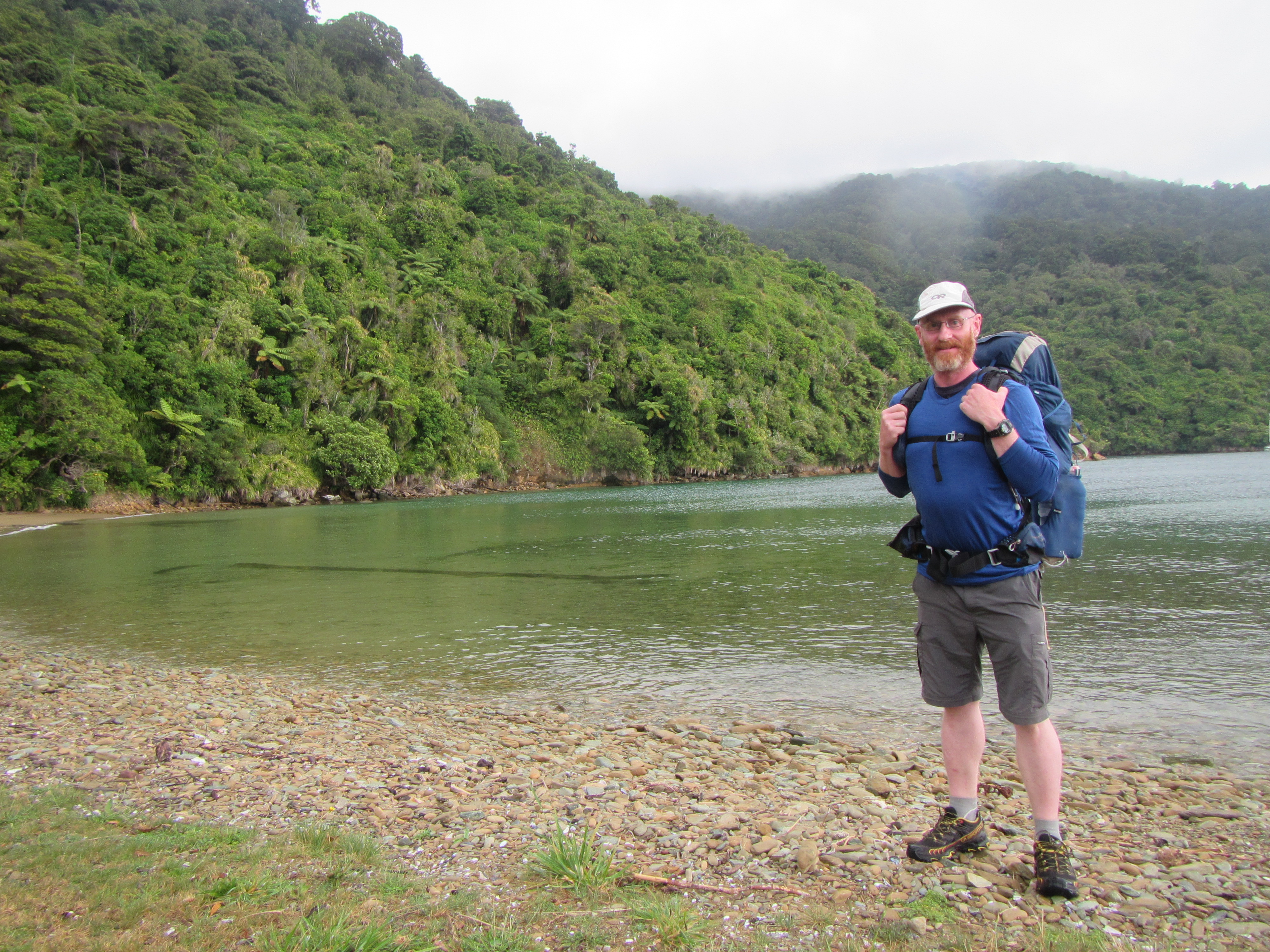
I reached Browning hut around 1:30pm for some lunch and was joined shortly later by Ben.

It was early in the day and I had several options for the afternoon but it all came down to time and how I was feeling. I told myself that if I reached the next hut, Hacket Hut, by 3pm I would aim to push on to Starveall Hut. The trail towards Hacket Hut followed the Browning Stream and required the odd crossing of what I would call a river, not a stream. A low water level and flood track higher up the bank provided options. I chose the river track. Well I reached Hacket Hut in good time and I was feeling good so decided to push on.

The next section was expected to take 4.5 hours according to DOC and required multiple river crossings of the Hacket Creek. Then leaving the river the trail was to climb some 900m in elevation over 4 kilometres. I judged that I was making faster progress than all DOC times to date and that even if this section was to take the full recommended time, I would still reach Starveall Hut in day light. I pressed on.

Following the river, I can’t judge this thing to be a creek, was amazing. It was large with lots of flow down deep channels between boulders, the banks lined with smaller pebbles. I didn’t count just how many crossings were required but I would guess maybe 10. Trail arrows were well placed and easy to follow with big arse arrows on the opposite banks indicating a crossing, but they weren’t always in the best spots. Several times I would travel above or below the arrows to find the best crossing point. I managed to find crossing points at each location, bouncing from boulder to boulder and stabilising my balance with my walking poles and was able to keep my feet dry for the whole section.

Then it as up and up and up to start the 900m ascent. I told you this was the theme for the day. Tuesday night is climbing night after all and it doesnt matter which country you are in. Climbing, climbing, climbing. Turned out to be one of the toughest days to date. Just with the heat, the constant ascent, sheer in places requiring all four limbs, always up. I have never sweated or drank so much water in my life, not even on the fire line I don’t think. I would have consumed more than 5 or 6 litres throughout the day. Scared of going hyponatremic I had to fish out the rehydration salts. Constantly filling water bottles at every stream crossing. Up and up and up it continued.

Finally breaking out of the trees I stumbled into Starveall Hut exhausted. My clothes were saturated with sweat and I needed to get the fire going to dry them out, my first fire on this trip. I have the hut to myself, with all the other trampers sensible enough to leave this ascent for tomorrow. The hut sits just above the treeline in the alpine environment and I’m sure the fire will help make for a good nights sleep. No problem there I don’t think – I’m knackered. Long, long day.

I was keen it get this climb out the way. Otherwise it would be straight into it tomorrow morning with the same outcome. By climbing high today, I’m hoping to make best use of the current weather window. Aiming to get over Rintoul tomorrow before forecast rain which will make an attempt impossible.

Day 76: Pelorus Bridge to Middy Hut

Distance travelled today: 28 km
Total TA distance covered: 1831 km

The party is over.

It was with mixed emotions that saw Jacinta and I part company for another 2 months. It was great to see her and I missed her heaps. Her birthday weekend will be one to remember. A few more days together would have been great but alas, work calls her back home (someone has to pay the bills) and Te Araroa beckons me on.

Lucky for me with the aid of a hire car Jacinta was able to kick start my day by driving around 6 kilometres on a section that I would have had to road walk. I didn’t start walking until about 10am or so and I wasn’t sure I would be able to reach my intented destination for the day, but 6 less road kilometres certainly helped.

On the drive in we passed a young Kiwi lad, Ben, fresh out of school and hiking the Te Araroa from QCT to Lake Coleridge before uni starts. We offered a lift and he thought about it for a second but then declined, firmly stating, “Nah. I want to walk every step.” Great attitude for someone as young as Ben. Shortly after we passed 3 more trampers. We didn’t have room for 3 and kept driving but it was only when we passed that I realised that 2 of the 3 were Sven and Catherine from Germany. I haven’t seen these guys since Hamilton.

Jacinta dropped me off and with a parting kiss she was off. I waited for Sven and Catherine and had a quick catch up and we all hit the road as there were still a few kilometres to get in before getting onto actual trail. I couldn’t wait. The road followed the Pelorus River and from what I could see from the road edge the next trail section wasn’t going to disappoint.

The trail section traversed through beech forest for much of the day. Following closely by the banks of the river. The turquoise coloured water looked inviting, with its deep clear pools intersperse with shallow rapids spilling over white rock. It was a picture.

For the most part the trail was pretty good. Steep in one section as it climbed away from the river to avoid a cliff and back down again. Several sections were sidles with out sloped tread with made it difficult under foot and there were a couple of sketchy climbs over the top of slips with sheer drops down 10 metres or so. Consentration was the order of the day for these bits. The trail also crossed several larger side rivers on swing bridges and crossed the Pelorus itself on one occasion. This was a wide crossing and a one person at a time crossing on the cable swing bridge.

image

Crossing onto the southern side of the Pelorus the vegetation changes quite rapidly leaving the beech forest and entering into drier veg as the trail climbed steeply up. Though water was in good supply from the many creeks the trail crossed which was great as I was drinking a lot, more than usual.

Once on the southern side the final few kilometres came easily and I arrived at Middy Hit in good time around 4pm. Enough time for a swim in the river. It was a hot day and I had been pouring out sweat all day. The river looked inviting enough although I thought it might be to cold. I found a nice deep pool and stripped off my sweaty cloths to lay them on the warm rocks and hopefully dry. With my feet in the temperature wasnt too bad. A little cold to go plunging straight in so I tried to inch my way in. But that didnt last long. One slip on a rock and I was in all the way. It was great. Being able to cool off after a stinky hot day is amazing. Once in, I wanted to stay in and I paddled around for a bit. My pool was over head height deep but the water so clear you could see to the bottom.

Drying off on the rocks in the sun with my clothes looked like a good option but the sand flies soon found me. The worst I have experienced sandflies to date. The little buggers were everywhere, swarming around my ankles and legs and getting stuck in. A few drew blood before I could swat them. They just kept coming and it was time to retreat, ahhh…. Such a lovely end to the day spoilt by the bloodsuckers. It was a bit like northern Queensland – you have hot weather and the water is so inviting but you can’t go swimming due to crocs, stingers etc… The Pelorus River was the perfect swimming hole but the experience destroyed by insects. Plenty of bumble bees and wasps about too, all attracted to my white hat, and yellow bits on my gaiters. The colours must give off the impression of flowers. And so it was time to retreat to the hut. The lesser of two evils – stinking hot inside but no bugs.

Tonight I would be sharing the hut with Ben and a couple of kiwi section hikers. Sven and Catherine opting to tent outside.

Days 72 to 75: Off trail micro holiday

After 2 months apart, Jacinta travelled over to NZ over the Australia Day long weekend to catch up with me. This was sort of like a holiday within a holiday for me. It was great to see her and looking good. Apparently I’m a shadow of my pre Te Araroa self, having lost a lot of weight.
This weekend was also Jacinta’s birthday which made it all the more special. I left the arrangements to her and she certainly didn’t have a budget in mind. Spend it while you can I guess and live each day as your last.

I had a whole day to wait in Nelson and basically hung around town, eating well and reading lots. I’m onto book 3 of Game of Thrones and am hoping to get through the series before returning home. We finally caught up in the evening at the end of her very long drive from Christchurch airport to Nelson. But we had a bit more travel to do to get to Tasman and our holiday suite on the water front. No expense spared.

The accommodation was amazing. Floor to ceiling glass windows on 3 side overlooking the beach front and a balcony overhanging water and serving as a back deck. The worlds most luxurious king sized bed, to die for. To top our first evening off, calm still waters on the ocean and a perfect reflections from horizon to the shore of the full moon.

But there is no rest for the wicked. The following day we grabbed some bikes and headed off on a jaunt around the local coast and did a bit of shopping. We found the perfect present for Jacinta’s birthday a scale replica of an old school bike about a foot long and half as high.

The following day was off for more adventures. Rising early and travelling north to get a water taxi to Able Tasman and a full day of canyoning down the Torrent River. An action packed day. Donning wetsuits, helmets and harnesses we abseiled, jumped, slid and zip lined down through the canyon. There were a couple of big jumps I had to give a go, the first 6 metres and the second 8 metres, off the top of rocks to the dark, deep pools below. Wow!!

imageimageimageimage

Day 71: Anakiwa to Havelock

Distance travelled today: 16 km

Total TA distance covered: 1783 km

On my way holidays.

Today was an easy day. A 16 km walk mostly on roads to Havelock so no need to rush. Anakiwa doesn’t have any shops to speak of and I was out of breakfast food. The lovely Anakiwa Lodge & YHA hosts looked after me though and for $10 I was provided with a bowl of fresh fruit (oranges, banana, kiwi fruit & strawberries), 4 pieces of bread for toast plus a couple of jams, a bowl of museli and milk – the cheapest breakfast of champions around.

I had a shared dorm last night but no-one else turned up and I was able to explode the contents of my pack across the room to get stuff dried out.

After breaky I headed out onto the trail and found that instead of having to walk on the road for the first 4 km there was a gravelled path just off the road to separte walkers from the traffic. Perfect. But once out onto the main road towards Havelock it was back onto the frustrating narrow roads with little room to walk. No verge to speak of and walking on the white line, where there was on, right on the edge of the bitumen, traffic wizzing past. Not much fun.

Around 12km in, the trail did leave the road for a bit but only to cut off a wide arch of road, reducing the distance from 6km to 3km. And while it was good to get off the road for a bit the trail section climbed straight up a hill, rising to 400m over 1 kilometre, and straight down the other side. I guess there is a reason to road curves around the hill. The sun was beating down hard and it was slow, tough work, winding up the track, essentially a power line easement to the top of the hill. Slow going on the steep descent down the other side as well. Back onto the road it was another 1.5km into town.

Grabbing some lunch I met two more TAers in a cafe and ran into Mario & Andrea later onas well. These guys are all heading onto Pelorus Bridge tonight to start the famous Richmond Range. For me, I’m heading off trail for a couple of days to meet up with Jacinta and have a mini holiday within a holiday. The section between Havelock and Pelorus Bridge is predominately road walking on a very busy road and I decided that rather than walk this and not enjoy it I’d get the bus into Nelson to meet up with Jac. Most TAers are choosing to hitch this section. After our micro holiday, I’ll get dropped off at Pelorus Bridge and continue into the Richmond Range, into a main highlight of the trail and real mountains.

After two months apart I can’t wait to catch up with Jac but it doesn’t sound like there will be much rest. It will be her birthday and an action packed one with mountain biking, of course, and some canyoning.

Anyway, for all the blog followers out there, I won’t be picking the trail back up until Monday. Also once in the ranges updates will be few and far between for the next little bit. I’ll continue to write a daily update but won’t be able to post anythng online until in a town. The next 30 days goes something like this:

  • Pelorus Bridge to St Arnaud: 7 to 8 days
  • St Arnaud to Boyle Village: 7 to 8 days
  • Boyle Village to Arthurs Pass: 3 to 4 days
  • Arthurs Pass to Lake Coleridge: 2 to 3 days
  • Lake Coleridge to Tekapo: 6 to 7 days

So only 4  or 5 towns passed through towards Tekapo.

For everyone that is reading this blog, please keep reading and hope you are enjoying it. Here is a snap shot of the site stats if you’re interested, receiving close to 100 hits a day and more than 750 a week. That is awesome. I started this as a diary for myself but it’s great to see so many people taking a interest as well. Thank you all.

image

Day 70: Cowshed Bay to Anakiwa

Distance travelled today: 20 km

Total TA distance covered: 1767 km

QCT day 3

It pissed down with rain overnight and I had issues again with drops slashing up under the awning and heavy dropslets causing condensation to be bounced down from inside the roof. While not saturated, my bag was a bit damp on the outside. Like most times it rains though, it eased off and stopped by 7am as I went about packing up. No chance to dry the tent and had to carry it saturated the whole day to dry out later.

We all left around 8:30 or so and it looked to be a promising day as the sun came out and the rain had cleared the low lying cloud. So there were actually some views from the top of the first climb for the day but too short lived. The low cloud returned and later a fine mist and then drizzle for much of the day.

image

With the first and only real climb out of the way early the trail levelled off and followed either ridgeline or contour just about all the way to Anakiwa. The trail was busy with heaps of slackpackers and day walkers out and about. I played leap frog with quite a few during the day.

With the cloud returned, the views disappeared and it was back into walking along a green corridor of vegetation. There were a couple of steep drop offs on some sections where if you were flying down hill on a mountain bike you would want to be paying attention.

image

I was surprised to walk through several sections that had previously been burnt and were regenerating quite well. The lush green on black was a picture.  I thought fire was meant to be devastating to beech forests but it looked to be healthy.

image

Around 6 km out from town I rounded a corner to a view across Grove Arm and down towards Anakiwa. This looked like a good spot for lunch and I was joined by a British couple walking the QCT, while Silva & Martin came past passed as well.

After lunch it was a quick walk into town on awesome track through beech forest. The forest was abuzz with european wasps as they covered some of the beech trees feeding off the sap. Along the way Davis Bay was passed. This looked like a really nice place to camp. But no camping tonight. A warm bed and chance to dry out at Anakiwa YHA.

Finishng the trail the Swiss couple were there next to the Green Caravan Cafe. Perfect way to end the trail. Coffee, chocolate and final goodbyes to the Swiss. Happy trails.

Day 69: Camp Bay to Cowshed Bay

Distance travelled today: 22 km
Total TA distance covered: 1747 km

Where are the views?

Such a disappointing day weather wise. I’m hiking through an area that I know has some of the best best coastal views in the country, looking down across the many secluded bays on both sides of the ridge line, yet I can not see a thing due to cloud. Damn it.

It rained quite heavy overnight but had eased off by morning. I woke at my usual time of 6am but hearing rain rolled over and slept in until around 7:30am. Packing wet gear is never much fun but I have a bit of system for it now, making sure that everything especially sleeping bag, clothes and electronics are individually packed in dry bags. Everything is laid out in the tent for easy access; secured & neatly packed inside the main pack dry bag; pack cover put on; pack out the door; leaving the tent to be pulled down and secured on the outside last. When the tent is wet, having it on the outside makes it much easier to just grab off and lay out to dry if the sun pokes its head out and keeps everything else from getting wet.

image

The trail climbed high today onto major ridge lines following the spine of one of the many sections of land rising out of the ocean to form the Sounds. I know there are views to be had but not for me today.

Without the views the walking was sort of boring. It passed through a mix of vegetation types including scrub/heathy stuff down low and beach trees up high with an understory of ferns, flax and other plants, leaves shimmering as they reflected sunlight off their wet surfaces, plus some areas of pine.

Lots of people were out and about on the trail today. Given the lack of views I made a bit of a game it. Chasing down the slack packers (day walkers without packs) and racing past them with my big pack and poles, to the hushed whispers as I got past and moved on, “he’s moving quick and with such a big pack!”.

A few mountain bike riders were also about. All were really good giving plenty of warning as they approached walkers from behind and flying down the hills. If I was to do the QCT again, in future I would definitely do it on a mountain bike. The walking is far too easy if not a little boring, other than the views, that I didn’t have today. Think I’d rather race down on two wheels and than slowly wander on two feet.

Tonight I’m at Cowshed Bay camping area. I’ll be sleeping in my tent and it is raining now. We are expecting a bucket load tonight with 25mm predicted and more rain tomorrow. Not to worry. I have a cook shelter to huddle under and catch up with other people. I have internet connection that lets me update this blog (without photos) and book a bed for tomorrow night after finishing the Queen Charlotte Track.

Silva & Martin, the Swiss couple, had slack packed today but on arrival at camp their packs were no where to be seen. How disappointing. The shuttle company was meant to deliver them to the campsite but hadn’t. They had to catch a ride into a lodge with a German couple car camping but also staying at the same camp to track down their packs. Luckily, they found them and more lucky for me they returned to camp with hot chips which they encouraged me to tuck into. Perfect on a wet afternoon. I only need to be asked once. My contribution was offering up tomato sauce packets. But how awesome are these guys? It’s Mario’s birthday today so they also returned to camp with a bottle of wine and some cake for him. Swiss people are the most amazing, friendly people in the world!

image

The awesome, friendly Swiss couple, Silva & Martin.

Day 68: School House Bay to Camp Bay

‘Distance travelled today: 21 km
Total TA distance covered: 1725 km

Relaxing afternoon.

I knew the Queen Charlotte Track (QCT) was going to be a well groomed and an easy track to walk but I didn’t realise just how much of a tramping highway it actually was. The whole track is basically like a narrow vehicle track for the most part. Very wide for tramping and besides the odd up and down, follows around hills on the contour. Easy walking and it made for a super fast pace.

Looking down from the track through the greenery there were views aplenty. Bright turquoise coloured waters were calm and sheltered yachts in just above every cove along the way. Big vistas right across from bay to bay from the ridge tops.

image

The track wound around from Schoolhouse Bay, Resolution Bay into the top of Endeavour Inlet and around to Punga Cove and Camp Bay. Along the way the trail cuts across private property in a few places and the QCT is one of the only sections along Te Araroa that requires a permit.

It should come as no surprise that the private property sections lined the water front for the perfect vantage points and sheltered coves. Most are holiday homes or baches but there are some residents who choose to live along the shores. There are no roads and all access is by boat only.

image

Part of the attraction of the QCT for the average punter is being able to walk the track and stay in one of the many private accommodation venues along the way while having your pack shuttled from your start point to your end point each day by water taxi. No such luck for me. I would be carrying my pack all the way and utilising the camping sites.

Carrying a pack didnt really slow me down any and I passed a heap of pack free weekend warrior trampers along the way. The quality of the track allowed me to fly along and I reached Camp Bay around 2:30pm. Very early to make camp. Under ordinary circumstances, if I arrive somewhere by 2:30pm I’d push on for at least another 2 hours and hopefully another 8 km or so. I had a couple of options today.

A: push on 8 km to the next camp site or

B: take my time, settle to stay at Camp Bay, go for a swim and head to Punga Cove, 5 mins away for a refreshing beer.

Easy decision really. Option B it was. I have all week to reach Nelson and pressing on any further would have me finishing the QCT in a day and a half, and then having to fill in my time or reach town much earlier than expected. I’m meeting Jacinta in Nelson on Friday evening.

Camp Bay must be a popular location as DOC have a Camp Host here to make sure people are doing the right thing and collecting stats on who is using the facilities. This week the host was David, a very friendly and likeable fella. He’s here for two weeks before heading to Stewart Island, lucky bugger. After a quick introduction and look around the campsite I was off for a refreshing swim.

The water was great. Calm, crystal clear and nice to be able to cool down and scrub the sweat away, even if it was in salt water. But a fresh water creek ran into the sea and it wasn’t too bad. Layers of cold and warm water were easy to find and locate the perfect temperature to just sit down up to my neck and laze in the shallows. Very, very calm. No a single wave.

I’d got my camp set up and all my gear secured from the infamous Weka, a native flightless bird that moves with stealth around camps looking for any loose bits of gear, that they then grab and make a bolt for the bush with. There were a few lurking around my tent but I had everything inside my pack, inside my tent.

They innocent enough... The weka

They innocent enough… The weka

Only 5 minutes away was Pungua Cove, a mini, cheap holiday resort, sporting a cafe and bar. I was starving, tummy grumbling, having not packed as much food as I thought I would need and quickly made my way over. I grabbed a 500ml Porter beer which hit the spot and ordered the worse $18 nachos i’ve ever consumed. They were terrible but I ate them none the less. Hunger called.

I caught up with Andrea and Mario as I went about cooking dinner in the shelter and met a few other people just walking the QCT. The QCT is jam packed with people just hiking the from Ship Coves to Anakiwa and I would be sharing the trail with them to Anakiwa over the next couple of days so it’s great to met them. There were a lovely young Swiss couple, Silva & Martin, incredibly friendly from the get go and a group of 3 Germans. Conversation flowed easy with the Swiss as we cooked dinner and I was treated to some real Swiss chocolate for desert. The German group, well, not sure what they were doing out here. They didn’t seem to be enjoying it or know how to camp really. One of them, we’ll call him Blondy, was bitching and moaning about everything – an amateur for sure. He couldn’t work out how to cook a Backcountry Cusine meal and I tried to show him how but he didn’t want to hear it and ended up dumping the contents into his pot and trying to cook it on the stove, and kept complaining how bad his meal was with every bite. We wouldn’t let him bring the mood down though and all took turns taking the piss out of him (for non Aussies – mocking, riling, joking).

Like so many conservations with new people, everyone was keen to hear about the Te Araroa and find out exactly what Mario, Andrea and myself were up to. None had heard of it. The German jerk trying to tell us we were mad and could not fathom why on earth anyone would want to do such a thing – “so long, such a hassle, so uncomfortable.” Your life mate – so boring. Each to their own I say.

David, the camp host was great and had many questions about the trail and the gear I was carrying. I was only too happy to oblige and can talk gear with anyone who is interested for hours. Hope you get a chance to get out and pick off a section or two David.

Day 67: Wellington to School House Bay

Distance travelled today: 4 km on trail, plus ferry from Wellington and water taxi to Ship Cove

Total TA distance covered: 1704 km

Long day but not far.

Today was pretty much a travel day so I wont bire you with too many details.

To get the InterIslander at 9:00am, required a check by 8:00am, which meant getting a shuttle from the hostel at 7:30am. So an early start. POD and disco would join me for the day on the ferry and the water taxi.

I got checked in at the InterIslander and was given a blue wrist band to put on. This was my ticket to access the premium lounge onboard courtesy of InterIslander who sponsored me a free ride across Cook Strait and kindly provided an upgrade. Awesome! Thank you InterIslander, very much appreciated. On board I was treated to a nice soft lounge to laze abouton, a cooked breakfast and as much coffee and cold drinks as I wanted.

image

The crossing itself was straight foward. If you’ve been on a big ferry before, like the Spirit of Tas, it’s basically just a shorter version. It was fairly calm despite the wind and made for a smooth voyage.

Once across the Strait the boat wound it’s way through the sounds towards Picton. The hills were covered in low cloud and misty rain.

Arriving at Picton was much like the airport with a scramble to retrieve baggage and move onto your next destination. I’d timed the ferry and water taxi perfectly with a half hour gap between arriving on one before getting on the next. With my pack in tow it was a quick 10 minute walk to the water taxi.

The watertaxi is basically the mail boat that delivers mail bags and packages to all the isolated settlements dotted on the banks of the sound with no road access. I’d managed to get a ride on the Saturday mail run.

That was a pretty cool ride. Smaller boat so seemed faster and we got to check out many of the smaller coves and settlements on the way to Ship Cove.

image

It was a late start on the trail, arriving at Ship Cove just before 4pm. So a big day of travel really. Ship Cove was named by Captain Cook who visited this site 3 times, running his boats onto the shore to get them cleaned and repaired. There are monuments for both the Maori and Cook marking the cross over between the two worlds, who Cook and his men formed good relations with. image

image

With all the travel during the day I really couldnt be bothered chasing big miles today and settled to pull up stumps at Camp Cove, the first camp site on the Queen Charlotte Track and only around 3km in on the trail. The next official site was 10km away and I while I’m sure I would have easily made it, decided not to push too hard. Besides I essentially have 5.5 days to complete the QCT and get to Nelson to meet Jacinta. I’m certain at my current TA pace and the highway standard of track on the QCT, I could easily complete the trail in 2.5 to 3 day. With 5 days up my sleeve, there was no need to rush.

Days end at Camp Cove. A couple of other TAers who I yet to meet, Andrea and Mario from Switerzland, arrived a bit later and we spent the evening cooking dinner overlooking the crystal clear waters of the protected cove. No waves, just stillness and water clarity like you couldnt believe.

image

image

Day 66: Wellington Zero Day 2

Distance travelled today: a few

Total TA distance covered: 1700

Well rested.

Did not do a lot today other than eat great food, lots of fresh fruit & veg; read; mail some more food packages and have a wander around the museum which is a block away.

image

Feeling well rested with two days off in a row but ready to get back onto the trail. I just don’t like the city. I’ve grown accustom to a simple life on the trail and the frenetic pace of the ordinary life just seems absurd.

Bumped into Emily & Simon at the hostel this morning and later POD & Disco. Looks like we may all be on a similar timed ferry across Cook Strait and water taxis to the start of the Queen Charlotte Track.

Yesterday I ran in Steffen, McKayla and Shania on my way back from the post. Sounds like they had a ferry ride across today. In amongst the sea of people on the crowded city streets, TA trampers stand out like a sore thumb and it’s easy to pick people you know. It still amazes me.

Early start tomorrow to get the InterIslander across to Picton and a connecting water taxi to the QCT. 6 hours of boating to look forward to. Generally I have a solid stomach, which is great for doing air attack work, but the winds have ripped into the coast for the past 36 hours and have churned the seas up. Heres hoping it drops off a bit tomorrow.


Day 65: Wellington Zero Day 1

Distance travelled today: quite a few but no idea how many

Total TA distance covered: 1700 km

No rest for the wicked.

Today was resupply day. The first 40 days or so through the south island are through some fairly remote areas with 7 or 8 days between small settlements, with the settlements themselves not really having much in the way of shops to resupply from. Sure you could do it but the range of food choices would be small and the price tags rather large. So most Te Araroa trampers put together food boxes to send ahead to themselves to pick up on the way through town. The alternative is to hitch out upto 50km or more to larger towns as you pass over thestate highways. 

My goal for the day? Buy up big. Hit the shops for around 30 days worth of food (one 8 day section I’ll get sorted out next week), assemble food drops and get them posted.

I had four locations in mind:

  • Alpine Lodge in St. Arnaud to cover 7-8 days
  • Boyle River Outdoor Education Centre in Boyle Village to cover 5-6 days
  • Mountain House Backpackers in Arthurs Passto cover 3-4 days
  • Lake Coleridge Lodge in Lake Coleridge to cover 6-7 days worth.

In addition I had my bounce box to pick up and send on to Tekapo; and a gear box from home to swap out bits and pieces of gear like changing my sleeping bag to a warmer one and mail back home.

This was going to be quite the mission, back and forth to the post office as there was no way I could carry all the different parcels in one go.

I’d also have to get food organised for the 1st leg of the south island along the Queen Charlotte Track.

Warning to any trampers completing the south island and getting ready for the south. Be prepared for a huge slug to your budget. With accommodation costs, food, postage to the south, the Interislander crossing, water taxi to the start of the QCT and permit for the QCT expect your hip pocket to be quite a bit lighter. Thanks great for all the ultralighters out there right?

Turns out shopping for 30 days is quite hard. Trying to keep track of what you’ve put in the trundler, making sure there is variety and that making sure you have enough is difficult. I’m sure it will all work out ok and I’m guaranteed to have bought too much. A few spare meals wont hurt just in case the is a day or two bunkered down in the mountains. As it turned out I’ll have to make a second trip to the supermarket to fill in the gaps.

Spreading all the food out looked crazy. Never have I ever bought so many snacks at one time.

My hostel room covered with food and boxes.

My hostel room covered with food and boxes.

To make purchasing main meals as easy as possible I stuck to a few major themes:

  • a few Backcountry Cuisine meals
  • instand mash with freezed dried meat or jerky plus a sauce of some description and dehy veggies
  • instant noodles with a soup mix and tuna
  • cuscus with freezed dried veg, dried onions, dried mice and a powdered sauce
  • instant pasta

Powered sauces include things like: tomato & herb, beefy mince, gravey mix, devilled sausages etc…

Snacks included: Oreo biscuits, museli bars (about 10 packets for 2 a day), chocolate bars, powdered drink flavours as water is boring every day, and pringles for a salt and vinegar hit when you really need it. Plus a massive bag of scroggin full of nuts, pepitas, saltanas, dried tropical fruit like paw paw, mango, coconut, M&M’s; jelly beans and gummy bears – all from the awesome pick n mix rack that can be found in all NZ supermarkets.

Breakfast, the most boring of the lot. Ceral with powdered milk and the odd instant porridge to mix it up a bit.

Lunches, super straight forward, wraps with either vegemite, peanut butter or nutella. 

Sending food ahead a month in advance everything needs to keep. I’ll see if I can at least grab some cheese on the way through small settlements.

And I almost forgot… toilet paper in each box.

Thats it. Resupply day. No time for rest. That is what tomorrow is about.