Day 107: Top Timaru Hut to Pakituhi Hut

Distance travelled today: 24 km
Total TA distance covered: 2559 km

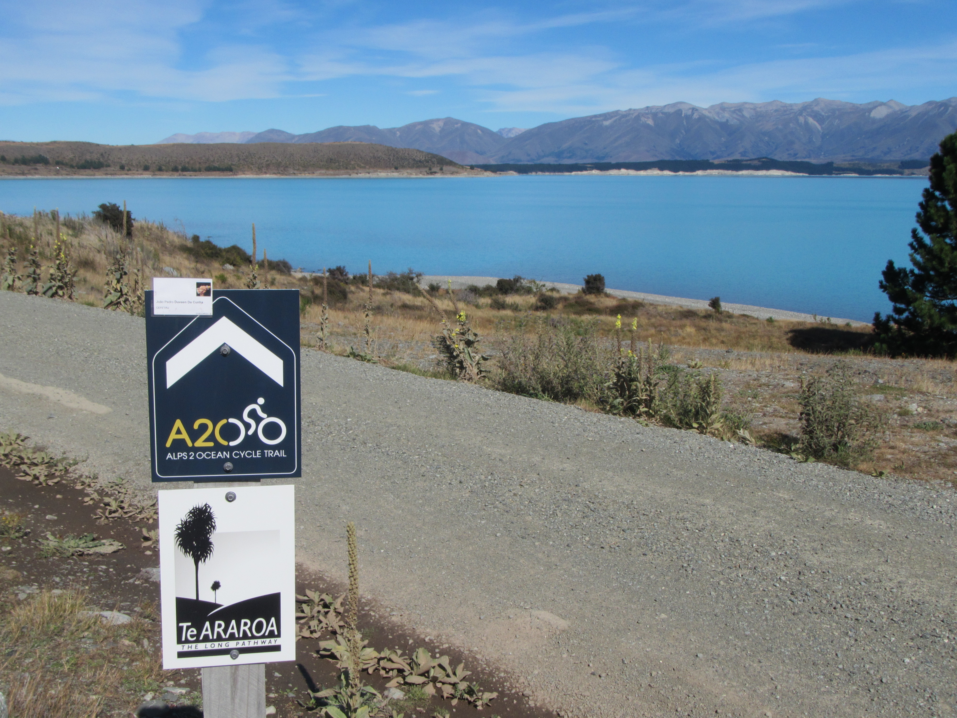
Back into the forest.

The wind never let up overnight. Strong north westerlies and unusually warm. The other guys were well and truly asleep when I rose so I grab my gear and headed outside the hut to cook up breakfast and coffee without making a disturbance inside. The sand flies were vicious and I had to pull on my shell pants to stave off the assault while the billy boiled and I got packed up.

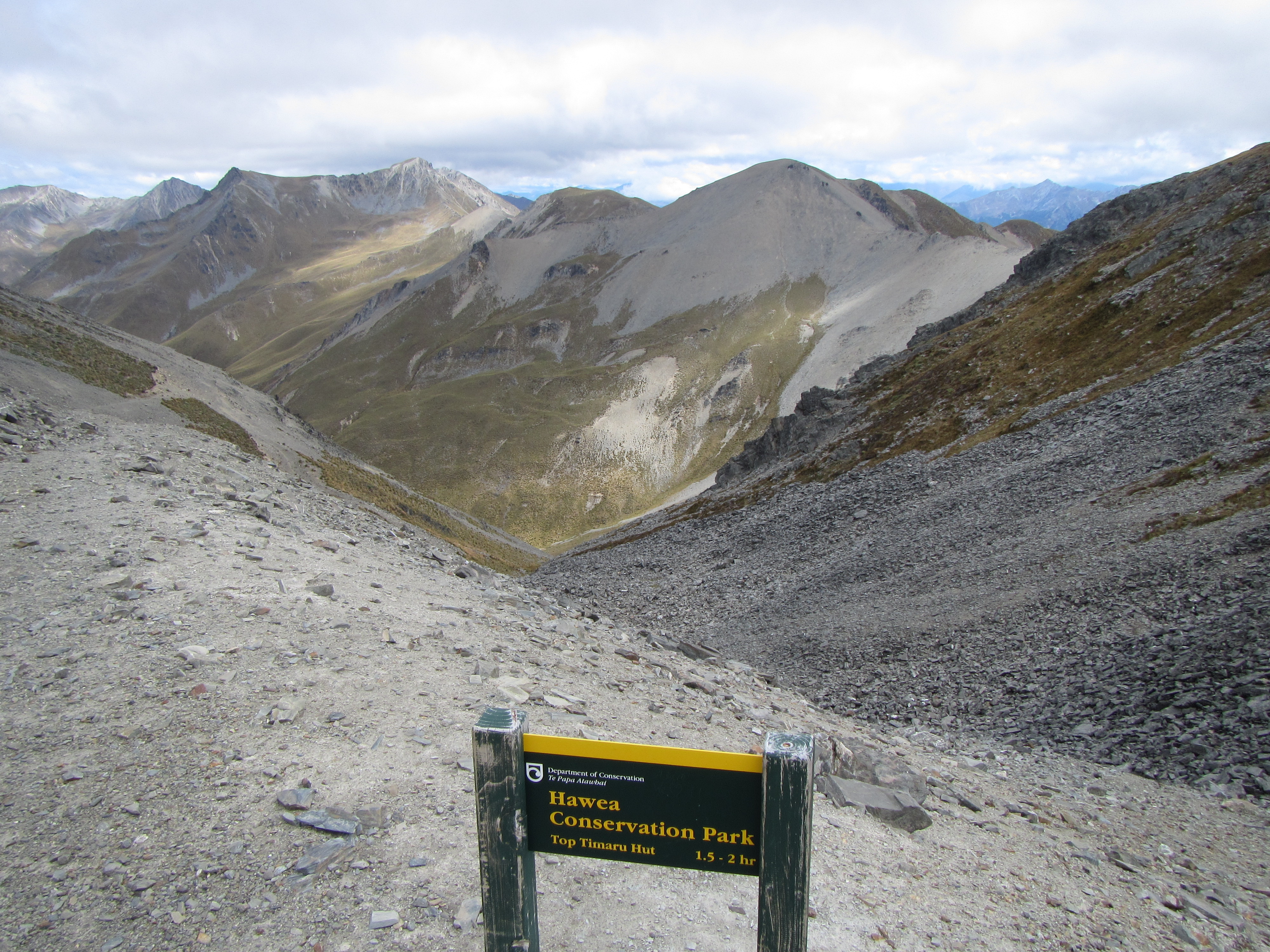
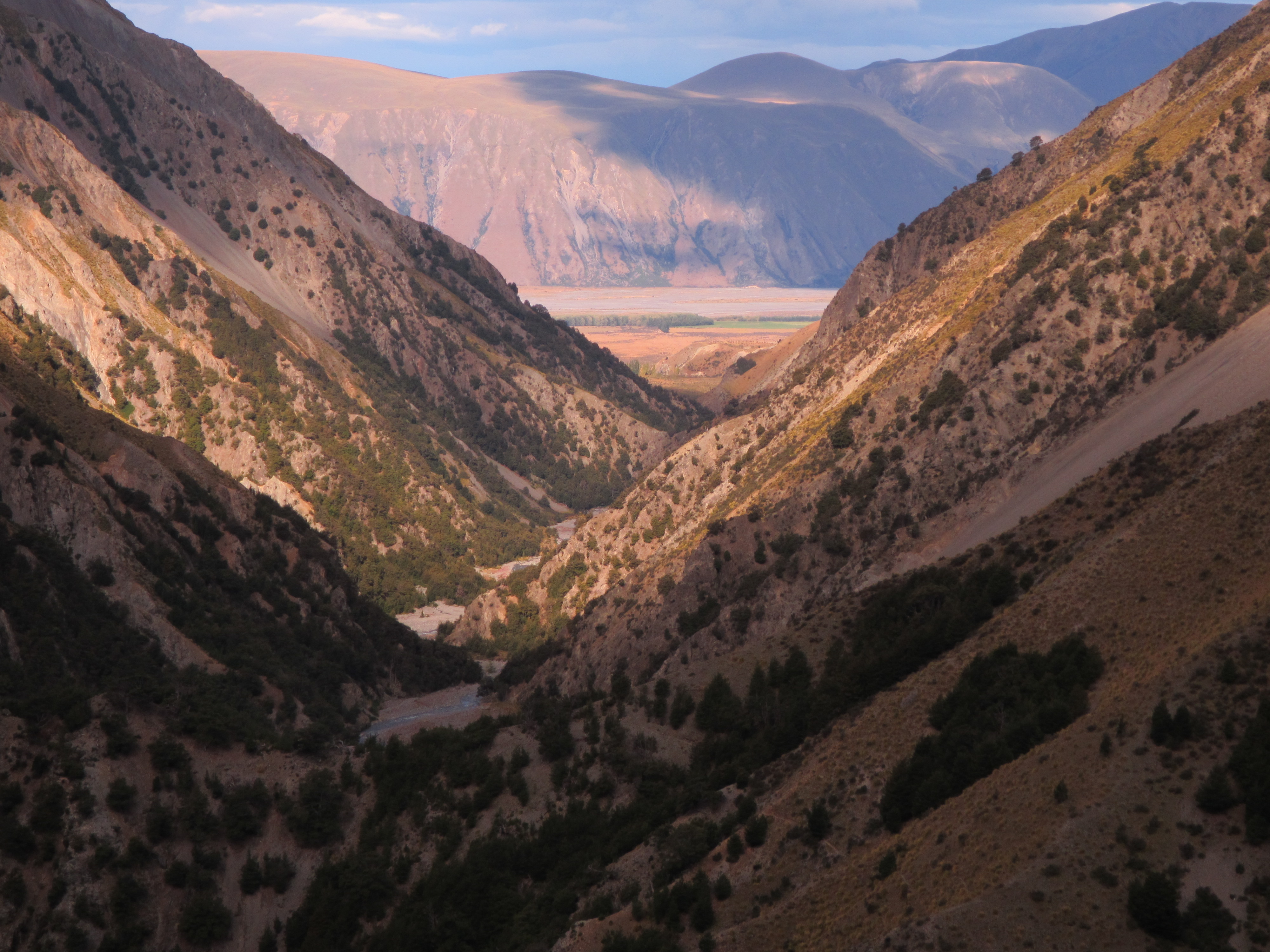
From Top Timaru Hut the dozer track continued for around a kilometre before it was back into familiar country. Into the Beech Forest following sidle tracks. Once in the shelter of the trees the wind was less noticeable. The track condition was the usual tramping standard. The sidle, out-sloped and picking its way between rock and roots, with some steep drop offs. I think after so much walking on this type of track that you get used to the exposed drop offs, to the point where you don’t really think about them any longer, crossing them just the same as you would flat ground without paying too much attention to big falls below.

image

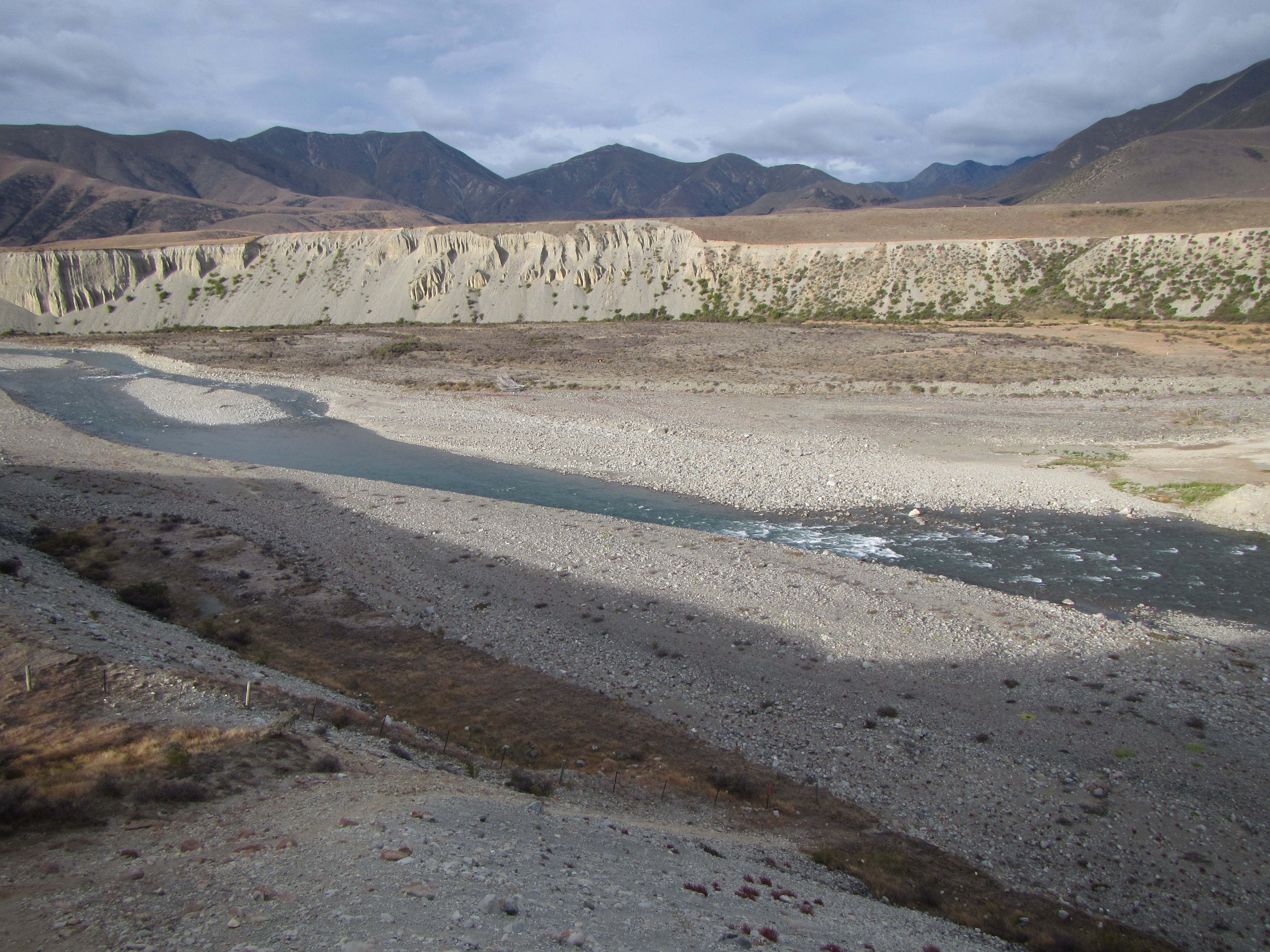
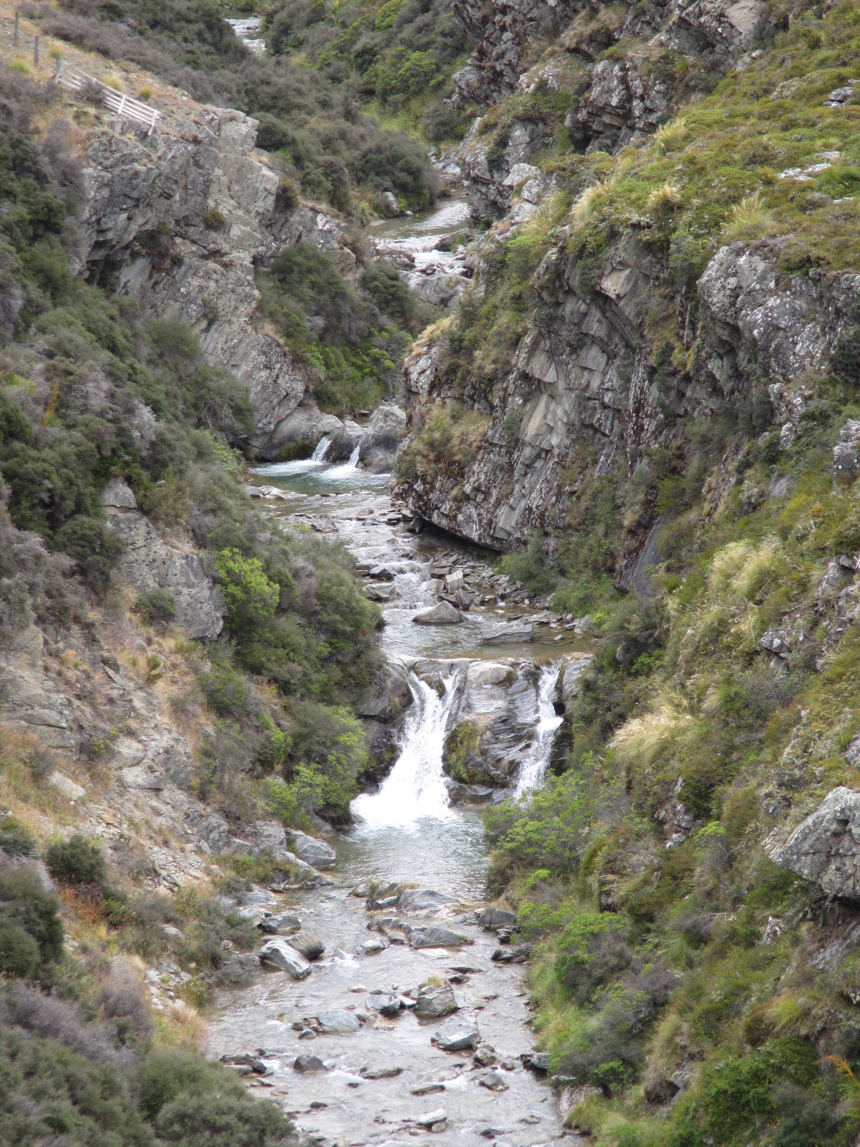
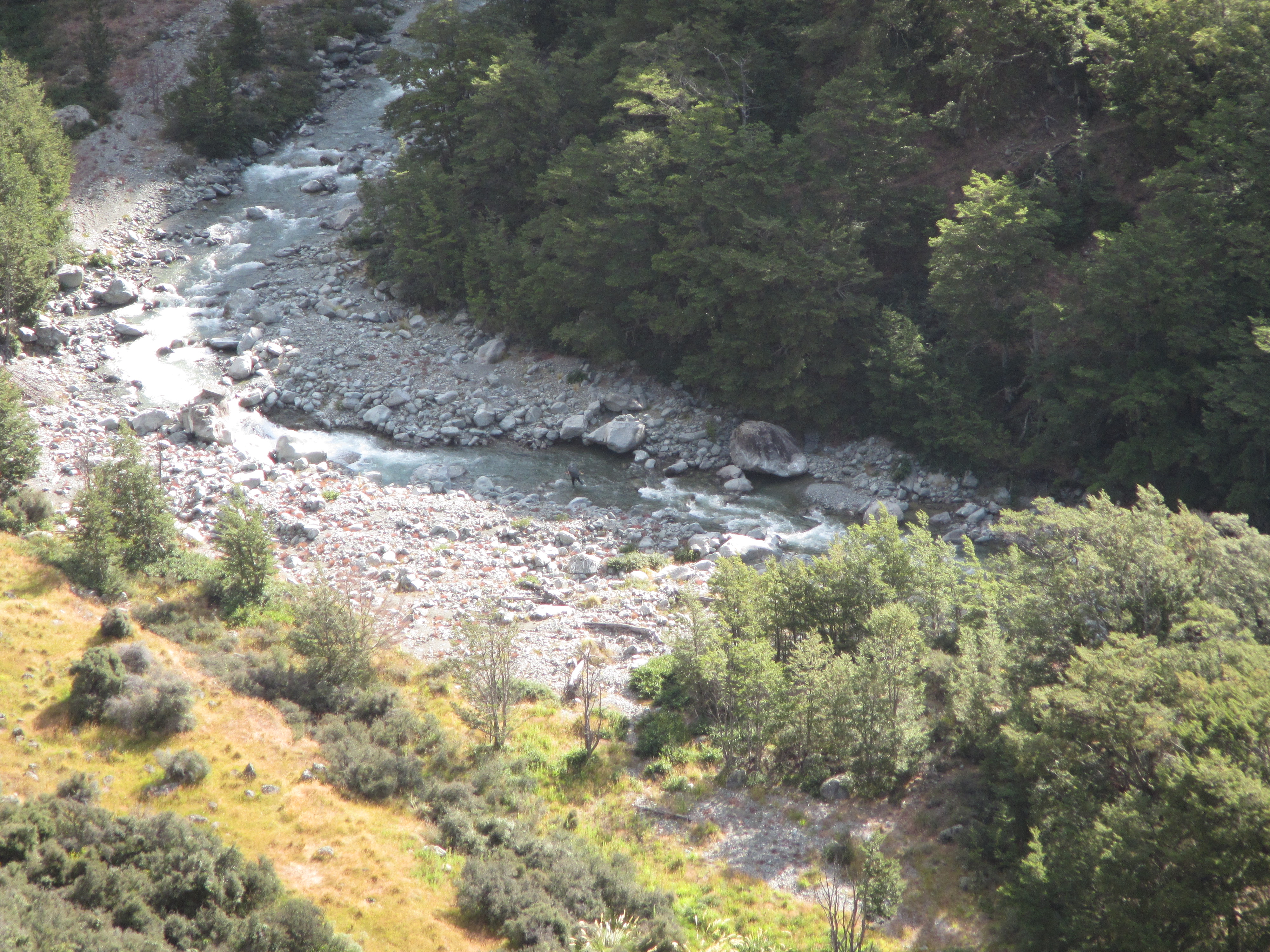
It was great to be under the shade of the trees again and sheltered somewhat from the sun. From first entering the forest the trail followed the Timaru River for 9 kilometres. Steep sidles, lots of ups and downs various spur lines running down to the river and climbing up and around rock features too tricky to negotiate on the river itself. I didn’t count them but there were around a half dozen crossings of the river itself. It was running a milky colour, indicating possible rain higher up in the catchment, but all easy negotiated. The deepest crossing was just over my knees and the current wasnt very strong.

The toughest section of the day was climbing from the river up to Stodys Hut. A horrible, steep, painstaking climb. It was another section of Te Araroa that I’m thinking is a joke. I reckon a couple of blokes were sitting over a map thinking, “hmm where can we put the trail?”, “I know. Theres a track along the Timaru River and another up on the ridgeline near Stodys Hut. Lets just join the dots up this spur line.”

It was crazy. Straight up for the first 20 minutes. In sections not even anything for shoes to grip other than making sure your feet were level with the ground to get as much rubber on dirt as you could. Talk about straining on the calfs. Once rocks started to appear it became easier as these could at least be used as steps. And once onto the actual spine of the spur the going got easier. Still, it was a hard slog up and up and up, for about an hour before the ground levelled off just near Stodys Hut.

I stopped in at Stodys for lunch. I didnt think much of the hut. A very old and run down place but I’m sure would be welcome relief in the rain. DOC don’t think much of it either and consider it to be a Basic Hut, free of charge to use.

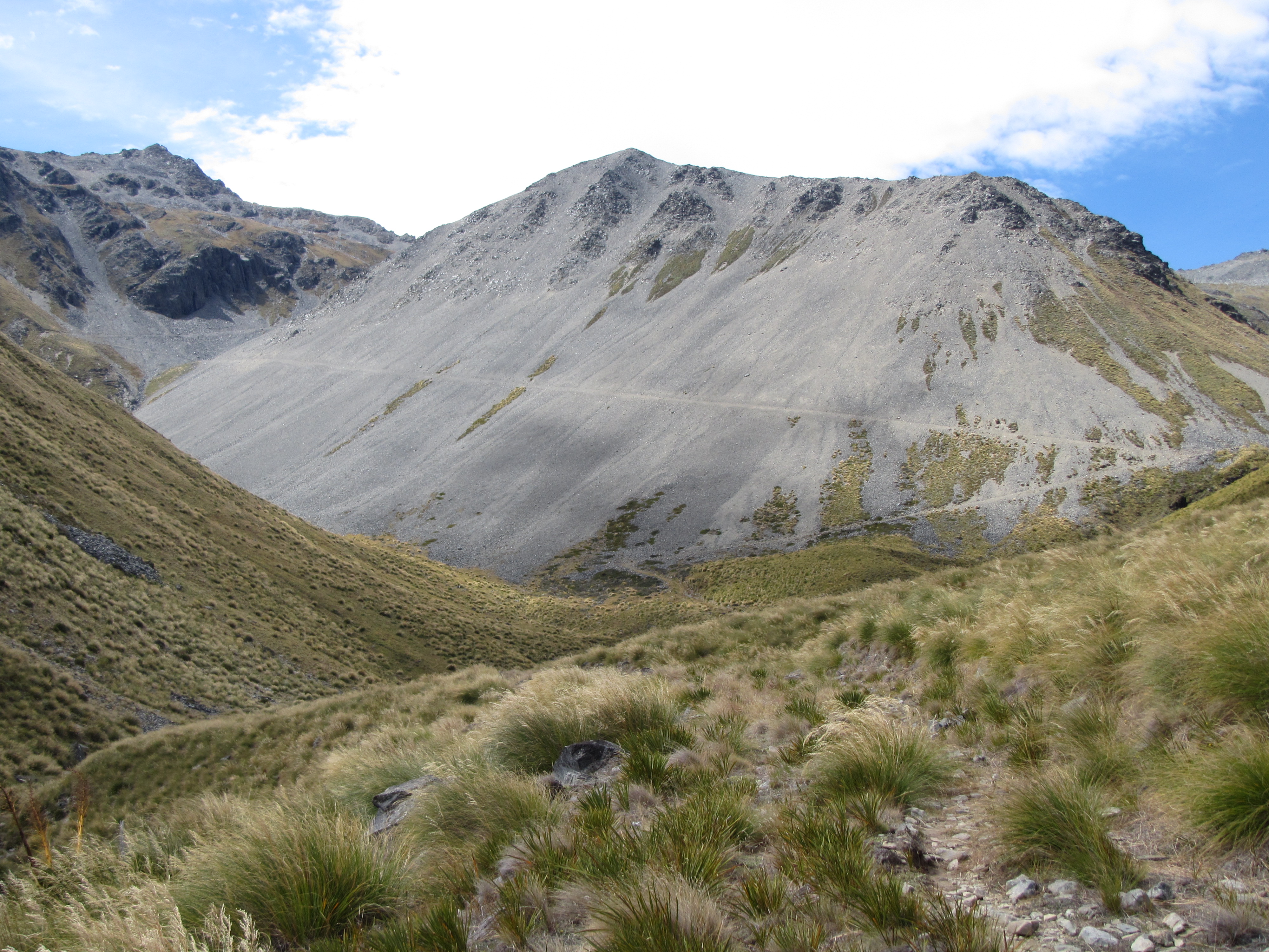
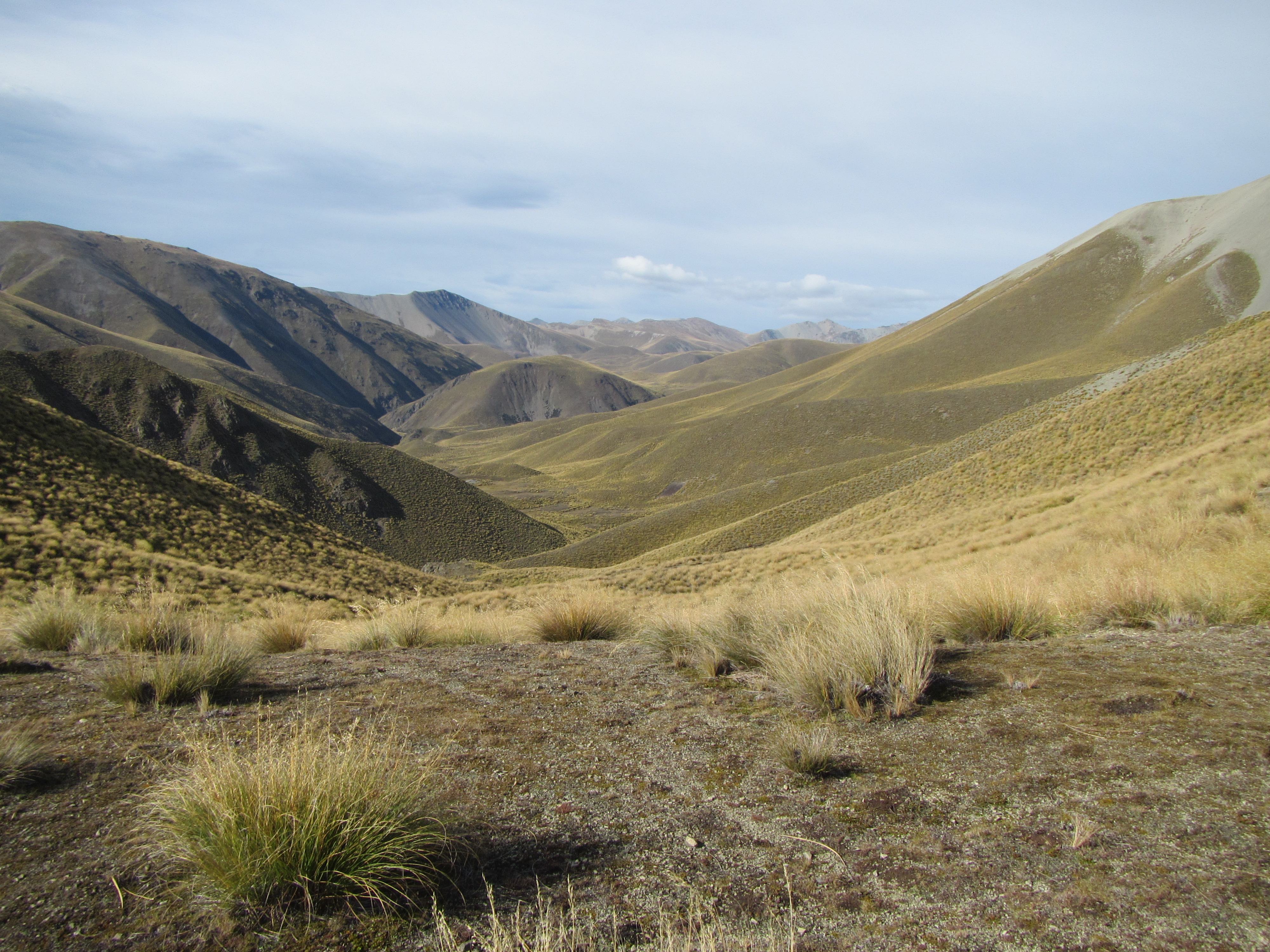
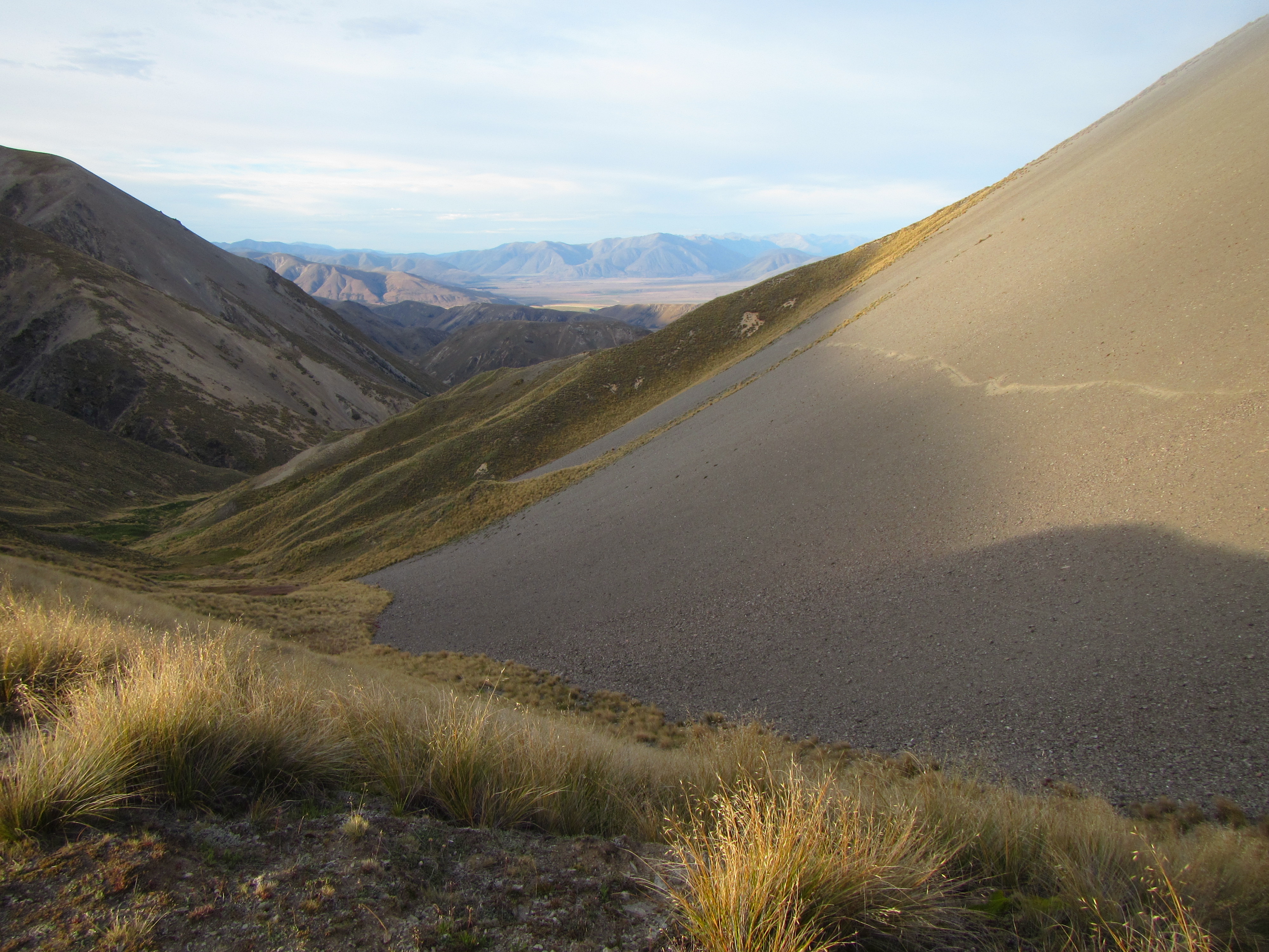
The toughest walking was out the way and the rest of the day was on old 4wd tracks from Stodys Hut right through to the top of Breast Hill. The track was high up above the tree line, through a farming station. Wide open views abounded and offered a sneak peak of Lake Hawea. The wind was fierce up high, smashing into me and trying to knock me off my feet or blow my sideways. It tried to take my hat a couple of times and eventually had to stow it before I lost it.

image

It was a quick 8.5km on the old track to the top of Breast Hill to be met with spectacular views down below to Lake Hawea and the surrounding peaks. The winds were still up and it was hard to get decent photos as the wind knocked the camera around. Arriving at the summit at the same time from the opposite direction was a French couple moving north bound. We took the opportunity to take photos of each other.

image

Leaving the summit views it was an easy last couple of kilometres along the top of th escarpment to descend a little to Pakituhi Hut, the trail moving through stunted alpine grasses. I had to fight the wind the whole way down as it funnelled up each gully to rip over the top of the escarpment, knocking me about. At least it was pushing the right way, battering me towards land and not into the void below.

On reaching the hut I met Will and Tyler from the states, both headed northbound. I’m meeting more and more north bounders every day now but unfortunately you don’t really get to know them as you those heading south as you only spending a single night together before moving on. They were great to meet. Young guys, living the dream and escaping the 9 to 5 world by taking their time on the TA. We shared music together on a small speaker that they had, shared some chocolate, coffee and great conversation. I miss playing drums and making music. I’ve found myself on a couple of occasions tapping my walking poles in time to rhythms playing through my head phones.

Day 106: TA km 2509 to Top Timaru Hut

Distance travelled today: 26 km
Total TA distance covered: 2535 km

An unexpected journey – a trampers tale.

River crossing early this morning. Just one kilometre from my camp site in the pines there a steep descent down to the Ahuriri River. Being so early in the day I wasnt about to get my shoes and socks wet and took them off. It looked a little deep as well. The water was clear and I could see the bottom and saw there were a couple of deeper holes. To be on the safe side I stripped off my shorts as well. Sure enough the deepest pockets were just under undies height. The current was strong but easily negotiable with no hassles. The water was freezing first thing in the morning. Across the other side it didn’t take long to dry off with the wind.

image

What goes down must go up. Approaching the steep bank on the far side that would take me up to the terraced paddocks up above I’m sure I was looking at a trail joke. The marker poles indicated to go straight up the near vertical gravel bank, when just a short distance to the side with a gully and much easier ground and a 100m further to the right a gravelled track leading up the hill. What the heck, I followed the poles. Impossible to head straight up on the slippery gravel, it was necessary to step up on rabbit tracks and slowly switch back my way up.

Once into the paddocks it was a quick walk to the Birchwood Road and the start of the next section, exiting Canterbury and entering into a new district for a long while, Otago.

From here the journey was quite unexpected. I had not paid too much attention to the route on my maps today and had it in my head that Te Araroa enters back into forest. To my surprise that trail followed a well graded farm road and dozer trails for just about the whole day. The walking was easy, following the undulating track along the Avon Burn. It was a big station that the trail led through but I didn’t see a lot of stock. What did stand out though were some black sheep with their tails intact. Seeing sheep with docked tails just about anywhere you go in the world that becomes the normal image that you have of sheep and you forget that they are born naturally with tails. They were funny to watch running up and down the hills, tails bouncing. The river was nice. Lots of small cascades through rocky gorges along the way.

image

Around 9km in from the Birchwood Road through the farm Te Araroa passes an old hut. I think it is a private hut but the toilet had a DOC asset tag attached to it. Anyway it was open, not locked like most private huts and I popped in for lunch.

Just as I was about to leave a hunter heading down from the hills swung by the hut for lunch as well. We had a great old chat, him having completed the south island portion of Te Araroa last year. He hadn’t had much luck chasing game up high with winds picking up. He was able to provide a great description of what lay ahead for the day.

Leaving the hut, there was an easy crossing over a river, leaving the station and getting back onto Conservation estate. From here the trail followed a bulldozed trail through some amazingly steep and rocky country. How they got a machine to construct a track through some of this rock is any ones idea. It was well graded. Obviously those that put it in know a little about roading. This continued for just about the whole next 11 km, right up and over a saddle and into another valley, the track deeply sidecut and switched back to get up and over. Crazy, madman dozer operators.

Up on top of the saddle the wind was horrific. Extremely strong and blustering, it didn’t know what it wanted to do, hitting me in the face, then swinging 180 and shoving me in the back. A couple of times I could hear the biggest gusts coming towards me as the wind whistled up the valley through the rocks. These biggest gusts strong enough to knock me sideways. I swear one gust caught my pack like a sail and fully lifted me off the ground and forward a metre. I had to really take my time to keep my footing and not get pushed over the steep side.

image

Working my way down the dozer trail the wind continued but did drop off a little. Once on the valley floor it was only a matter of following the easier trail for a few more kilometres following the Timaru River, to the Top Timaru Hut, the nice dozer trail petering out into more of tramping standard trail.

image

Dozer track side cut in scree from the pass.

It wasn’t a long day today and I reached the hut around 4pm, meeting up with Carl and Venessa ‘Nessa’, from Germany. I first met Carl a few weeks ago near the Harper Pass. Nessa and Carl have just teamed up over the last few days. Shortly later a kiwi NOBO arrived named Amber; and an Aussie NOBO, Harry. Great conversation, tea, coffee and chocolate to while a way the afternoon.

Day 105: Lake Middleton to TA km 2509

Distance travelled today: 27 km
Total TA distance covered: 2509 km

Less than 500 km to go.

There is nothing like a nice dry tent and I’m sticking to my theory that sleeping under tree cover helps a lot with this. Leaving Lake Middleton I had an easy start walking a few kilometres on road to trail turn off. There wasn’t much traffic apart from a bunch of cyclists off early for the day. They all hollered good morning remarks on their way past.

Turning off the road it was an easy walk to the Glen Mary Ski Club and up on old 4wd tracks through grazed pasture country for 2 km to link onto the A2O track again. This looked to be a relatively new construction and was perfect to walk on. It would have been a dream to ride it. Nice wide paths, new bridges over creek lines and looks of room for cyclists to pass. Both the TA and A2O share this piece of track. It entered into beech forest which I’ve missed being out the exposed Canterbury plains for more than a week now.

Te Araroa soon left the A2O, heading west steeply up through beech forest, following the Freestone Creek up stream. It was great to be back under tree cover but it didn’t last. Sadly it exited the trees and back into what has become my least favourite walking, through tussock country. There was a partial track however there were still plenty of sections where you had to pick your own route through.

Around 3 kilometres into the tussock I was starting to get a bit shitty and wasn’t enjoying this section a hell of a lot. That quickly improved as the trail headed up past some rocky bluffs to the head waters of the Ahurui River East Branch. There were tricky, scrambling sections down to the river, with the tussocks continuing high up in the valley and a few river crossings to contend with. Initially it was still hard walking for serval more kilometres but as the river wound down the valley, the valley opened up wider and the walking became easier as the trail snuck up high to some terraces and flatter ground up above the river.

A healthy specimen of Spiky Spaniard (Spear Grass)

A healthy specimen of Spiky Spaniard (Spear Grass)


imageimage

On the terraces the grass was much shorter and the there was more of a defined trail over the rocky ground. I liked this and was throughly enjoying the back end of the day, strolling along, taking in the sights. The last 10 km of the day were through similar country, following the Ahurui River. I didn’t have a set destination for the day but by 5:30pm I’d had enough and found a sheltered camp under pines. Along the way I passed the 2500 km mark but didn’t really pay that much attention, only noticing this at the end of the day. Another sheltered camp was great as the wind was howling out off the hills down onto the flats. My chosen stop would set me up well to cross the Ahurui River proper first thing tomorrow morning.


Day 104: Twizel to Lake Middleton

Distance travelled today: 29 km
Total TA distance covered: 2482 km

It doesn’t get much simpler than this.

A really relaxing, straight forward day on a mix of very quiet 4wd tracks and continuing on the Alps to Ocean (A2O) cycleway.

I shared a hostel room with a Japanese guy last night and had a restless sleep. The bunk bed was a cheap metal thing, moving and creaking loudly anytime either one of us rolled over. He was a loud snorer as well and kept me awake for a good chunk of the night. My alarm went off at the usual time of 6:30am but I hit the button, rolled over and had a sleep in. I knew the walking would be a piece of cake today and there was no rush.

Finally up and moving, I had a nice hot shower, packed my gear and headed across the road to the bakery to pick up some fresh salad rolls for lunch. Next stop was across to the Hydro Cafe for a cooked breakfast and large double shot latte.

I was on the road around 8:30am, picking up a walking/bike path adjacent to the highway and followed this for a few kilometres to a bridge over the Ohau River and the Ruataniwha Dam wall. A Salmon farm operates in the Ruataniwha Lake with a line of large floating cages and nets strung together in a lot line. I couldn’t see the fish but could hear them breaking the surface and churning the water. Quite a few fisherman lined the banks hoping to snag the odd fish that have made an escape from the pens.

The trail lead headed up past the salmon pens, along on a terrace above the lakes stoney banks. It was easy walking along here. A mix of trail and the odd section of a 4wd track before the trail continued predominately on the 4wd track. It was very, very quiet. No traffic at all. This was great. I floated along, listening to my ipod which always seems to make the miles tick by. I’m reliving my childhood and halfway through Mark Twain’s the Adventures of Huckleberry Fin.

image

I made it around the southern edge of Lake Ruatainwha and continue following the Ohau River up stream which connects Lake Ohau to Lake Ruataiwha as part of a large hydro electric scheme in these parts. Getting to the weir at Lake Ohau itself I stopped for lunch before I started down the A2O route.

image

I found the tiniest piece of shade under a bush and made myself comfortable for a long lunch. Now on the cycleway proper quite a few cyclists started to come past, a mix of rail trail type riders out on guided tours and the authentic cycling tourist types, bike loaded with panniers. Also a large pack of 10 riders in matching jerseys raising money for a cancer charity on a long ride around the country. They were all great. Many of the touring cyclists took a real interest in my Te Araroa journey and I had a stack of conversations along the way. It was great to be able to talk shop with them as well, looking at their bike set ups and talking gear. A couple were on fold up bikes with panniers which I took a real interest in. They’ve ridden about 2000 kilometres but were struggling on the gravelled cycleway with small wheels.

The walking was a cruise as I continued on the A2O around the edge of Lake Ohau. Approaching the end of the cycleway and getting out towards a short road section if was mid afternoon with a blazing sun. It was hot out and exposed. I had plenty of time and cut across to the lake, dumping my pack, jumping in for a refreshing swim. I imagined it would be freezing given the steep peaks at the back of the lake, many with snow deposits still clinging to their sides, but it wasn’t too bad. I ran into the water in any case so I wouldn’t chicken out when my feet first hit the water. Out above head height it was cold. Coser into shore it was perfect. I wallowed away in the shallows for a good 20 minutes, absolutely refreshed, and lay on the warm rocks to air dry.

After my swim it was an easy 1.5km of road walking to a nice campsite at Lake Middleton. Lots of families and cyclists camped down by the lakes edge but not for me. I’ve always found that sleeping in the open without tree cover or near open water that I get a stack of condensation in the morning but not so under the trees. I found the perfect site nestles in amongst pines. A lovely day.

image

Day 103: Tekapo to Twizel

Distance travelled today: 69 km

Total TA distance covered: 2453 km

Biking and slack packing.

To get to Twizel from Tekapo would have taken two days to walk on roads and cycleways, so I made the obvious decision to hire a treadly and get to Twizel in half a day by riding this section of Te Araroa.

Wow! After walking for 3.5 months with a pack I had forgotten what cycle touring is like. The kilometres were chewed down, covering the distance of a typical 8 to 10 hour walking day in only a couple. I was loving it and really need to do more cycle touring.

Being a hire bike it wasn’t the best but I made do. I found the gravel roads a little tough on the hands as they got the shit shaken out them on corrugations which is tough without bike gloves, knicks and descent suspension. I would wear it though. Getting 2 days completed in less than half a day was great.

Once along side Lake Pukaki and onto the official Alps to Ocean cycleway things got a little better, especially the views out over the lake  and Mount Cook dominating the horizon.

imageimageimageimage


Day 101: Camp Stream Hut to Tekapo

Distance travelled today: 34 km

Total TA distance covered: 2384 km

Fresh snow.

Another rainy night in my tent but the Six Moon Designs Lunar Solo held up well. I stayed dried in the tent and warm in my sleeping bag and thermals. Very thankful that I swapped out my summer bag for a warmer model for the south island. I envisage more cold nights coming up as I head further south.

There was no chance to dry yesterdays wet clothes though and I had no option but to get eventually put them back in. Sun was expected today and I knew with a shell layer over the top to act as insulation I would soon warm up and my clothes would dry later in the day. That thought did nothing for that uncomfortable feeling of putting on damp clothes first thing in the morning.

Exiting the tent, I was amazed to see all the surrounding hills had a fresh dusting of snow on top so it was obviously a cold night. I was thankful that I was able to cross Stagg Saddle yesterday otherwise I would tackling it in snow today. In the early morning light the hill top scene was amazing. Others in the hut thought so too as they spilled out to take some photos.

imageimage

The tramping was easy today. Big miles butveasy to do.

From the hut the poled route followed Camp Stream Hut and I started to follow this but was soon running into multiple creek crossings, spear grass and tussocks aling the creek. I knew I had to follow the creek for several kilometres so navigation was easy and I spied a much easier route on a gravel terrace up above the creek. I headed for it and sure enough this route was much easier. Better yet it overlooked the creek and it was easy to see the marker poles down below.

There was one major climb today and it came early. Crossing Camp Stream the trail headed straight up hill towards Round Hill to a hanging valley. A valley suspended high above the river on a wide terrace and surrounded by tall peaks. Still through tussock country but small stunted stuff with looks or bare or open ground. Once up high the walking was easy and would continue all the way to the  Lilybank Road on the edge of Lake Tekapo.

Getting up on top was amazing. Clear views over Lake Tekapo, Mt Cook and surrounding mounains all with fresh snow.

image

I had heard Tekapo can be quitecthe zoo and most accomodation booked out so I wasn’t quite sure where I would be staying tonight. I found a hill top will reception and began making calls. Sure enough most venues were fully booked, including the YHA and camping sites. I had sent my bounce box and a 3rd pair of trail runners ahead to the YHA from Nelson some weeks ago and was hoping to stay there. Unfortunately not to be this time. After about the 5th phone call I finally scored a motel room. That would suit me well as I planned to have a day off tomorrow and not having to share a room with stanard backpackers is always good – they tend to follow the party, stay out late and make lots of noise; trampers on the other hand are typically in bed by 8:30 exhausted from another hard day.

Continuing along the suspended valley the trail finally led down to Lake Tekapo. I wasn’t looking forward to the road walk into town but it had to be done.

Once on the road it was just a matter of counting down the kilometres. I got to within 5 or 6 km of town when a car pulled up and offered a lift. I accepted. Turns out my ride are part of the Sri Lankan 1st class team over in New Zealand for a tour with a day off and doing the touristy things. Awesome. Great conversation for the short ride into town but I cant for the life of me remember their names. Sorry guys. Good Luck against the Black Caps. Watch out for Brendan McCullum.

image

Day 100: Crooked Spur Hut to Camp Stream Hut

Distance travelled today: 30 km
Total TA distance covered: 2350 km

It’s a ton – 100 days in.

Big storm overnight. Lightning, thunder, strong winds and more rain. I don’t like the chances of the north bounders we were with last night in being able to cross the Rangitata and they might even have some difficulties down Bush Stream towards Mesopotamia Station.

By morning it looked like it had cleared. The winds were still strong but blue shone through. From Crooked Spur Hut it was straight into a long climb for an hour through high tussocks and up a scree slope to a saddle into a new valley system.

The theme for the day was total landscape immersion and I realised that that is what Te Araroa offers any tramper right along the length of the country. The trail doesn’t just give you a taste of different landscapes, be they beaches, muddy forests, road walking, river valleys or high mountain passes, the trail gives you total immersion in each. Why walk through a landscape for a day when you can do it for 4 days or a week at a time. At the moment I am immersed, if not engulfed, in tussock country.

image

There is no trail through these. Just the odd faint mark of where others have walked if anything. For the most part is find your own route through the stuff. For kilometres and kilometres. There is a lightly poled route through. Black pickets with orange pipe markers on top. These can be really difficult to locate and are often obscured in the head high tussocks. You have to look hard to find them but there are just enough to keep you headed in the right general direction. Often they will be located on the top of saddles or hills where they stand out on the horizon if viewed from below. The really tricky ones are down low with a background of tussocks to camouflage them.

So yes, tussocks, tussocks and more tussocks plus some speargrass thrown in. For good measure, for just about the whole day, some 29 kilometres, minus a kilometre or two of rock and scree scrambling.

But despite the tussocks walking the mornings terrain was relatively flat. Descending down from the saddle the route followed along an undulating line over a series of small ridges, saddles and the odd stream crossing towards Stone Hut for around 7km.

I got here around 10:30am and was shortly joined by Steffen, Will, Liz and Carl for a morning tea break. These guys were only headed to Royal Hut today, only another 2 hours away, where as I has keen to get some kilometres in and climb over Stagg Saddle today, working my way towards Camp Stream Hut. It was going to be a big day. As much as I would have liked to hang around for a leisurely break I had to keep trekking, particularly while the weather was still semi favourable, and got myself going.

Not far from Stone Hut, maybe 45 mins in, the rain started again. A good soaking rain and I was drenched in no time, but warm. I had my Icebreaker gloves on for the first time today given the chill factor and even had to wear shell mitts over the top to keep my hands warm. A sign of the weather heading further south?

I reached Royal Hut in around 1.5 hours and got stuck into some lunch while I contemplated my next move. To stay in the hut or move forwards. In the hut I could strip out of my wet gear and get dry and enjoy a relaxing afternoon. Unfortunately there was no fuel around to get a fire going out in the middle of the tussock country so drying wet gear would have been impossible. To keep going, I could getvmore distance in and while the wind held off could tackle Stagg Saddle, the highest point on Te Araroa. I couldn’t get any wetter. If the wind stayed off and I kept moving I would be warm enough.

Decision made, I pressed on. Leaving the semi comfort of Royal Hut I headed back out into the rain and started toward the saddle. The first two kilometres was a gradual climb following an unnamed stream, crossing from side to side as required, before the terrain really kicked up for a 500 m section, climbing 200 m of what felt like near vertical terrain.

A lightly poled route lead up over tussocks and scree slopes. Lots of false summits kept appearing. I’d see a pole on the horizon thinking this has to be the top only to approach it and see another, bigger hillside behind it. The rain was coming down hard but the wind held off. All good to get to the top and down across the other side. The ground was saturated. Every depression and minor gully filled and over flowing with water. Alpine peat bogs acting as sponges to soak it all up and felling like sponges under foot. Water seemed to be seeping out of everything, scree, rock and moss patches.

Over the steepest ground the terrain flattened a little as the trail climbed on scree, eventually bring me out at Stagg Saddle. On top I could feel the wind and wasnt about to hang around. I grabbed a couple of quick pictures on top of the highest point onthe Te Araroa and was keen to drop down the other side.

image

On a good day there is fantastic route that leads up even higher from the saddle to an open ridge top to walk on for a good 6 km with stunning views over Lake Tekapo and over Mount Cook. This wasn’t an option for me today. The cloud cover would have obscured any views and up even higher it was bound to be colder with the wind chill. The low land route it was for me.

Unfortunately once off the scree from the saddle it was back into tussocks. No trail to speak of, only a lightly poled route to follow all the way to Crooked Spur Hut. i was drench and had to keep moving to stay warm so I was on a mission, a forced march to Camp Stream Hut.

I was picturing a quiet hut all to myself with a roaring fire to get my gear dried and warm up a bit. Other than stupid me, who could possibly be out walking in this shite weather. Camp Creek Hut is an old 6 bunk hut. Imagine my surprise on reaching to hut to find 8 other TA trampers crammed inside. All bunks taken, one would be sleeping on the floor, the 8th in a rigged up hammock in the middle of the hut. Oh no! My worst nightmare. I was going to have to settle for a damp night in my tent. But the crew inside were all very understanding and had all been in this situation themselves. As I set my tent up, they made me a nice hot cup of ginger tea and shuffled around to make room so I could at least get out of the cold and hang some wet gear to dry a little.

Eventually I had to make my way out of the hut and into the tent as the others were getting settled for the night. Oh well, town tomorrow and a earned day off I reckon.

Day 99: TA km 2297 to Crooked Spur Hut

Distance travelled today: 36 km, officially 23 TA km
Total TA distance covered: 2320 km

Rangitata River – an essay on how not to cross hazard zones.

One of my biggest fears eventuated overnight – it rained. Not heavy but constant through the night. This is not what I needed coming up to a crossing of the Rangitata River. This river is another hazard zone that does not form part of Te Araroa with the trail ending near the Potts River and commencing again on the opposite side. Like the Rakaia River, the Rangitata is a major braided river with constantly changing channels and banks with an unsettled shingle bed that is constantly shifting. The major difference between the two rivers that I can see is the Rangitata has a much wider river flat at over 5 kilometres and more braids, thus the water flows are generally less than the Rakaia. Most trampers I’ve spoken with heading north has successfully negotiated the river in ankle to knee deep waters. I was prepared to give this one a go but did not need the rain to increase the hazard or make a crossing more difficult than it was going to be. The alternative to crossing is a major hitch around on isolated country roads with low traffic flow. Getting around could take several days and back tracking the previous two days would have the same outcome. Time was of the essence and I got going before more rain started and the river had time to collect the water from its large catchment making a crossing impossible.

From my camp site it was easy walking up the river valley to a small saddle, reaching the 2300 km on the way. From the saddle there was a steepish descent along a fence line on red clay that the rain had turned to a slippery mess. Part way down I skidded uncontrollable and landed on my butt, sliding down hill for a couple of metres and ended up covered in red mud. It made the descent quicker but not the way I would have liked. Not far from the bottom of the hill a turn off to Lake Coleridge Village was sign posted only a couple of kilometres away and an hour or so walk. Hmm… fresh coffee or a cooked breakfast would be good right now but I didn’t have the time to waste. I needed to get across the river.

The rain came and went. More a light sprinkle than true rain. The annoying sort of moisture where its too much not to wear a shell layer but hot and sweety walking in a jacket. It was fast walking through open paddocks on a defined track towards Lake Clearwater itself.

The sun made a brief appearance and I took the rainbow that formed out in front with its end touching down towards the Rangitata as a good sign. I kept moving. Five kilometres or so across undulating paddocks the trail took me high above the banks of the Potts River and great views out across the broad valley of the Rangitata. Spying the Potts River was not a good sign. The water was not clear but a milky grey indicating that the water volume had picked up and was moving sediment about. Fingers crossed.

image

Te Araroa continued along the high banks adjacent to the Potts River for another 2.5 km, emerging at a small carpark and bridge over the Potts, where the trail ends on this side. I was still determined to cross the Rangitata but fully prepared now for the possibility of having to turn back once I’d assessed the conditions. The problem is that you don’t reach the first braids of the main river to assess until about 3.5 km of walking on old settled rocky flood debris.

image

I crossed the main Potts River over the bridge but did have to tackle a few small braids. All good. Yes the water was discoloured but was just above the ankles and no problem to cross. Now for the 3.5km of walking old shingle beds. Out along the singles Mount Sunday could be seen a few kilometres to the north. This is the hill top where the city of Edoras was built for filming Lord of the Rings, an isolated hill top in a sea of yellow grass.

I’d mapped out a route across the Rangitata above the major braid confluences and was going to tackle each braid as a separate river, always prepared to turn back. But its difficult plotting a route as what is mapped is constantly changing.

Getting to the first braid the water was the same as the Potts, milky and stirred up, not clear and I couldn’t really see the bottom. Braving the first few tentative steps in I found the water to be just under knees and headed across. So far so good but a long way to go. I wouldn’t recommend this as an option to anyone. If the water is discoloured turn around, don’t risk it.

Continuing on I picked the river apart always moving up stream when coming across a confluence of braids in order to separate the flow and tackle each piece separately. For the most part the crossings were ankle to knee deep but they did get tricker the further across I went. The deepest sections were just at hip height and you could pick the much deeper channels with surging water. I stayed well clear of these.

More than half way across I came to the deepest channel. This looked like a piece of work and it was. The water was ripping through and the shallowest crossing point I could find was just above hip belt deep. Slowly stepping in I could feel the waters surge trying to knock me off my feet. With feet braced and walking poles planted up stream I took it very, very slowly. One foot slowly stepping side ways as the other plus poles were firmly planted. All it would take is to have one leg knocked off balance or step into and unseen hole and I’d be going for a swim. Needless to say for crossing each braid my pack straps were not done up and well loose in the eventuality that I needed to ditch it and make a swim. I repeat – do not try this at home kids. The worst section was just about done but not quite yet.

I see what they mean about unsettled shingle beds. For a few metres in the deepest section of the major braid with the highest flows my footing was constantly shifting under foot. There was nothing firm to stand on. I would describe this like standing in the shallows at the beach in bare feet and having the sand shift under foot was the waves moving in and out. This was the worst section and if anything could go wrong it would go wrong here. I’d like to think that sensible decision making and hardcore outdoorsmanship got me through this but really it was probably just luck that got me to the other side unscathed. I was thankful that I didn’t have to swim and chase my pack down river.

A few more braids to cross at knee depth and I was home and hosed. Nerves shot. Safely on the other side I picked up and old 4wd track and followed this down to the trail head. Here is the route I took across. Do not attempt this under any circumstances if the water is not clear.

image

image

Looking back across the Rangitata River braids


A picture tells 1000 words - the many braids of the Rangitata, Potts River confluence.

A picture tells 1000 words – the many braids of the Rangitata, Potts River confluence.

Picking up the trail head I followed the very lightly poled route up Bush Stream. This too was higher than expected and the water slightly discoloured. Like many a stream track already encountered, the route up Bush Stream was a choose your own adventure, picking the easiest walking along the rocky banks and crossing the river to easier ground when encountering an impassable feature on the side you are on. It was really lightly poled and not many clues were offered on where the route follows. In such circumstances follow your nose and eventually you will spy a marker offering some reassurance you’re on the right path.

image

After a major day already, Bush Stream took a good 3 hours to negotiate a path up stream. Eventually a massive orange triangle indicated the route now left the river to climb very steeply up hill on a switched back track. For anyone that is a Lord of the Rings fan this reminded me of the switch back track that the main characters climb above the Rohan camp as the assemble for the battle on Minas Tirith and to the start of the Path of the Dead.

In true kiwi tramping style this trail took me straight up and straight back down to the river again on the other side. I think it climbs around a gorge section of the river too tricky to negotiate otherwise. Just before climbing down again I came across Stefan standing on the high point taking some photos. I haven’t seen him since Wellington, many weeks ago. Chance meetings like this are awesome on the trail. You think your walking solo but you’re not really. It was great to have a quick catch up and we would in more detail at Crooked Spur Hut.

I followed Stefan down the slope to the river, only to cross it and commence up another 250 metre climb towards the hut. What a relief to make it to the hut after a massive day. The pay off was the views offered looking right back down Bush Stream towards the Rangitata River and the surrounding hill sides.

image

imageimage

I would be sharing the hut with Stefan’s new companions, Will from Scotland, Liz fron the US and Carlos from Germany; and a couple of NOBO’s. Catching up on everyones adventures and challenges is always great. I found out that Shania, aka Slips, has also had to leave the trail recently – bad luck Slips, hope you can earn a few bucks and get back on trail later in the year.

Day 98: TA km 2265 to TA km 2297

Distance covered today: 32 km

Total TA distance covered: 2297 km

Just short of 2300 km.

I woke to what would be another stunning day. A few clouds about, glowing bright pinks and reds in the pre-dawn sky.

image

image


I had a big day planned to set myself up with plenty of time to cross the Rangitata River tomorrow, another hazrad zone. I was aiming for around 30 km today.

From my camp site the trail continued through thick tussocks and speargrass, climbing to Clents Saddle. After experiencing the spiky spaniard yesterday I made sure I had long gaiters today and did not regret it.

Approaching the top of the saddle there was a series of scree slopes to sidle across.

imageimageimage

Across these it was back into more tussocks and a climb down along ridges to the valley floor. I met up with a junction to Double Hut but it was a good kilometre off track. Normally I would visit each hut and sign into the intentions book but it was going to chew into my day and I opted to skip it, instead continuing towards Manuka Hut.

From the Double Hut junction the trail picked up an old track, partially on an old stoney river bed and other times through short tussocky country. The walking was easy and fast on the flat valley floor. Along the way several mapped lakes were shown but these turned out to be dry this year and looked more like salt pans.

As with Double Hut I got to the junction of Manuka Hutband made the same call. Rather than walk in 500 m for a 1 km round trip, I skipped it and kept going, continuing through tussocks as the old track petered out. Up and over a hill I was treated to some stunning views north. Snow capped mountains forming the back drop to Lake Emily in the foreground and Castle Ridge Station.

image

Once into the farming property the walking was quick again as the trail picked up a farm road to follow for the next 4.5 km out to a gravel road.

From the road I started to get a bit tired. More road walking but only short. Gravel roads dont make for the most enjoyable walking and I plodded along. Although I wasn’t expecting much traffic, it wasn’t the widest of roads and walking in the middle is easier than on the loose gravel edges. If there was some sort of verge to walk on I would have put my ipod on to listen to some music, podcast or audio book to make the kilometres go quicker but I judged it too risky with the odd vehicle coming through, particularly the ones from behind. I don’t want tonget cleaned up by a vehicle. It was a good 5 km of road walking before Te Araroa headed off again.

I’m loving the wide valley scenery as it makes for big 360 degree views but one issue I am finding is the lack of shade for my pale arsed skin. With the sun out in force there is nowhere to hide. I’d normally make like a lizard, darting in and out of the sun all day but out here it is exposed all the time. Some come rest break time I try and seek out what ever shade there may be, whether than be an isolated tree, small shrub or in my next case a bridge.

At the end of the road bash i was desperate for a long, cool break and found one. Like a good hobo, I sort out the shelter underneath a small bridge over the Ashburton River. Perfect. Cool, dark, out of the sun and out of the strong wind that had picked up. Also an opportunity for a quick dip and restock of water. I throughly enjoyed a nice half hour break.

For the rest of the day I was going to just keep walking until I’d had enough and found a nice flat site to pitch my tent. Tussocks don’t provide the best opportunities for camp sites as there just arent that many gaps of cleared space between the plants.

Leaving my bridge and getting off road again, I stuck my ipod in for some motivation and pushed on another 6.5 km to a nice location on the edge of Paddle Hill Creek, nestled in a valley between Dogs Hill and Mount Guy, both over 1000 metres. I would have loved to have pushed the extra few kilometres to reach the 2300 km mark but just didn’t have it in me today. 32 km is not a bad effort though.