Te Araroa Stats

‘Attached below is a spreadsheet showing each days start and end points, distance traveled, total Te Araroa kilometres and where I stayed.

Te Araroa Daily Log

Other trail stats and tid bits:

  • Trail slogan: keep putting one foot in front of the other
  • Starting kilometer: 0 km Cape Reinga
  • Finishing kilometer: 3008 Stirling Point / Bluff
  • Days walked: 108
  • Zero days: 16
  • Total days: 124
  • Average distance walked (including zeros): 22 km / day
  • Average distance walked (just walking days): 25.3 km / day
  • Longest stretch between resupplies: 7 days
  • Longest day (distance): 45 km, Whangauni to pines in Stantof Forest
  • Longest day (time): 13 hours for 36km in Reatea Forest
  • Top speed: 6.5 km / hr, road walking
  • Slowest speed: 1.5 km / hr, northern forests
  • Number nights in a tent: 42
  • Number of nights in a hut: 28
  • Number of nights in a bed: 52 (hostel, motel, holiday parks and trail angels)
  • Number of nights hosted by trail angels: 6
  • Favorite huts: Waitewawae, Hunter, Hamilton, Anne
  • Best tenting sites: 4 km south of Caroline Biv in beech trees above river; and Clents Hill Saddle
  • Funniest tenting site: veggie patch at Melva & Hiltons
  • Strangest placed slept: Nakid Inn; common room at Stillwater Holiday Park – it was free for TA walkers, Koriniti Preschool on Whangauni River trip.
  • Longest stretch between showers: 7 days
  • Longest stretch between clothes washes: 14 days
  • 4 monthly weather forecast: fine with showers
  • Number of gear items replaced: 14 (pack cover, shoes x 3, insoles, socks x 6, pot, sleeping mat, rain pants)
  • Number of gear broken: 3 (2 x shoes, pack cover ripped)
  • Favorite pieces of gear: Leki Cork Lite walking poles, Sea to Summit pillow, all of my IceBreaker merino clothing
  • Least favorite sections: road walking on north island, Moir Hill forest roads, Puketi sidle hell trail, gravel walking along Taramaku River, Otira River flood track, Two Thumbs Track tussock country, all out sloped sidle trails.
  • Favorite sections: so many. Papakauri Stream, Mangapukahukaha Stream (Ohamuta Forest), cliff top walk into Auckland, Hauhungaroa Range (Puerora Forest), Tararua Range, Pelorus River, Nelson Lakes National Park, Arthurs Pass to Hamilton Hut.
  • Best views: too many. Clents Saddle dark sky zone, Crooked Spur Hut, Lake Pukaki, Breast Hill, Travers Saddle, Blue Lake, Waiau Pass etc…
  • Hardest section (physically): climb up to Starveall Hut
  • Hardest section (mentally): long stretches of road walking, tussock walking
  • Number of wet feet day: 100, at least once a day for sure minus a few
  • Number of hissy fits: 100, every time my feet first got wet
  • Number of times swore each day: at least 5
  • Number of injuries: 0, minor scraps and cuts
  • Weight lost: 15 kg
  • Estimated number nut bars consumed: 216
  • Estimated amount of chocolate consumed: 6.5 kg
  • Estimated amount of tuna sachets consumed: 3.6 kg
  • Estimate amount of scroggin consumed: 16.2 kg
  • Most water drunk in a day: 6 liters

Amazing trampers I met and spent time with on the trail:

Bob: New Zealand, Dunedin, section hiking Cape Renga to Auckland

Vicky: United States

Christian & Cathi: Germany

Steffan: Germany

McKayla & Shaina: United States

Zeeda & Petra: Czech Republic

Sven & Catherine: Germany

Bastion: Austria

Antoine & Solenne: France

Logan: United States

Jay: Canada

Emma: Denmark

Jurgen: Germany

Gareth: New Zealand, Puhoi

Hanna & Ian: United Kingdom

Luke: United Kingdom

‘P.O.D’ & Disco’:  United States

‘Skittles’: United States

‘Bloody Mary’: United States

Marc ’10 speed’: Switzerland

Emma: Germany

Imme: Denmark

Emily & Simon: United States & Barbados

Mario & Andrea: Switzerland, walking south island

Silva & Martin: Switzerland, section hiking top of south island

Ben: NZ, section hiking QCT to Lake Coleridge

James & Mary-Kate: United States

Carl: Germany

Nadine & Philippe: Switzerland 

Celistino: Germany

Rune: Denmark

Bella & Mat:  United Kingdon

Tom: United States


Te Araroa Sound Track

‘I Don’t Mind’ by the Tabasco Donkeys provided the soundtrack to my journey along Te Araroa. The lyrics sum up a long distance thru-hike and many of the reasons why we take on such adventures. I share them with you here:

I am looking, I am searching, I have found
Near the ground, my soul, myself, Beneath this trail
There’s no other place I’d rather be
Can’t you see me out here walking, In the rain and hail
The purpose of life, it seems to me Is not to take yourself too seriously
I wouldn’t want to be an old man
Sitting in an office building someplace far away With worry on my face

Well you can take my car, my stereo, my little money
Leave me with nothing but my trail family
Take my dress up clothes, my cheap cologne, my college loans
I don’t mind
I don’t mind

Well if that tax man comes looking
I’m at ten thousand feet cooking up some oatmeal
Or some rice and beans
I worship the spirit who doesn’t just look down
He looks up and through and all around
Find him in the rocks and trees
Cause there’s no reason to pray
When you wake up every day to the sunrise
Over Cito Peak

So find some ground, lace up your boots, start walking
And you will find reason
Enough reason to believe
Well you can drop your worries at the parking lot
Or way down in the city where the sun burns hot
Although civilization is a nice place to visit
I wouldn’t want to live there

And just one final paragraph of advice
Don’t burn yourself out
Be as I am
It’s not enough to fight for the land
It’s even more important to enjoy it while you can
While it’s still here

So get out there and hunt and fish and mess around
Ramble out yonder, explore the woods, encounter a grizz
Climb the mountains, bag the peaks, run the rivers, breathe deep
That yet sweet, lucid air
Sit quiet for a while, contemplate the precious stillness, that mystery
And awesome space
Enjoy yourself, keep your brain in your head, and your head attached to your body
Your body active and alive

And I promise you this much
I promise you this one sweet victory, over our enemies
Over those desk-bound people with their hearts in a box
And their eyes hypnotized by calculators
I promise you this one sweet victory….
You’ll outlive the bastards!

Finale night

Talk about going out with a bang.

With the trail complete it was time to head back to town, get cleaned up and celebrate some more. Most of the people I’ve shared Te Araroa with, having left jobs and homes, are on tight budgets, while I’m still bringing in a salary from work while on paid leave. And I thought it only fitting to show this crew my appreciation of their friendship and congratulatins by putting some money over the bar for celebratery drinks.

We met up at a tavern later that evening and I got the tab started. First rounds ordered, everyone was in a celebratory mood. Me, I put down a nice dark ale in quick time and was ready for a 2nd while I waited for the kitchen to bring out my dinner. But my evening didn’t go so well from there. Before ordering a 2nd beer I was talking with Mat about the camera he used on the trail, because it was small, could change lenses and he took awesome photos with it; I started to feel light headed. Mid conversation my vision blurred and my world was reduced to black.

I don’t remeber fainting but on opening my eyes I was on the floor looking up at everyone. I remember asking, what am I doing down here, did I just faint? Apparently so. That’s not good. I’ve never fainted before. Initially I don’t think anyone quite knew what was going on. Did I trip, was I drunk, did I faint?

Luckily we had a doctor in the house. Bella is a doc but in her own words “usually deals with lady parts and babies”. I was well looked after and felt fine so got up and returned to my seat. Moments later it happened again but this time I knew what was going on. Poor Jacinta looking on frightened as hell, as it was only a week or so ago that a 30ish somethng world renound mountain biker died from a heart attack and this was fresh in her mind. The second faint had me a bit worried as well.

Bella skillfully took charge of the situation and I was kept on the floor. An ambulance was called and arrived minutes later. The paramedics initially attending to me on the floor but I felt ok. Probably a little fatigued, a little dehydrated and no food for a good few hours. I knew this and was desperately hungry. Food had been ordered and I was waiting for it to come out of the kitchen. They wanted to assess me properly and got me into the ambulance and hooked up to an ECG.

I’m a fit bloke and and at the best of times I have a low resting heart rate in the range of 55 to 60 bpm. Having just spent four months walking 3000 km, I was in peak fitness and my heart rate still low. Jacinta, Bella and myself tried to explain this to the paramedics but they were not convinced. The ECG kept reading my heart rate below 60 bpm and the medics were keen to get me to hospital for a thorough check over. They had tested blood sugars which were fine and had a cannula in my arm with saline drip flowing.

It was not the way I had expected or wanted the night to end. My friends all gathered around the back of the ambulance saying farewells as a mountain of wires extended from my chest to the ECG. A bit confronting I’m sure but the ambo’s were just fulfilling their duty of care and I wouldn’t have wanted it any other way.

So it was off to hospital we went, poor Jacinta following in the car.

image

On admittance it was straight to the resuscitation ward in the emergency department. I felt fine, truly. A million questions, blood taken for tests, another ECG and blood pressure taken. Most ECG’s are set up to sound alarms with a bmp of less than 60. My machine kept beeping. I kept explaining I typically had a low resting heart rate and I was fine. Surely someone else was in greater need of this bed than me. Chest xrays followed and that got me a little worried but again everyone was just doing the right things and fulfilling their duty of care.

Anyway long story short…. a few hours of monitoring and all tests coming back fine I was given the all clear from the doctor for discharged. I forget the full name of what she said but basically just a typical one off fainting episode due to a combination of emotions running wild on finishing the trail, fatigue, lack of food, mild dehydration and standing still as opposed to walking for which my body had got used to. Phew…. What a relief….and what a way to end Te Araroa. Rune had promised a big finale to Te Araroa but I don’t suspect he thought one of us would be carted off to hostipal in a meat wagon.

Thanks to all that helped. Most importantly Bella, Mary-Kate and Jacinta but also the St Johns ambos, nurses, docters and staff at Southland Hospital in Invercargill. Not to one attending nurse though…I never did get that meal that was promised and was starving on leaving the hospital, hooking into the doggy bag that the tavern had kindly packaged up our meals in. I swear that was all I ever needed. Some food in my system and a beer to wash it down.

I left hostipal with the all clear but with the biggest injury I’ve suffered right through Te Araroa – a sore and bruised left butt cheek from when I first went down like a sack of shit and hit the taverns concrete floor, my now boney bum having lost all excess fat along the journey through New Zealand.

Day 124: Invercargill to Bluff!!!

Distance traveled today: 34 km, plus 2km from hotel

Total TA distance covered: 3008 km.

The finish line.

Sleep did not come easily last night. It was one of those restless nights you have where the mind continually wanders, thoughts popping in and out. Remembering the trail for all its good bits and bad; the people I’ve met; moments of bliss and pain; and the realisation that this journey is coming to an end shortly. Looking ahead to what is next and thinking through the transition from life as a nomad back to my life in Oz. I got to sleep at some point because my alarm woke me early, signalling to get up and moving. Te Araroa wasn’t over just yet. There was another 34km to complete.

I left a sleeping Jacinta and the hotel before day break, making my way into town to find some breakfast and a coffee. I had an extra couple of kilometers to reach the trail head than the rest of the crew who were more centrally located. I didn’t know if I’d be leaving before or after them and was super keen to meet up along the route. Finishing at Bluff together was always on the cards but it depended on regrouping along the way. By leaving early, my thoughts were I would be able to see anyone in front along the wetland walks or highway; and if not, it would be easy to sit put and wait for them to catch me.

Reaching the trail head, I started along the estuary wetlands walk for the first 10.5 kilometres of the day. No-one was around. The walking was flat, easy and fast but a little boring. Only a kilometer in I reached a trail junction with masses of flagging tape and council signs stating that this section of the trail was closed. Surely not. We’ve come all this way and the last section of trail is closed. This can’t be. Ignoring the signs I continued on. If the trail was in fact damaged beyond repair the only option would be to cut inland and walk all the way to Bluff on roads. But it turned out OK. There had been some storms and high tides that had washed debris onto the path but nothing to prevent walking through. Along the way more tape and closure signs were encountered but nothing to prevent further progress along the track.

Long stretches of the estuary walk were on levy banks, standing tall above the surrounding area and offering good views ahead and back. I still couldn’t see any other trampers and continued on. Nearing the end of the estuary walk I spied a solo tramper back about a kilometer. So on reaching the end of this section to where TA exits onto roads I stopped, refueled and waited.

It was Celsitino. He had spent the night at a home stay and had the same thoughts as me in leaving early to ensure we could regroup for the final push to Bluff. While enjoying a snack and a drink, the rest of the crew started to appear and join us on the railway track, Tom, Bella, Mat & Rune. Not far behind Solenne and Anotine and a few minutes later POD and Disco. It was definitely going to be a mass finish at Bluff today. I was thrilled and looking forward to finishing with others who had been on the same journey and who could truly understand the significance of reaching the sign at Bluff. Although walking solo for much of Te Araroa and happy in my own company, finishing by myself would have been bit hollow. Jacinta will be meeting me at the end in Bluff and has a great appreciation of this trip but ending with other trampers, particularly those who I met early in the piece and those I’ve connected to over the last few weeks will be extra special.

image


The atmosphere at the railway line was palpable. Excited smiles all around. We had one last 16km road section to complete to reach Bluff and a final 8 kilometres of trail to reach the end at Stirling Point. No-one was looking forward to walking on the road but everyone was keen to get this done and reach the end. And so we ventured out onto the road, a motley crew of 10 from across the globe.

Walking on the road was fast. Made faster by the eagerness of everyone to finish. Being a Sunday, the traffic wasn’t too bad. A few trucks but mostly cars. Many local cars, acknowledging our monumental trip and signalling they knew where we were headed and why, hooting their horns as they passed. We got split up along the road at several points with different walking speeds but intermittently stopped for breaks and to regroup along the way.

For me the road section couldn’t be completed quick enough. It was long, boring and hard on the feet. Not the most exciting way to complete Te Araroa but the trail is what it is at the moment. I know the local council has been looking at ways to get this section off the roads and provide a more appropriate trail finish for TA trampers. I guess it’s a matter of watch this space for the future.

A welcome sight indeed was the town sign for Bluff. A few of the crew had reached it already and I just about ran on seeing it. This also marked the 3000km mark on Te Araroa. 3000km! Starting the trail 4 months ago, 3000km seemed so far away and was put to the back on the mind, only ever focusing on a few days to a week at a time. To have reached this marker was awesome.

Talk about timing. Just as everyone had regrouped at the Bluff sign, Jacinta drove past, turned around and joined us, to finally met these trampers I’ve been writing about for months and to take group photos. Only 8 more kilometers to go. Jacinta would drive to the end, start walking up the track, meet us along the way and share the big finish with me. It has worked out so well that she could get the time off work and travel across the ditch to be there for the big finale. Virgile, another TA tramper who the other guys knew, and who finished the trail yesterday also happened to be walking by and greeted everyone, staying for our groupie photo.

image

We hit the trail towards the end. The final kilometers were quick. You could feel the excitement pervading the air around us. The focus most definitely on the end point now. Walking along the coast for a few kilometers the trail crossed one last stile to join onto a graveled walking track to Stirling Point. From here, the trail was wheel chair accessible and we knew the end was neigh. We got within 1 km of the end and stopped one last time to wait for everyone to regroup and end this as a group. Jacinta came up the track to met us bringing much needed provisions – a nice cold beer.

With everyone together we hit the trail almost running. Around a corner or two, there it was. The sign post marking the end now in sight. There were a stack of tourists around as we arrived but as we counted down 3, 2, 1 to sprint to the end, we soon muscled them out the way in our celebrations. We had done it.

4 months. 124 days. 3008 km walked, paddled and ridden from Cape Reinga at the tip of the north island to Bluff at the bottom of the south island. Te Araroa complete!!!

imageimageimageimage

For a final few paragraphs I’ve borrowed heavily from Colin Arisman. We hug each other and kiss the sign. Champagne is sprayed and a round of beers clash to the shouts of cheers. Initial hollering petering out, we fall silent. The journey is done and we don’t really know what to say, what to think or what to do. There is no great realisation, no epiphany, no feeling of bliss. These moments rested in the life of the journey itself, not in its ending.

Throughout this journey I met some of the most unique, determined, intelligent, kindly people I have ever known and made some of the most unlikely friends. I tramped, paddled and rode with Germans, Americans, French, Brits, Danes, Swiss and Kiwi’s. We laughed, we danced, swore, sweated, shared huts and hitches, muddy, wet and cold, but mostly we just walked. Complete strangers offered countless random acts of kindness, rides, meals, beers and places to stay.  I wore my shoes until they fell apart. And then wore through 2 more pairs. I felt exhausted and crazy at times but never once did I wake up and think I don’t want to do this anymore. I dropped out of society during one of the longest summers of my life. I performed a feat without any concrete value that most people can’t seem to grasp. Somehow each day I fell more in love with the wild, with the journey, with humanity. And people must have seen this in me. For if they couldn’t understand what drove me, they saw the grin on my face, that neither pain, nor rain, or mud could seem to wipe away.

Thanks for following this crazy adventure with me. I have a few more posts to wrap up Te Araroa and am hoping to get some video up on YouTube over the coming weeks.

Happy trails.

Mick


Day 123: Riverton to Invercargill

Distance traveled today: 32 km, plus 2 to hotel

Total TA distance covered: 2974 km

Hi my name is Mick. I like long walks on the beach….

The vast majority of walking today was along the beach from Riverton towards the road access onto the beach near Invercargill. I departed early this morning to match the outgoing tide. With 22 kilometers of sand walking I wanted to make it as easy as possible by improving the chances of finding firm sand in low tide conditions. In addition, half way along the beach was the final river crossing of Te Araroa. This can be hip deep on high tide, so getting as many k’s in as possible, in the cool of the morning and getting across the river was priority number one.

It was a short walk from town to the estuary. The first rays of sun glistening off the wet shells and rocks freshly exposed with the outgoing tide. The estuary waters were flat, reflecting brilliant reds and oranges and throwing light onto the bows of moored boats. As I walked on the firm sand along the estuary towards the ocean I saw that the tide was matching my walking pace as the waters sped out to sea.

imageimageimageimage

On reaching the beach, the sun was over the horizon and continued the light display. Groups of birds hung about in the shallows, feeding happily as the receding waters exposed food. It was another cool morning. Mist rose off the calm waves, filling the air with eerie swirls. The shallow curve of the beach spilled out in front pointing the way for the next 22 kilometers. It was great to find the sand firm underfoot. This would make the walking much easier today.

I rambled along the beach for around 2.5 hours, moving through the mornings flotsam washed in on the high tide. Numerous small shells, lots of mussels and rocks with seaweed attached, big sheets of kelp, driftwood and pink weed littered the beach. I found half a crayfish as well. Whole, it would have been massive.

Half way along the beach I reached the final river crossing. It was well low tide and it was great to find a shallow crossing. My feet were dry and I planned to keep them that way so took off shoes and socks. Regardless, wet feet and sand don’t mix in shoes and they would have come off anyway. The crossing was just over ankle depth. I spied a nice drift wood log up ahead and stopped to have a nice long break, to dry my feet, have a snack and take on some water.

to invercargill1

After a good 20 minute break I noticed 4 more figures heading up the beach and towards the river crossing. I knew it would be some of the guys I’ve been walking with over the last couple of days and hung about for them to get over the river and join me. Sure enough, it was Celistino, Mat, Bella and Rune. They came over to where I was and had a break as well.

We all continued up the beach towards Invercargill, another 10 kilometers to go to the road exit point. Vehicles can access and drive down the beach from the road to the creek I’d just crossed. Quite a few young blokes were out on their motorbikes trying, but failing, to replicate Burt Munro’s fastest indian speed record. Burt was from Invercargill and a local legend, and used this very beach. Motorbikes raced up and down the hard packed beach.

Further along I could pick that the end of the beach was approaching when a stack of vehicles could been seen shimmering in the suns heat way ahead. Getting closer the vehicles came into sharper focus and I found the road exit. The other guys were in front but turning off the road I lost them. They had exited to the Surf Club for lunch but I couldn’t see them and continued on, finding a shady spot under a tree on a side road.

With lunch in I continued towards Invercargill, another 7 kilometers on. I thought this might be a road walking section the whole way but was pleasantly surprised. Initially it was walking on the road, sharing a lane with bikes, but it turned into a dedicated off road cycle/walking trail separated from the road. Walking for 45mins I started to pass shops. On finding a cafe I stopped for a coffee. While in the shop or while looking at my ipad I must have missed the other guys walking past. I started towards town again but only got 10 meters past the cafe before a chorus of wolf whistling began and I saw the crew sitting out front of the dairy next door enjoying a drink break. Obviously I joined them and we all made our way into town.

to invercragill

On roads now, no more forest, no more beach; and heading towards the end at Bluff the realisation that this amazing journey would be over tomorrow began to sink in for everyone. The main conversation themes were recalling our favorite sections of Te Araroa, trials, tribulations and funny moments. Talk also continued to turn towards what was next for everyone. Returning home, impending work engagements; shorter walking trips and extended biking tours; our immediate futures all different. Work related emails and phone calls have started to come in for a few of us, confirming return to work dates and immediate priorities already. A few people I’m traveling with have quit their jobs and sold up everything but it seems way too early to pick up the pieces and reestablish themselves in the 9 to 5 just yet. Others will continue to travel and work in New Zealand. Changing pace and integrating back into a ‘normal life’ will be challenging and I’m not looking forward to it, no-one is.  I would like to put down the anvil and get off the bandwagon but not sure how. There must be a way to make the way we have been living for these past 4 months into that normal life. Rune, the crazy Dane, will immediately start cycling from Bluff back to Cape Reinga on a bike he has purchased and will have delivered to Bluff tomorrow.

It was walking towards town and chatting the whole way with others that it dawned on me, that I’ve missed the company of others on my solo journey through New Zealand. Don’t get me wrong. I have loved walking solo and have no regrets tackling everything on the trail one up and I love the uncompromising nature of walking alone; taking breaks when I want, walking at what ever speed I wanted to etc… But it has been great catching up with others at campsites or huts; with the last week or so being a real highlight in being able to share the company of other like minded souls. Reflecting on this, one aspect of this tramp I would have liked to have done more of is share in walking and talking with others. Next time perhaps.

Walking and talking the last 7km into town flew by. The walk itself was boring with typical outer suburb views along the road. It was great to make it into town. One more day to go. Bluff here we come!!


Day 122: Colac Bay to Riverton

Distance traveled today: 13km

Total TA distance covered: 2942 km

Short day.

With only 13km to Riverton today, essentially only 3 or 4 hours, I had the whole day ahead and so hung around until the Tavern opened at 9am to grab a cooked breakfast. Just like dinner, breakfast wasn’t a disappointment. The cheapest, largest Big Breakfast I’ve had for a long time. Bacon, eggs, toast, 3 hash browns, tomato, mushrooms and a gigantic sausage, plus coffee of course. Perfect start to any trampers day.

Rune, Bella and Matt had already left town, getting an early start in.

Hooking into breaky, POD and Disco came through to the tavern and caught up with the rest of us. We all left at a similar time and walked towards the beach. I found it to be really, really cold with the morning wind blowing off the ocean. Autumn is most definitely here. I had to rug up wearing multiple top layers, long legs, beanie and gloves to start the day.

The trail followed an old road for several kilometers, that was closed and free of traffic. Being so close to the ocean at some point in the past or multiple times, high tides and weather had undermined the road, washing sections and depositing piles of shells, rocks and drift wood on.

At the end of the road the trail moved onto the beach for 3 km or so. This was hard walking. The beach consisted of small pebbles instead of sands and was really hard to walk on. There was nothing solid underfoot and each step was a challenge. I persisted for a while, moving up and down the beach trying to locate firmer ground but it wasn’t there. I ended up moving inland to walk right on the edge of where grass met the beach like everyone else.

IMG_1166

A few small head lands had to be crossed and a farm as well.

IMG_1163IMG_1169IMG_1176IMG_1179

It was in the farm paddock that we met the farmer, 3 crazy dogs in tow. He had seen the small band of trampers moving across the paddock and drove down on his quad bike and trailer to greet us. He was great and chatted away for about 10 minutes. And with an empty trailer he offered to take our packs and transport them to the end of the property. Who was going to refuse an opportunity to slack pack? Not me. Nor anyone else. Even if it was only for 3 kilometers I’ll take it.

It felt weird to be walking on the trail without a pack. Unencumbered, liberated and light. We relished the opportunity. Walking, talking and enjoying the views out along the coast.

From the paddock, the trail moved into the one and only climb of the day, a short 100 m ascent to a viewing platform overlooking Riverton. The trail is a popular short walk and perfect to walk on.

From there, only a short walk into town. On our way in we ran into the other guys on their way back from a resupply.

I was looking forward to reaching Riverton. Not only was it a short and easy day; today Jacinta will meet in town. She has been able to secure a long weekend away from work and has flown over to New Zealand to see me to the end.

IMG_1180IMG_1181IMG_1183

Day 121: Martins Hut to Colac Bay

Distance traveled today: 30 km (plus 5km, wrong turn)

Total TA distance covered: 2929 km

Water race.

The final section of forest today. We all woke early and weren’t shy about making some noise for last nights visitors as we ate, packed and go moving. It rained solidly overnight and continued to rain as I left the hut with Tom. Jackets on, hoods pulled tight and pack covers secured, we ventured out onto the final muddy section of track, made more challenging with the rain. We only had 2 kilometers of track to walk before hitting a road for a further 2km. We charged through the mud, descending to the road with rain constantly pattering on the outside of my hood. Soon enough we hit the road and thankful to be out of the worse mud. However the volume of water formed several streams along the road and it was still wet.

Happily chatting away as we walked and with hood drawn down Tom and I missed the turn off the road to the trail following an historic water-race, completely oblivious to our mistake. It was only when we exited the trees and the road began moving through gorse country that I thought this can’t be right and pulled my GPS out to confirm our location. Sure enough we had overshot by 2.5km. We looked at the options and could have continued all the way to town on roads but where is the fun in that. Turning away we walked quickly back to pick the trail up, adding an extra 5 kilometers distance for the day. We didn’t get fair, maybe 10 minutes, when we saw someone else heading towards us. It was Celistino and he had done exactly the same thing. Continuing on the 3 of us reached the start of the water race track and understood why we missed the turn. The entrance was narrow and there wasn’t much to give away that there was a track there at all. We found a DOC post and and orange arrow but with hoods down, easy to miss. To ensure everyone headed this way we created an arrow of stick on the road and shifted a direction arrow to the edge of the road so they could be seen.

Once underway on the water race track, we split up a bit and played leap frog for most of the morning. Following the old water race the trail was very level and followed the contour exactly. What could have been a 12km track through the last of the Longwood Forest was in fact doubled that distance, snaking 24 kilometers south towards the highway. I should have played a bit more attention to blogs from last year to get a feel for this track. I had it mind that following a water race the trail would be easy. Being an historic section I thought it would be nicely maintained and frequently quite a bit. How wrong could I have been. The majority was flat and fast to walk but there were lots of sections that were not. With old timber bridges no longer there, every gully had to climbed down, creeks crossed and clambered back up the other side.

IMG_1155

Relics were scattered right along the trail. Old machinery, wooden remains of the race itself, collapsed bridges and crumbling tunnels.

IMG_1154

Progress south seemed really slow on the map though. I’m certain I was walking 3 or 4 kilometers and hour but every once in while I pulled the GPS out to track where I was and it didn’t look like I was moving. The twisting, turning nature or the trail on the contour was driving me nuts. Approaching gullies that could easily be crossed and looking through the forest to the trail on the other side, the actual trail would stay firmly on the contour, taking a wide berth and travel twice as far as necessary. The perfect grade and route to move water but frustrating as a walking trail.

IMG_1159IMG_1158IMG_1157IMG_1156As it turned out I didn’t have to walk too much more of it. 13 kilometers in I saw Celestino up ahead having some lunch. I had my ipod in and cranking to get some motivation to move fast and get this section complete. Now apparently he was sitting on a trail junction, the second junction I would miss today. A trail and direction arrows lead off both left and right but I only saw the ones on the left and headed that way. Celestino said something as I walked past but with my music playing I mistook it saying hello and I kept going. I was keen to finish this section and didn’t really pay attention to the direction I was headed either, south east instead of south before swinging to the west. Another kilometer along and I stumbled out of the forest and into a paddock. Apparently I’d taken a marked alternative route. That was alright with me. I’d already added 5km to my trip today and I wasn’t about the back track another one and continue on the water race track. The alternative route turned out to be a public access walking route across private farm land and onto roads. It was another 5 kilometers out to the main highway once off the farm.

Walking along the back road towards the highway a really strong southerly had developed. Cold winds and driving rain lashed inland off the ocean only 3 kilometers away as the crow flies and added one last challenge to the end of Te Araroa. I would put the winds well over 50km and hour. They buffeted me left and right along the road. I had to lean into the gusts with a good tilt and then they would suddenly dissipate, the resistance gone I would stumble forward. The backroad wasn’t too bad. The highway? Well that was interesting walking.

Normally when walking on heavily traffic roads I would be walking on the right side of the road, towards traffic. It’s easier to see the traffic ahead and move out of the way, rather than walking with the traffic and being surprised by a fast moving truck from behind. But once turning off the back road, the southerly that was a head wind was now at my side. The wind had increased somewhat and it did a great job of pushing me around. Walking towards traffic, the wind would push me onto the road, so I had to walk on the left side with the traffic at my back. I’m sure I provided a few laughs to passing cars as they saw me constantly pushed into the long grass and knocked down at least once.

Only a few kilometers of highway though and I was very pleased to reach Colac Bay. Even if I wanted to, I would not be going any further toady.

IMG_1162

Just behind the welcoming sign to Colac Bay I found the tavern slash holiday park. Luckily they had a room for me as I didn’t want to put the tent up in the weather. The tavern was a fantastic haven for trampers and I’d highly recommend it. They certainly looked after me and others. I got a double bed room for $30 and a towel. I was soon in the shower, shoes and all, loving the high pressure hot water which let me thoroughly clean my shoes and socks, as well as my body. I clean clothes I hit the bar. It was a Thursday I think from memory and what a day to stay. Thursday specials included $10 burgers and $5 pints.

Later in the afternoon others started to roll in. Mat, Bella & Rune first off. I told them about our missed turn this morning and my second one in the afternoon. Celistino was next followed by Tom. Solenne and Antoine also showed up but no POD or Disco. A had a great night, filling up on burgers, chips and beer.

Day 120: Island Bush to Martins Hut

Distance travelled today: 33 km
Total TA distance covered: 2899 km
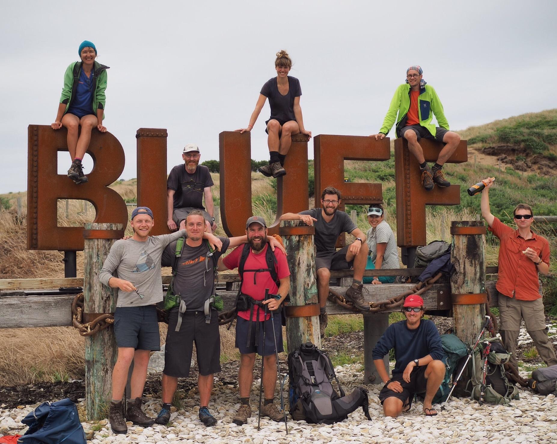
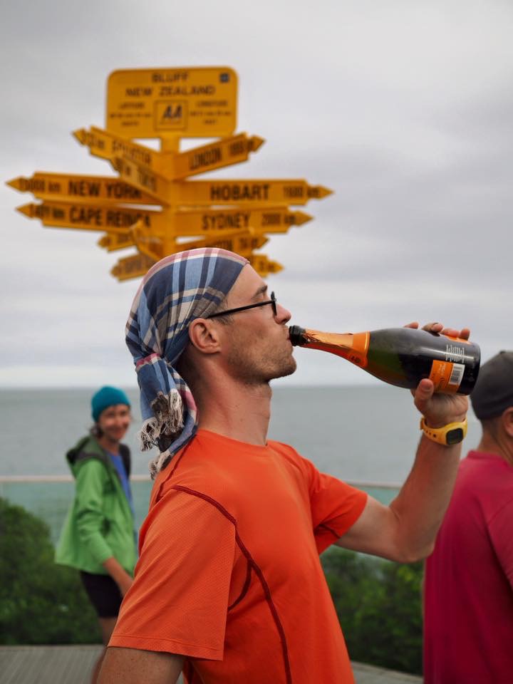
Final trail trials.

Today was was going to be another challenging day with muddy forests and I was keen to get away at first light. The sun is rising later and later each day now and it’s just light enough to start walking without the aid of a head lamp just after 7am. Once my morning alarm went off, just after 6am, my hand automatically reached back over my head to perform the daily task that would ensure I got up and moving – opening the valve to my mattress to deflate it, listening to the pssttt… of the air flowing out. With the mattress flat it gets uncomfortable lying on the ground so there is nothing for it but to rise, toss the sleeping bag aside and get the day started. If I didn’t deflate the mattress, it would be so tempting to sleep in just a little longer.

Given that it was a dry camp I filtered my water for the day ahead from the bladders I carried from the last forest, brewed a coffee and hooked into cereal. This was my final tent camp on Te Araroa and it was a pleasure to be able to pack the tent up dry. After four months on the trail I have honed my camp packing up skills to a fine art and was ready to leave just as there was enough light.

The first few hours of the day were easy. Walk through Island Bush on forest roads, cut across a farm property and out to a road, to walk 6 km to the Longwood Forest. On reaching the start of the forest the trail stayed on forestry roads for another 4 kilometres leading uphill through plantations to the start of another tramping standard forest track. The road walking was easy enough but I didn’t know what to expect from the Longwood Forest – I’d heard mixed reports of deep mud to being an easy, beautiful walk.

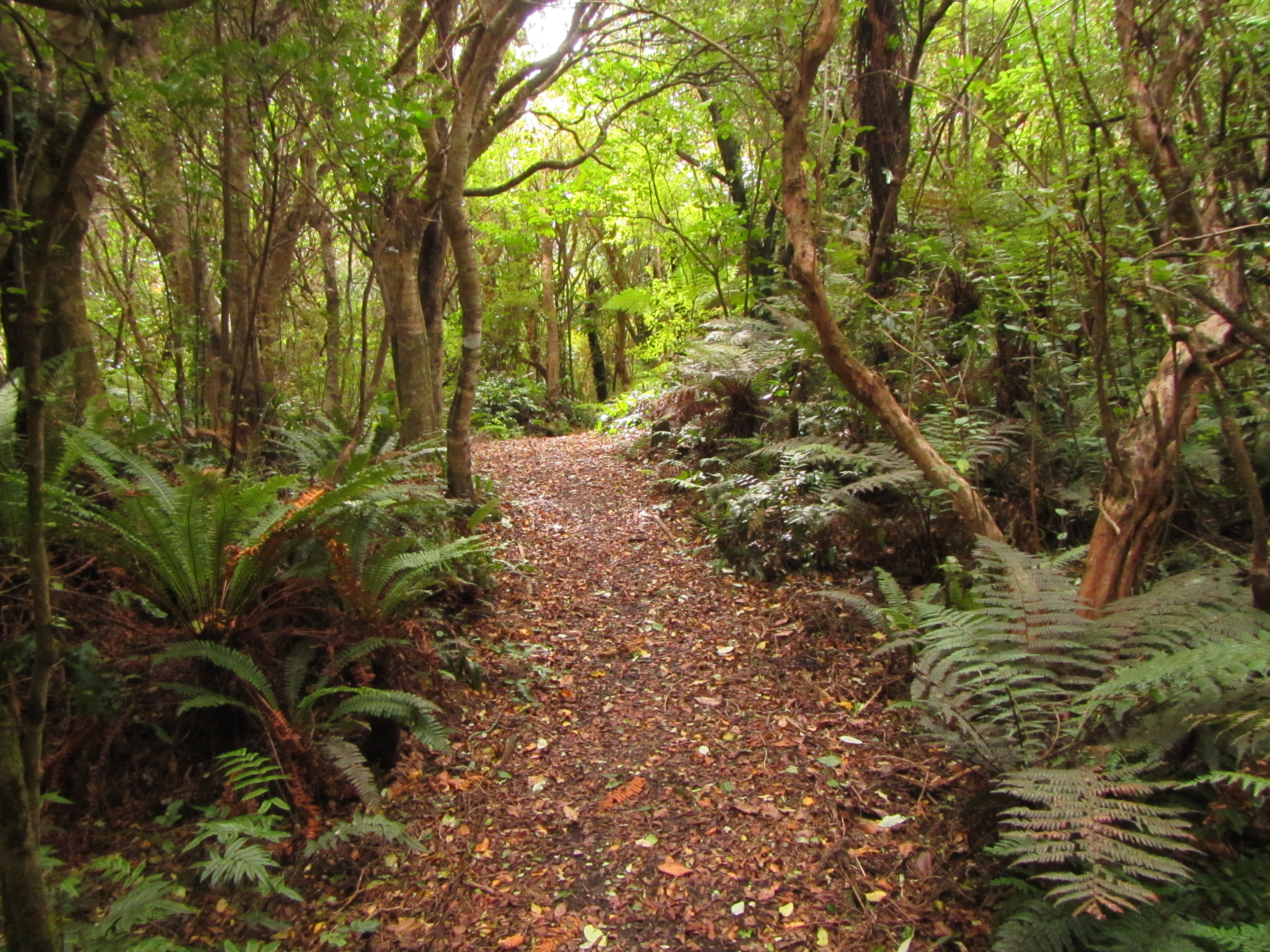
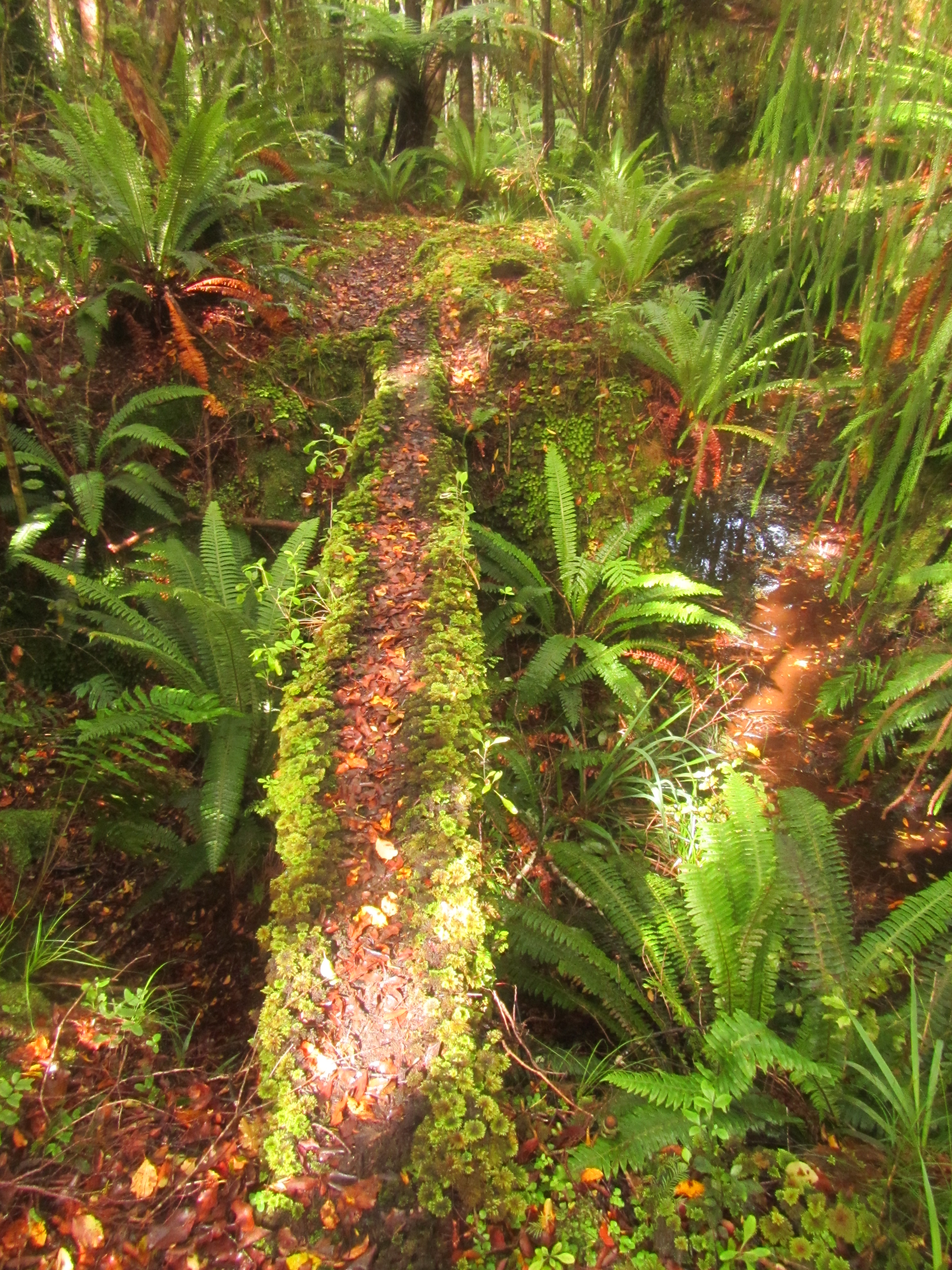
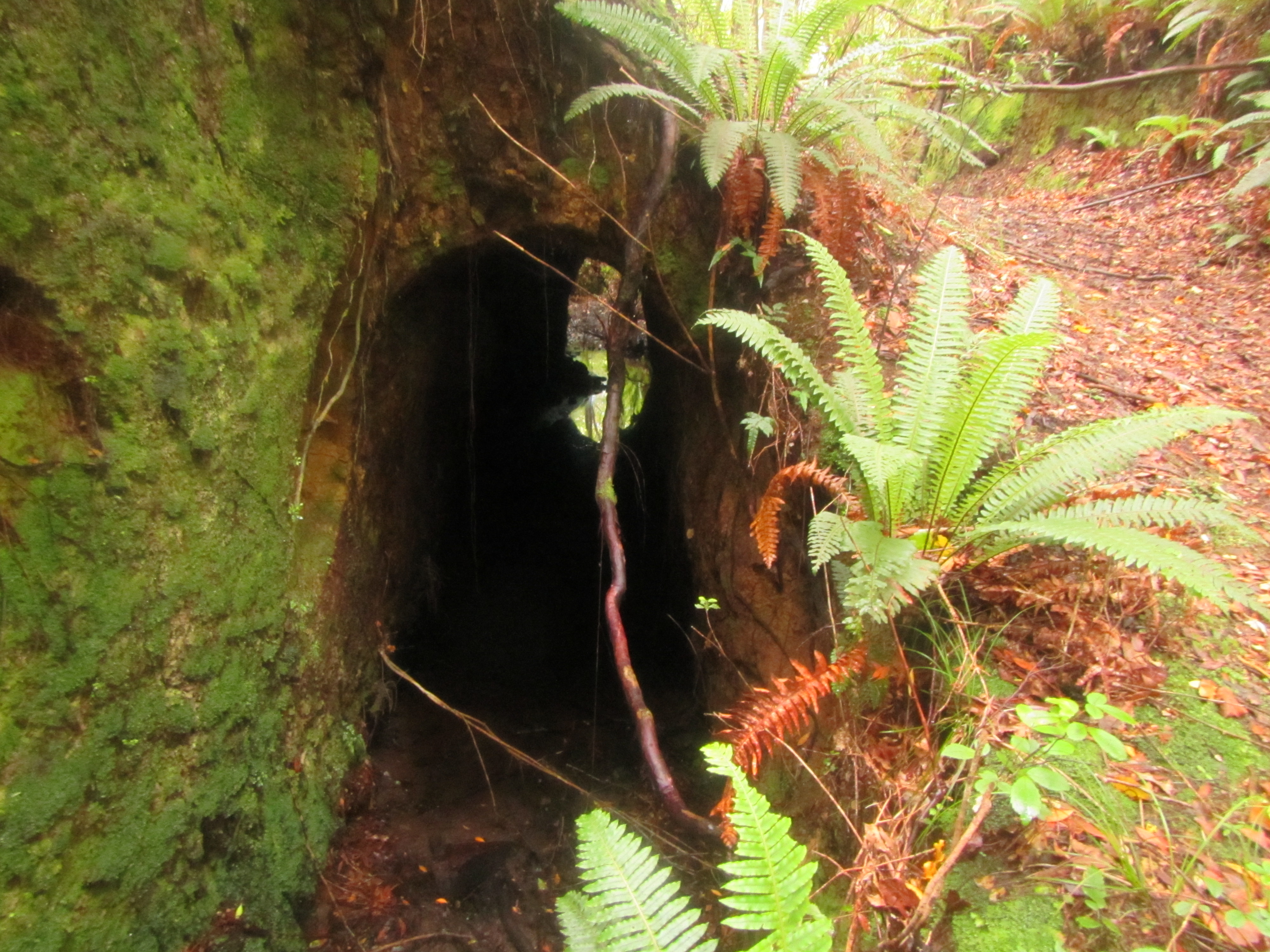
Add all the mixed reports together and they form an accurate description of the Longwood Forest. The trail immediately enters beech forest and for the first kilometre or so it has sections of mud but dry mud, if that makes sense. Not enough mud for your feet to sink through or for the mud to stick to your shoes, more like mud that would be really sticky with some rain but for now had been settled and compressed with the passing of many boots. What did strike me for this first section was just how ancient and mystical it looked. Fairy tale stuff for sure. I wouldn’t be surprised if hobbits, elves or goblins jumped out on the path ahead. Long, pale green tendrils of moss covering trees branches, thick mats of spongy moss the ground, iridescent fungi growing in damp hollows, and ancient looking beech with crooked branches intertwining above. Beautiful and mystic. Mats of exposed roots crossed the trail, waiting to catch a foot.

IMG_1150

image

Further into the forest the true mud began. It always starts with small holes that ca n be skirted around to keep shoes clean and dry. It always ends up with one stepping in a hidden hole, sinking deep, covering shoes, soaking socks and having mud scrap up your legs as your foot is pulled clear. From there it doesn’t really matter how deep or long the mud is, you can’t get any dirtier, or can you? So you end up plowing right through. Longwood didn’t disappoint with the mud but there was more to come.

Just before leaving the forest for the first time to enter into open tussock country, towards Bald Hill, there was a series of wet, boggy sections to get across. On getting through these and the tussocks to top out near the towers on Bald Hill my feet were soaked. It would have been good to find a clear stream to wash them but there wasn’t one to be found.

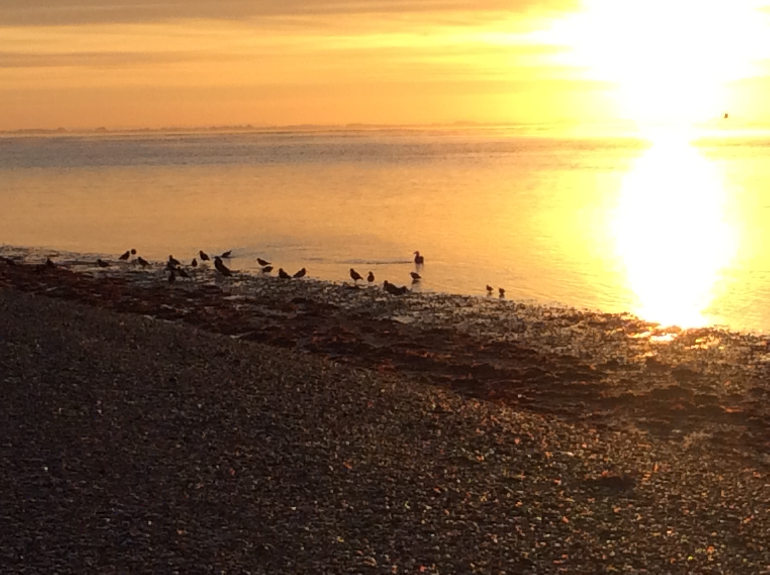
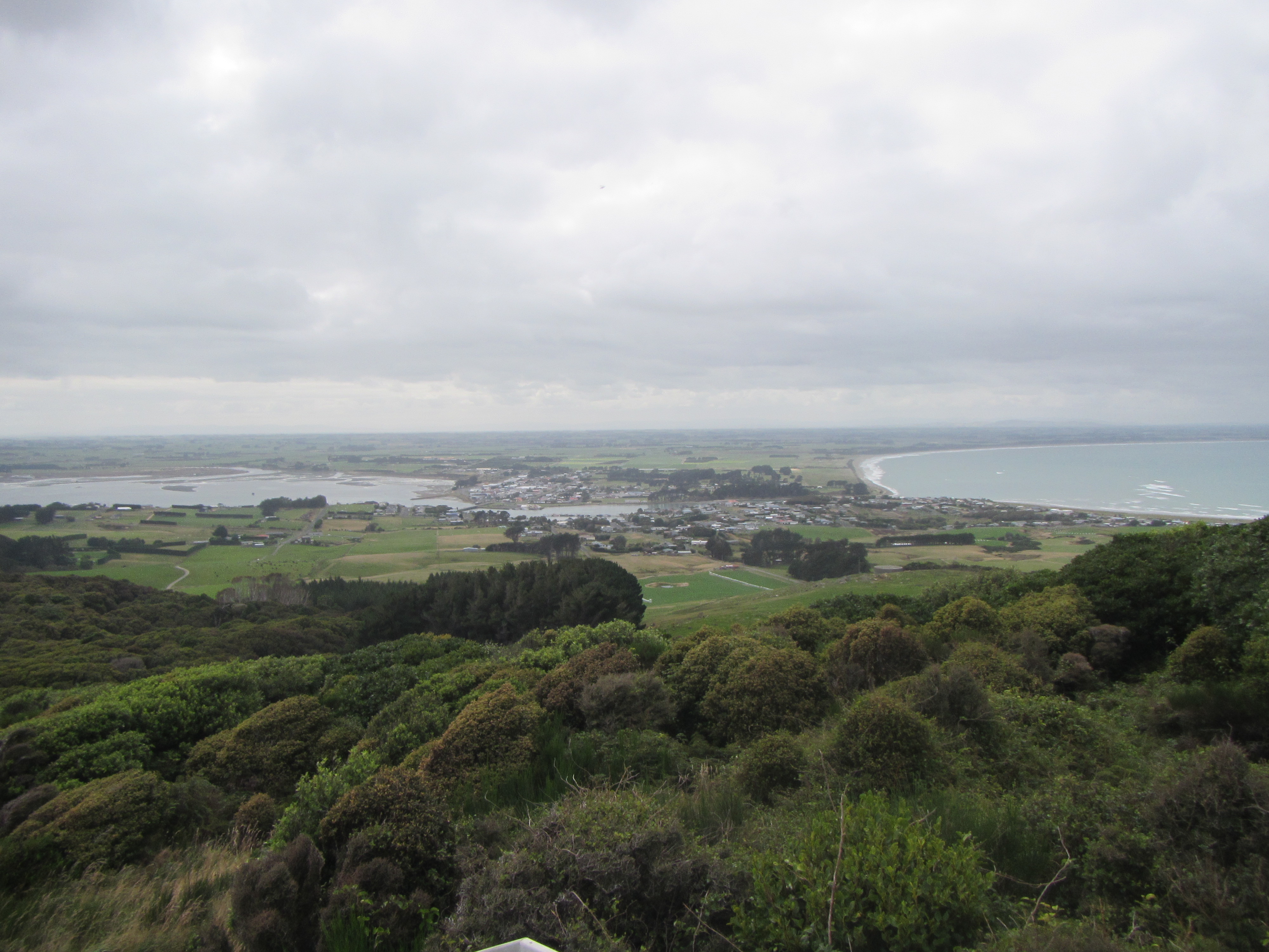
Rising to the top of Bald Hill, views out towards the coast and Bluff occupied my vision. It was sunny and a great place for lunch overlooking the remaining hills of Longwood Forest, Riverton and the curving coast line to Invercargill, only a few days away. The finish line in sight.

image

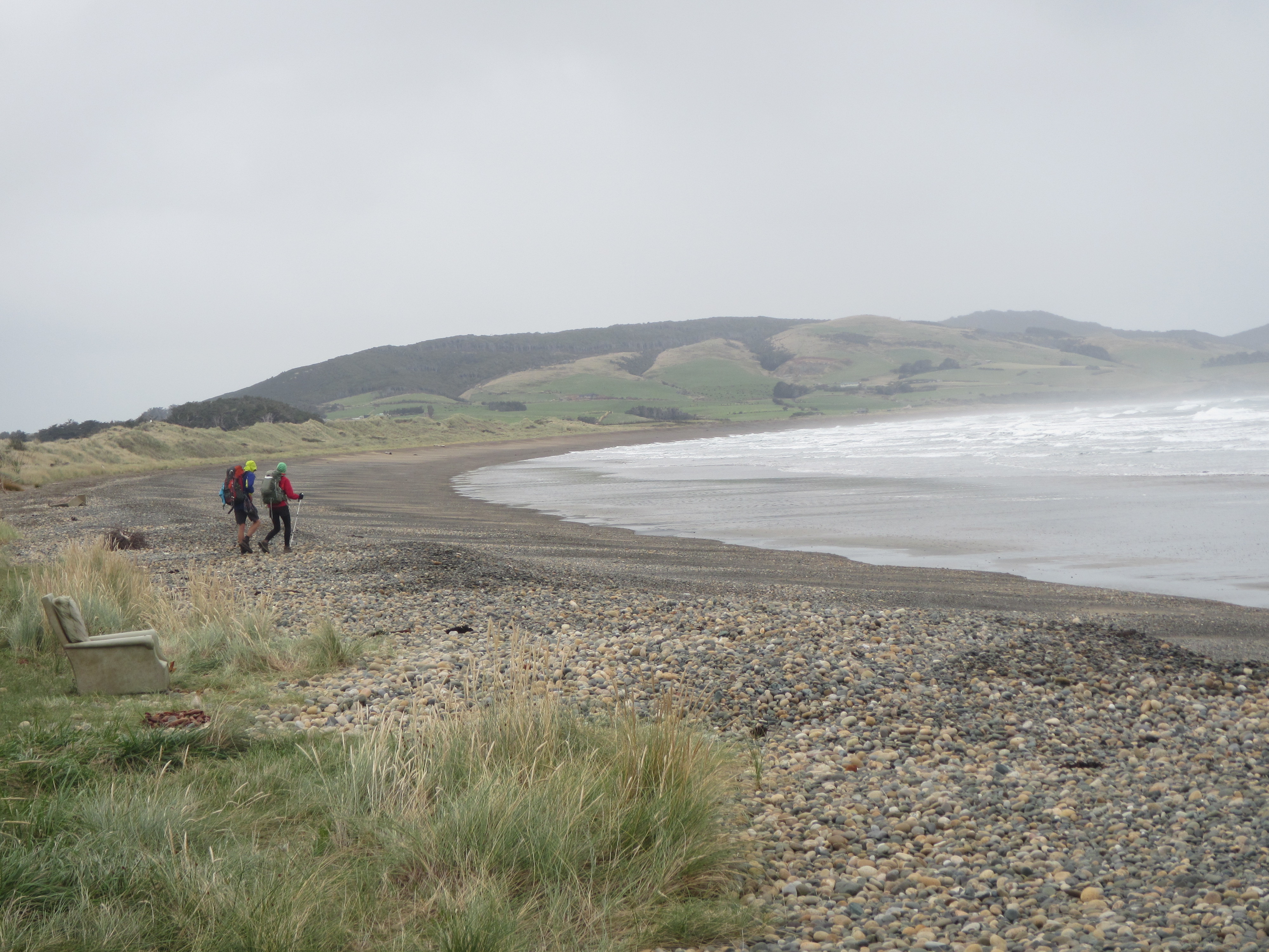
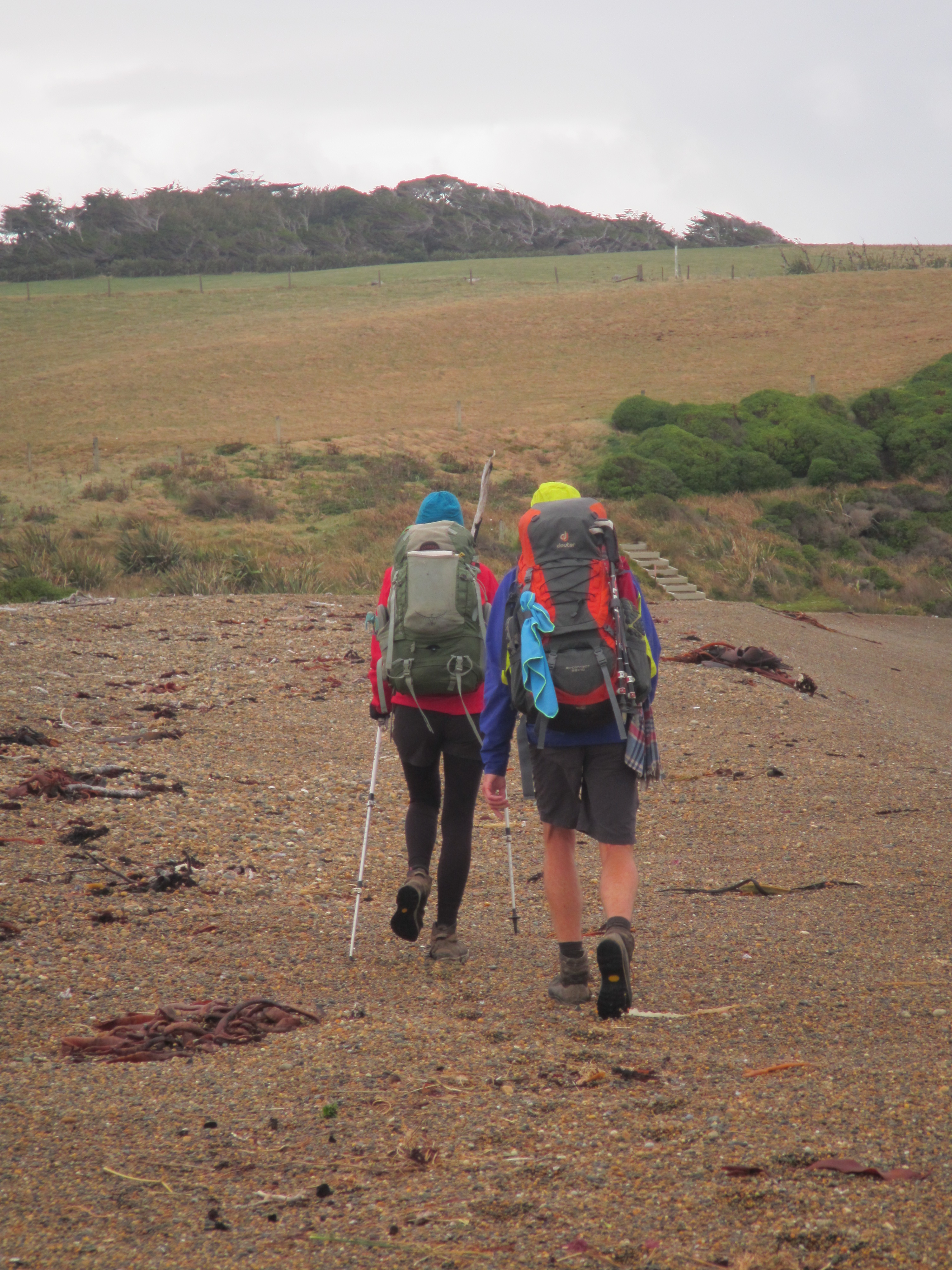
But the trail wasn’t done with its tests for trampers just yet. It seems fitting that Te Araroa starts with beach walking, muddy forests and roads only to end with exactly the same. The last few days providing a reminder to anyone who has come this far south of the trials and tribulations that have been endured along their journey. The toughest tussock section encountered two days ago, it just wouldn’t seem right if the trail didn’t end with another crazy arsed, eyeball deep mud section, beach walking and bitumen road walking. That is exactly what it provides.

From the top of Bald Hill there were a few kilometres of road walking on the service roads for the tower, down hill, to the start of the last forest section that would take the rest of today and most of tomorrow to complete. Along the edge of the road several small trickles of water ran from the side cut bank. This was the last water source until pretty much reaching Martins Hut. This was quick walking and good timing. On reaching the security gate, one of the workers was opening the gate to get his vehicle through which avoided me a climb down the steep bank to get around the gate. We got chatting for a good 10 minutes and he was able to give me the heads up on the trail section ahead – a steep climb, lots of mud, tussocks on the bald hills, and a steep muddy descent to Martins Hut.

He wasn’t wrong. The only thing he didn’t mention was the wind blown trees across the track that required scrambling under, over or punching a path in around the sides. It was muddy. Long pools of thick, sticky, stinking mud. The climb solid, passing over a rooty track in amongst more of the same mystical beech forest. Plants grew on top of other plants. Lots of vivid greens in the sun light and moisture from rain last night. This forest soaks the wet stuff up and retains it well. The mosses were like sponges from which moisture could be squeezed out.

image

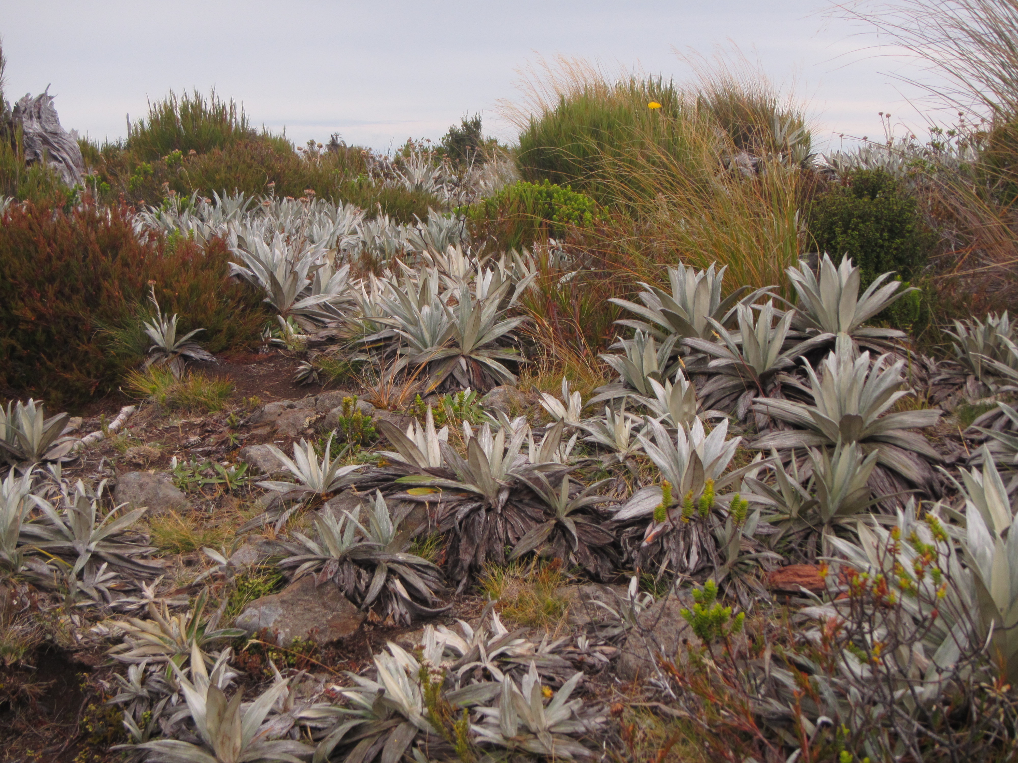
Approaching the top of a bald hill offered clear views across the remaining forest section for the day and tussocks further on. For the next 3 kilometres the trail moved between forest and small tussock patches. All wet, all muddy, before finally emerging into a long tussock section following a ridge to a few high points giving up nice views to the coast below.

Starting the descent down towards Martins Hut I only had another 1.5 km to go but it was slower moving than I anticipated. The mud got worse. Not quite as bad as the descent from hell off Pirongia some months ago, as it wasn’t as deep or long, it still sucked. Steep sections of rooty stairs, moving from one pool of mud to the other. My shoes were covered in the stuff. My ankle gaiters were no assistance in keeping it out of my shoes either as stepping into it, the mud would lift up the sides exposing the shoe opening and allowing big chunks of the stuff to get in between shoe and sock. Yuck. A few months ago I would have been cursing. Now, I accept the trail for what it is, always thinking it could be worse and just move through it. I can’t not. There is no other way off the mountain without mud now and Martins Hut is not getting any closer. There was no way I was camping here either and resolved to just keep going, putting one foot in front of the other and moving towards Bluff. Things can always be worse. It could be raining, snowing and windy. Instead it was a sunny day and its just mud. It will wash off. The 2nd last day of having to deal with it. So I pushed on down to Martins Hut.

I saw and smelt pale grey smoke rising from the chimney before I saw the actual hut. Arriving at Martins Hut, the last hut on Te Araroa, I saw a tent outside and numerous sets of walking poles and boots lined up drying out the front. It was only a 4 bunk hut and it looked like I’d be camping in my tent for the night. It was an old, run down hut, full of character. Holes in the floor and a big open fire place, remains a dry haven for trampers.

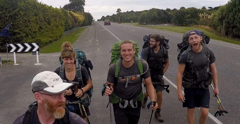
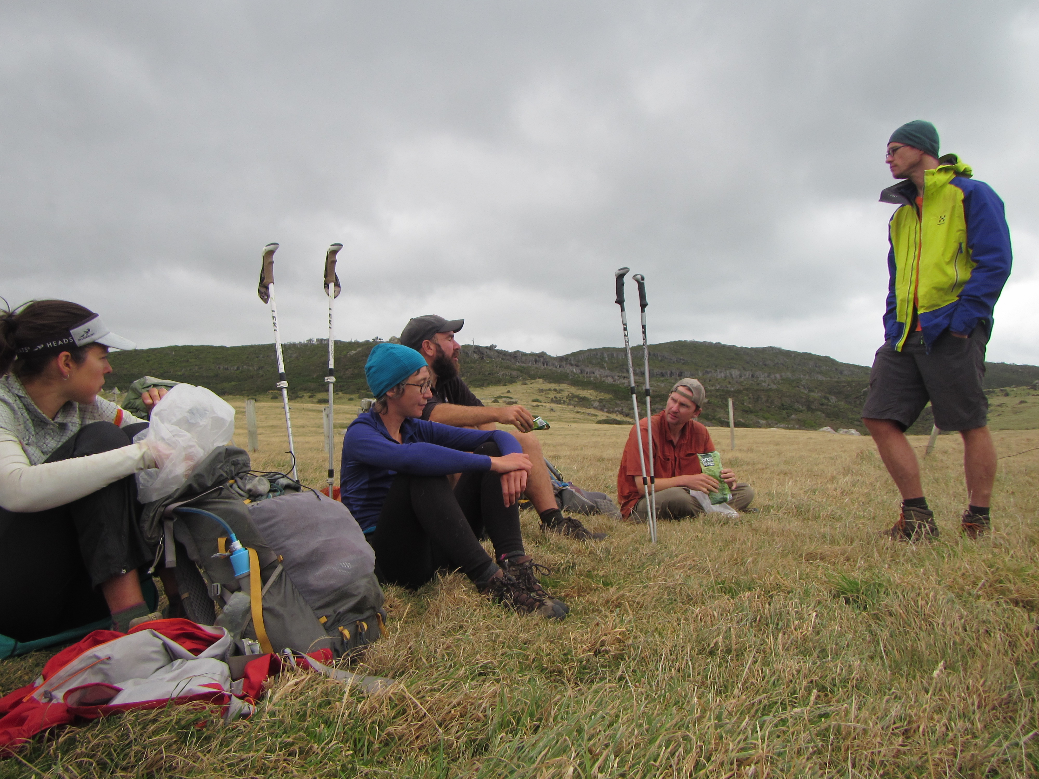
Opening the door I found Mat, Bella, Tom, Rune and Celistino sitting around a nice fire. All the bunks were full and Rune would be camping in his tent, exiling himself for snoring. Looking around for a suitable tent site (there were not many), the others wouldn’t have it and cleared enough space on the floor to allow me to roll out my mattress and sleep on the floor later on. Perfect.

With sleeping arrangements sorted my priority was to find water to wash down in. Pushing through thick vegetation for 5 minutes from the hut brought me to a small running stream that would do the job. The pool of clear water soon turning cloudy brown as I walked straight in to wash the mud from my shoes, socks, gaiters and legs. I knew things were sort of clean when the fresh water in the creek started to run clear once more.

The evening was spent catching up, munching food, laughing and sharing tales. Much of the chatter was around heading to the finish line and the fast approaching end. What would we do next? Continue to travel, go back to work, stay in New Zealand or further abroad? We all had different ideas, opportunities and commitments. We wondered as well where POD, Disco, Solenne and Antoine might be at and whether we would grace us with their presence tonight.

It was a chilly night and the hut draughty. Mat cut a mountain of wood that would see us through the night. With the fire stoked up, boots and socks were hung to dry and dinners were cooked. Great company and good times, I just wished I’d packed in a nice Piont for this section. Soon enough it was dark and we were all in bed, me spread out on the floor in front of the fire, designated fire fighter for the night to ensure the hut didn’t burn down. I’m sure I had a few people worried during the night. As the fire died down to red embers I would stoke it up. Sudden bursts of yellow flame springing the fire back to life, a few heads would turn to make sure it was just the fire and not the hut alight.

At around 10pm as we all slumbered there was a knock on the door. The door has to be fastened from the inside and anyone outside would need us to unlock it. I thought it was Solenne and Antoine and opened the door. Much to my surprise it was a couple of north bound hikers with ginormous packs arriving late. They were surprised to find the hut bunks full and felt pretty put out by this, almost expecting a bed. They feed us a storey about how massive their day had been, walking 15 hours, walking in the dark and mud. It didn’t have to be that way. From what I understand they didn’t leave Riverton until after noon that day. We all make choices on the trail and they made a few bad ones sorry to say. They had a tent and debated putting it up or not, by now making enough ruckus to wake everyone. In the end Bella selflessly offered her bunk up, sacrificing a good nights sleep to double bunk with Mat. The other person ended up on the remaining floor space. I wasn’t too pleased. If this were me I would:
– [ ] plan my day and leave at a reasonable hour to arrive before dark
– [ ] pitch my tent around 8pm if it looks like I’m not going to make it so I’m not walking through mud in the dark
– [ ] count the shoes and walking poles outside the hut, do the maths and know there is no room in the hut and put the tent up without even entering the hut and disturbing everyone
– [ ] not be so expectant. Always assume huts will be full and there will not be room.
Each to their own I guess.

The ruckus continued for a long while after, as both then rifled through packs with head torches to find their gear and get to bed. I rolled over to sleep as best as I could.

Day 119: Telford Camp to Island Bush

Distance travelled today: 41 km
Total TA distance covered: 2866 km

Easy peasy almost marathon day.

To be honest it was a really uneventful day of walking on farm and back roads mostly with a few small forests so I’ll keep this one short.

Pack up this morning was at lightning speed with all of the sand flies still about. It was going to be a big kilometre day and I was keen to get away on first light, packing up mostly in the dark by head torch.

Back into the paddocks first thing and a river crossing within 1 kilometre of starting. I desperately looked for a dry crossing but the Telford Burn was just too wide and too cold to take my shoes off for a bare foot. So, there was nothing for it but to swallow my concrete pill for the day, harden the fuck up and plunge through the water in the knowledge that my feet would be wet for the rest of the day and smelly at the end.

Once over the river the whole morning was through Linton Station, a working property, with lots of sheep and cattle. The station can be busy with farm workers shifting stock along the farm roads and between paddock. If this is occurring trampers need to stand to the side and give way but I lucked out and had the roads to myself.

Shuffling along farm roads is easy and can be a bit boring, particularly if there is not much in the way of views other than paddocks. To keep myself occupied I popped my ipod on, listening to podcasts and music. There were a few long climbs on the farm road with views to the south and forests beyond from the top of the climbs but mostly farm views. The 17 or kilometres across Linton flew by and by mid morning I was walking through turnip paddocks towards Birchwood and a swing bridge over Morley Stream.

image

Another hour and a few more kilometres on Birchwood Road brought me to a eucalypts plantation. I could smell it before I saw it. Reminding me of home I found a nice stop in amongst the blue gums and settled town for lunch. And what could be more Aussie than having vegemite wraps.

From the plantation the trail lead through yet mire paddocks stocked with sheep. I was down wind and it was amusing to watch the sheep suddenly look up, see me behind them and hoof off a million miles an hour. Through the paddocks there was a steep climb on an old farm track up to Twinlaw where some radio towers stood sentinel on the hill. I took the opportunity to take a drink break and catch up on email.

From the top it was more road walking, this time on forestry tracks, through to the Woodlaw Forest and back onto tramping tracks for a 5 kilometres or so. I was going to push hard today and didn’t know where my next water source would be so on finding a small trickling creek in the forest I collected water, filtered it and carried a few extra litres to get me through until morning should I end up dry camping.

Woodlaw was nice to walk through. Not much mud and through beech forest. The steep descent back towards roads was giving my knees some grief and this stage I’d already put in 35km or so. Time was getting on, it was around 5:30pm and I was keen to keep pressing on. The next suitable site to camp that I could see was the Island Bush, a pine plantation, a further 5km from the exit out of Woodlaw. I gauged it would take me just over an hour on gravel roads and I kept moving, my speed slowing down right towards the end of the day as I shuffled along the quiet country roads.

image

I made it Island Bush and found a suitable spot to call home for the night at around 6:30pm. It was going to be a dry camp so I was glad to have carried the extra couple of kilos in water from the forest. I was pleased to call it a day having knocked off 41 or so kilometres over an 11.5 hour day.

Day 118: Aparima Hut to Telford Camp

Distance travelled today: 21 km
Total TA distance coveted: 2825 km

Forward planning. What to do?

Shout out to Restless-Kiwi, Kirstine Collins, if you’re still following this blog. Right through this trip most of the trampers I’ve walked with have constantly referred to Kirstine’s blog from last year to gauge time and distances for the days ahead and today was no exception. The crew I’m with are all walking at a similar pace to Kirstine and her blog has been an excellent resource to use in planning the coming days. You’ve set the benchmark Kirstine. The talk in the hut this morning was all about where people might walk to today based on Restless-kiwi’s blog. What ever was decided there were going to be a few long days thrown in there somewhere. Everyone had a different strategy in mind. Me, I was thinking of doing a low milage day to Telford Camp and saving a big 40 km plus day for tomorrow where there were long road sections ahead and the walking would be easier.

I left the hut first and walked for a couple of hours. The trail notes talk of unmarked track and a tough walk this morning but I found it was marked right through and had a pleasant walk right through to Lower Wairaki Hut. With only 20 kilometres or so to walk today I took it relatively easy, enjoying the beech forest. There were a heap of small sticks and branches over the trail which meant a lot of leg lifting and sections were being encroached by ferns but it was all easy enough and flattish. No big hills for the first part of the day, with the trail following undulating spurs, mostly along the contour. There were a few sections of mud as well but nothing like some of the mud previously encountered in other forests. Still, enough mud to warrant wading through the stream crossing before Lower Wairaki Hut to try and wash mud out of my shoes.

image

During my mid morning break Mat, Bella and Rune came through and pushed on. We played left frog along the trail for a while and caught up again at Lower Wairaki Hut. For me it was lunch time. The other guys were going to push up the long climb ahead to have lunch on top. Celistino joined me at the hut as I hooked into my standard salami and cheese wraps and Tom came through shortly after as well but pushed on to try and catch the other guys, 20 mins or so ahead.

After lunch it was onto a steep climb from the hut, rising 500m over 2 kilometres. The first kilometre climbed gradually and was all good. Constantly climbing but nothing strenuous. The last kilometre of climb really kicked up and I struggled on this. My body wanting to be done with climbs, while my mind remained strong and pushed through. One foot in front of the other I kept saying.

Topping out was awesome. I took a quick drink break in the forest before moving out of the trees onto open tops with incredible views south. I was certain I could spy Bluff off in the distance on the hazy horizon which really got me excited. I found reception on top and took another break to take in the views while catching up on emails.

imageimage

From the top, the trail followed down an open rocky ridge line. This was around 1000m in elevation and moved through stunted alpine veg. I expect this area would cop quite a few southerly winds which influences the vegetation types.

Walking along the ridge was easy and fast. It was a bit rocky and the views kept distracting me from looking ahead at my footing so I stumbled along in a few places.

The days walking was drawing to an end with only a descent back down to the valley floor to Telford Camp to complete. Rain clouds threatened around the hills and just as I was approaching the camp it started to drizzle. Not much but enough to have to fdig my jacket out and to put the tent up straight away on reaching camp to keep my gear dry. And if it wasnt raining the tent would have gone up regardless due to sandflies. There were thousands of the little buggers. Any exposed flesh attracted the little thirsty blood suckers. You could slap and kill 4 or 5 at one time.

Telford Camp was a pretty shitty camp spot. Out in the open, surrounded by paddocks, cow shit, no shade and not many flat spots for more than 4 tents or so. It did have a long drop toilet and water close by that needed to be filtered. To get to Telford Camp only took around 3.5 hours, not the 6 hour DOC estimate.

Once the tent was up I was virtually confined to it due to the astronomical number of sandflies. Every time I opened the door at least 20 to 30 would get into the tent and I would launch into a murderous rampage to kill the little bastards as quickly as possible. It rained on a d off. At times I thought it was still raining but the noise was just sandflies flying into the tent material. Other trampers started to roll in including Solenne & Antoine, POD & Disco, and Celistino. All the other guys had pushed on further for the day. It was a horrible, horrible campsite. With everyone confined to tents we had to shout from tent to tent to talk.

Sandfly hell

Sandfly hell

I thought about pushing further on for the day but it didn’t make much sense to me. The next section was around 18 km through a working cattle station and access was only granted for daytime. The trail notes state that you should start the section before noon to ensure you have enough time to get across. It was close to 5:30pm and I had about 3 hours of daylight. It judged
I

could probably do this but decided to stay put, tackling the cattle station and long road walk tomorrow as planned.

Confined to the tent I had to do everything from within the mesh including cooking dinner with the stove inside and filtering water.