Day 38: Te Kuiti to Benneydale

Distance travelled today: 23 km

Total TA distance covered: 935 km

Easy relaxed day today.

I enjoyed my splurge on a hotel room last last and had a sleep in. A double bed, fresh sheets, endless hotwater = multiple showers, washing done and the novalty of TV. Would you believe 50 channels and nothing to watch. Of course you would. That’s too bad, as getting out of the habit of plonking myself down and watching drivel for hours has been a good one to break. With 38 days on the trail I have read no newspapers and watched zero TV. I have heard no news from any source and I love it. I’m sure the world is still turning: that politicians are discussing the same old tired issues and resolving nothing; I wouldn’t be surprised if Australia has a new Prime Minister; that the eternal war on terror that the 1% want to continue in perpetually is still going on; that oil stocks are continuing to deplete and we are doing to wean ourselves off the black gold drug. Ah… Life on the trail is so simple. Wake up, walk, eat stuff, drink water, let the mind wander, get some kilometres in and so on.

The trail comes out direct opposite my hotel and a cafe across the road. I headed across the road for a nice big cooked breakfast. Eggs benny and real coffee is a great way to start the day.

Once packed up and checked out I wandered into town, in no hurry at all today. I briefly met up with Chris and Cathi who were fresh out of the bakery. Mmmm…bakery…what a good idea. With lunch sorted I hit the trail at a leisurely pace.

image

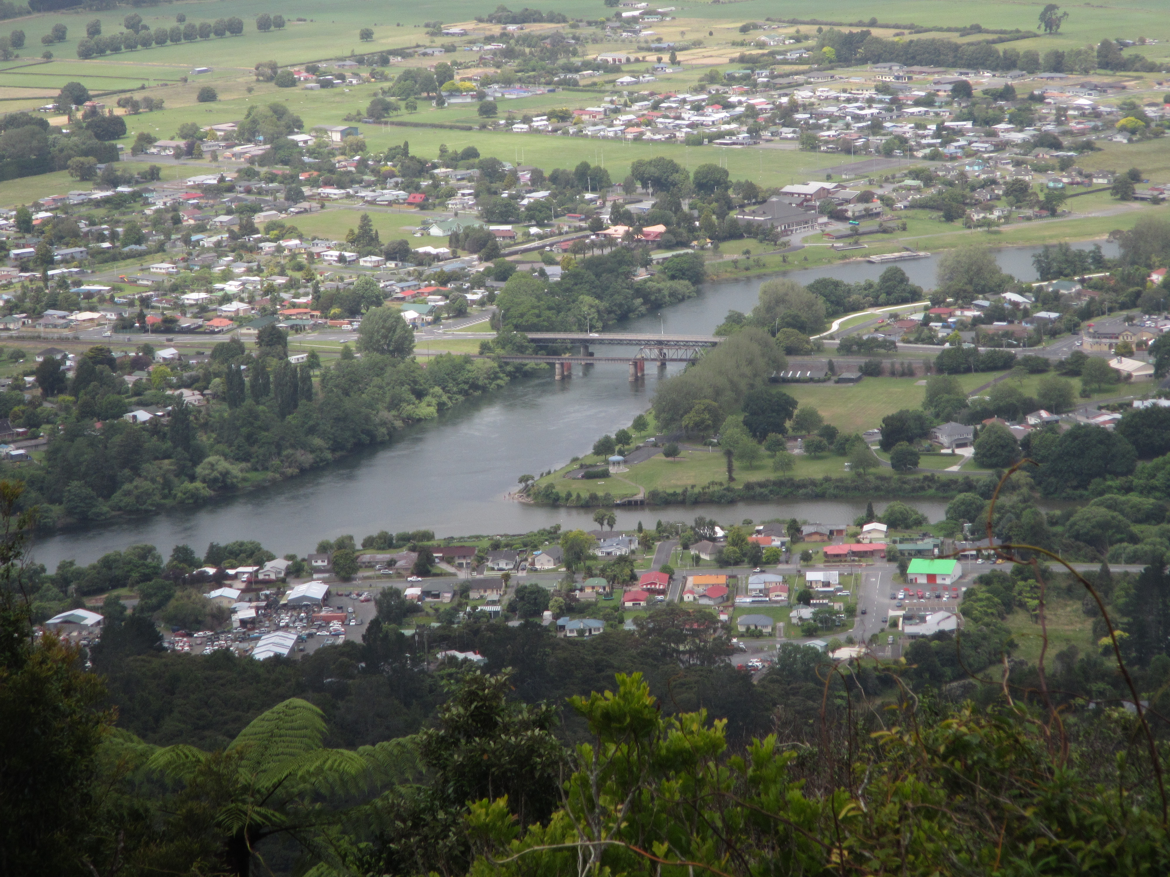
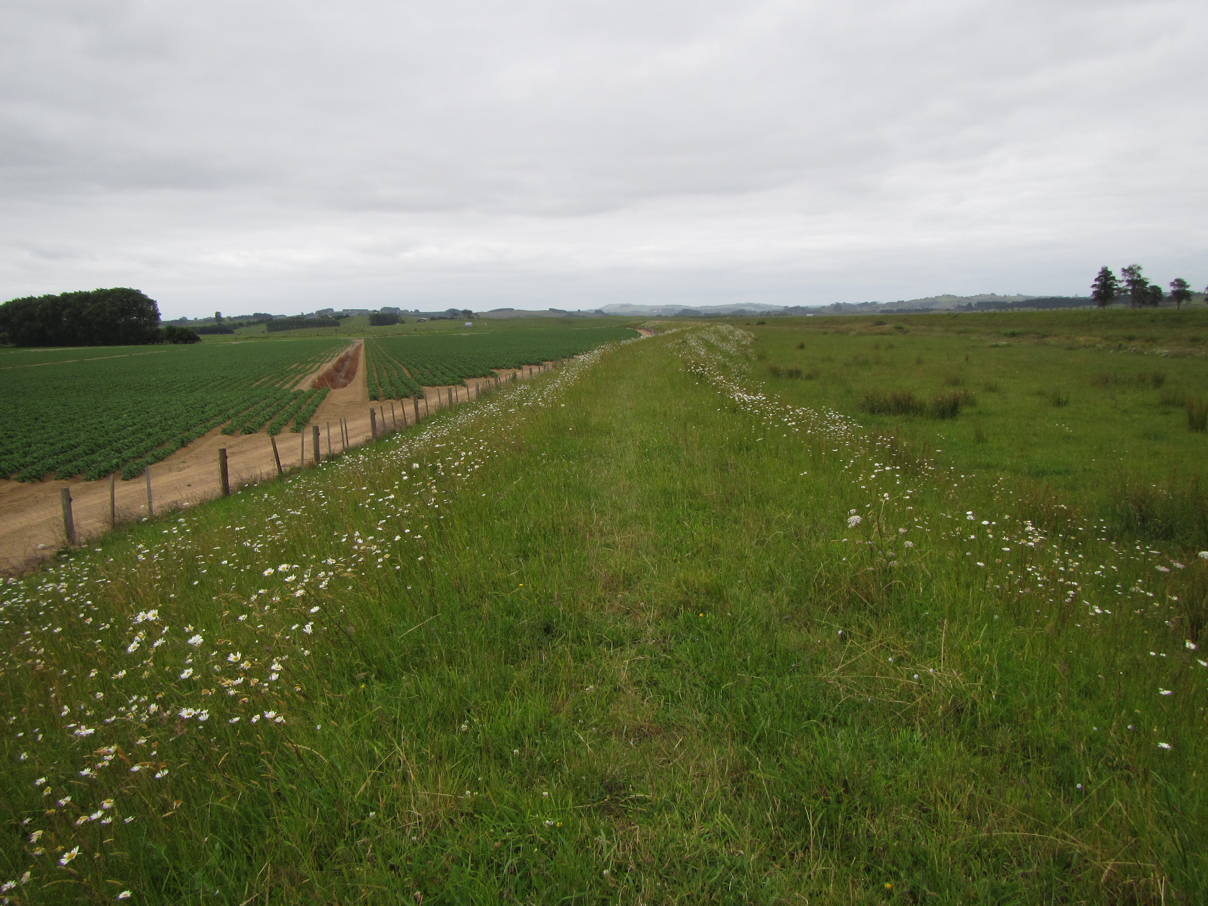
Straight out of town the trail skirted around the industrial area following the Mangaokewa Stream. The stream was quite clear for running through this sort of area but I wouldn’t be game to drink it without treating it. I was on the look out for trout but didn’t see any. Out behind a major limeworks plant, over a bridge and up hill through an old quarry area. Some of the old quarry walls were high and steep. I immediately thought it would be the idea sports climbing crag if I lived in Te Kuiti and needed to be bolted.

image

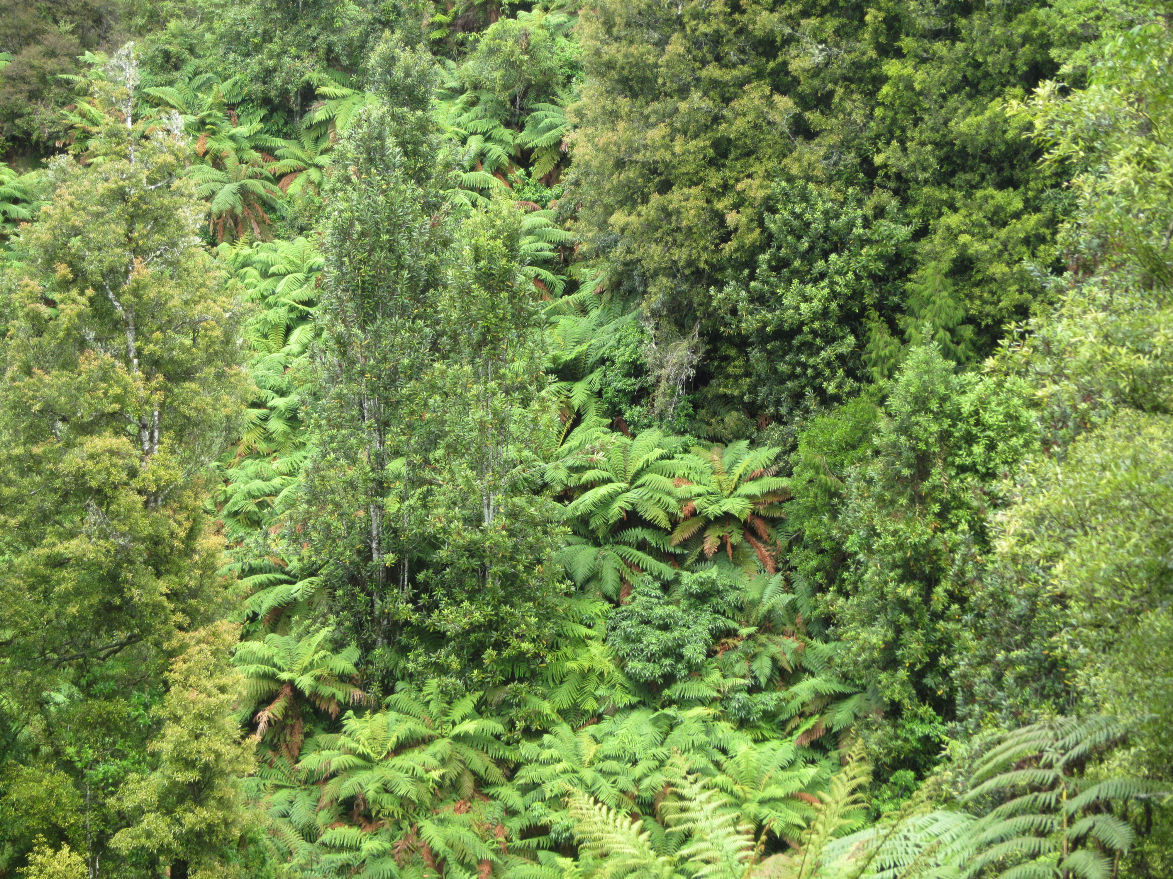
The trail then swung back to the river following through shaded forest along the rivers edge for a kilometre or so. Several side streams ran under the track to join the major river and some small picturesque waterfalls adjacent added to the scene.

I could see the clearing of the Mangakewa Reserve on the other side of the river and knew there was a swing bridge coming up to cross onto the opposite side. The reserve was a lovely spot and in hindsight would have made the perfect camping spot to save a few bucks. There really isnt much in the way of accommodation for trampers in Te Kuiti – hotels, if you can afford them; a backpackers 3km out of town; and a cheap but very, very basic holiday park in town. Anyone coming through behond me, you are better to resupply at New World as you come off the trail,mget out of town and head for the reserve.

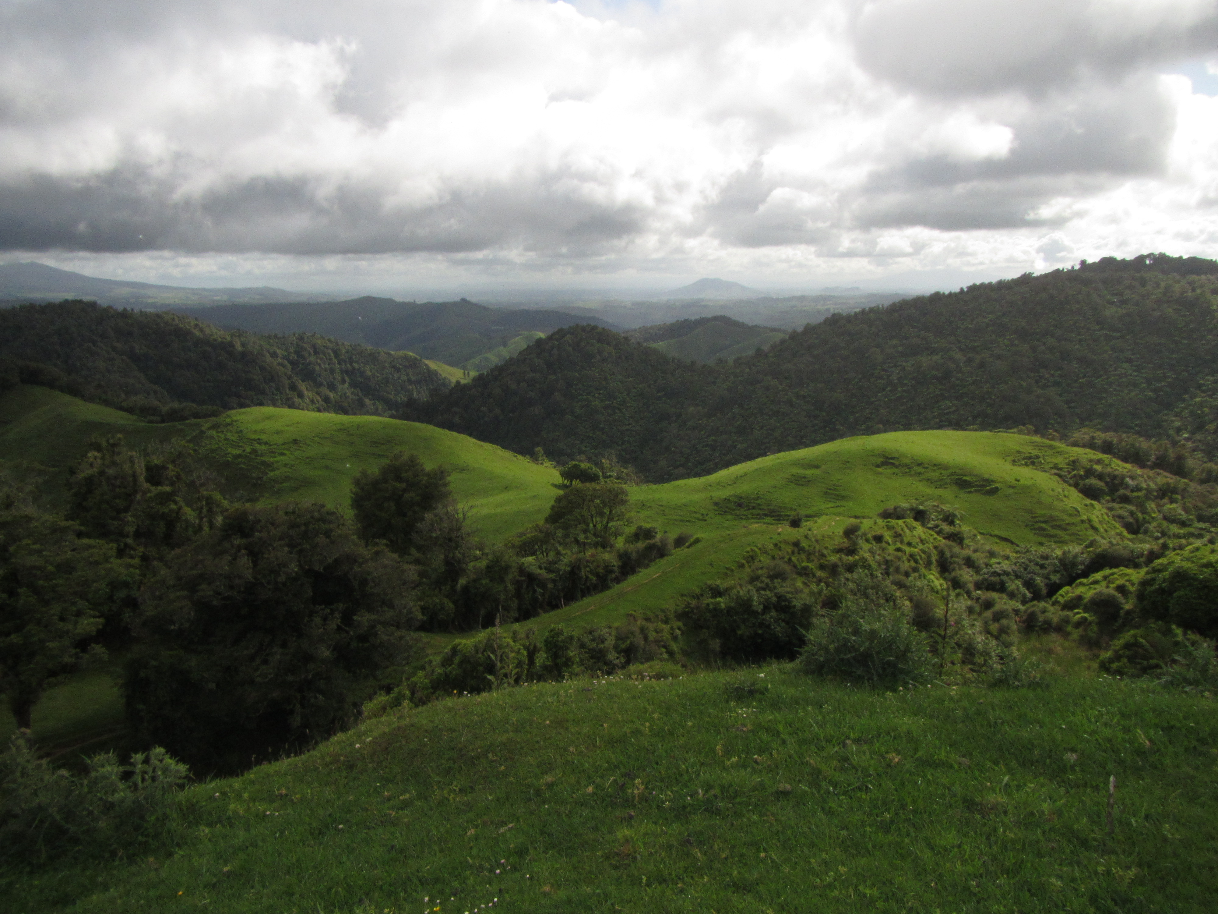
In the shade of the forest on the east side of the river you can only really see a green corridor but crossing over out into the open and into the reserve offers clear views to the towering lime stone cliffs lining the upper banks of the river.

From the reserve the trail meandered along the rivers edge for around 5km. I found the walking to be great. A clear sunny day, not a hassle on the world. It was difficult to find the trail at times but enough foot traffic had been through to point the way. There were a few steep ups and downs as the trail zig-zagged its way following the river through forest initially and opening up into farmland. The farmland tracks were hard under foot but I pressed on and eventually made it out to a farm road. It was a gradual lead in, with initially no distinction between the trail and the farm road but easy to follow. This continued for several kilometres before becoming a more formed road and finally hitting a road junction with the Mangaokewa Road.

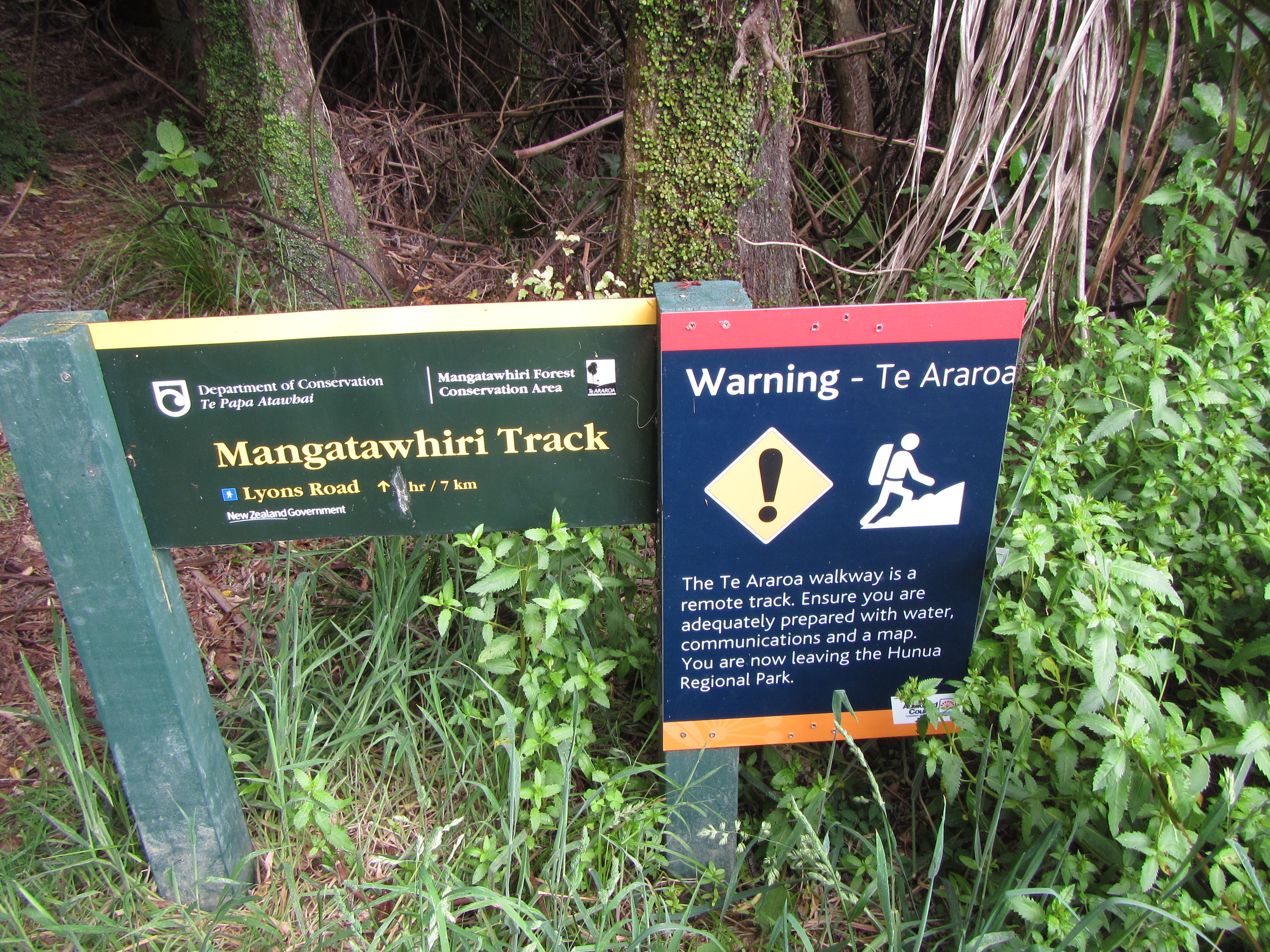
From Mangaokewa Road it was just a matter of waiting for a pre arranged pick up to take me into Benneydale and my place to stay for the night at Artdoc. The next section of trail is around 27km all on road and I chose to skip this tomorrow, instead opting to hitch from Benneydale to the start of the Timber Trail and continue on the Te Araroa. It also runs through private property with very few places to camp. Sure I could stealth camp and risk being asked to leave for trespassing or simply knocked on a door to ask to camp the night but doors were few and fair between. Besides if I’m not going to walk the next road section why look to camp on it instead of heading into town.

I didn’t have to wait long and my ride was right on time, luckily so was I. Not sure what would have happened if an hour or two late with no phone reception. I’d have to keep walking.

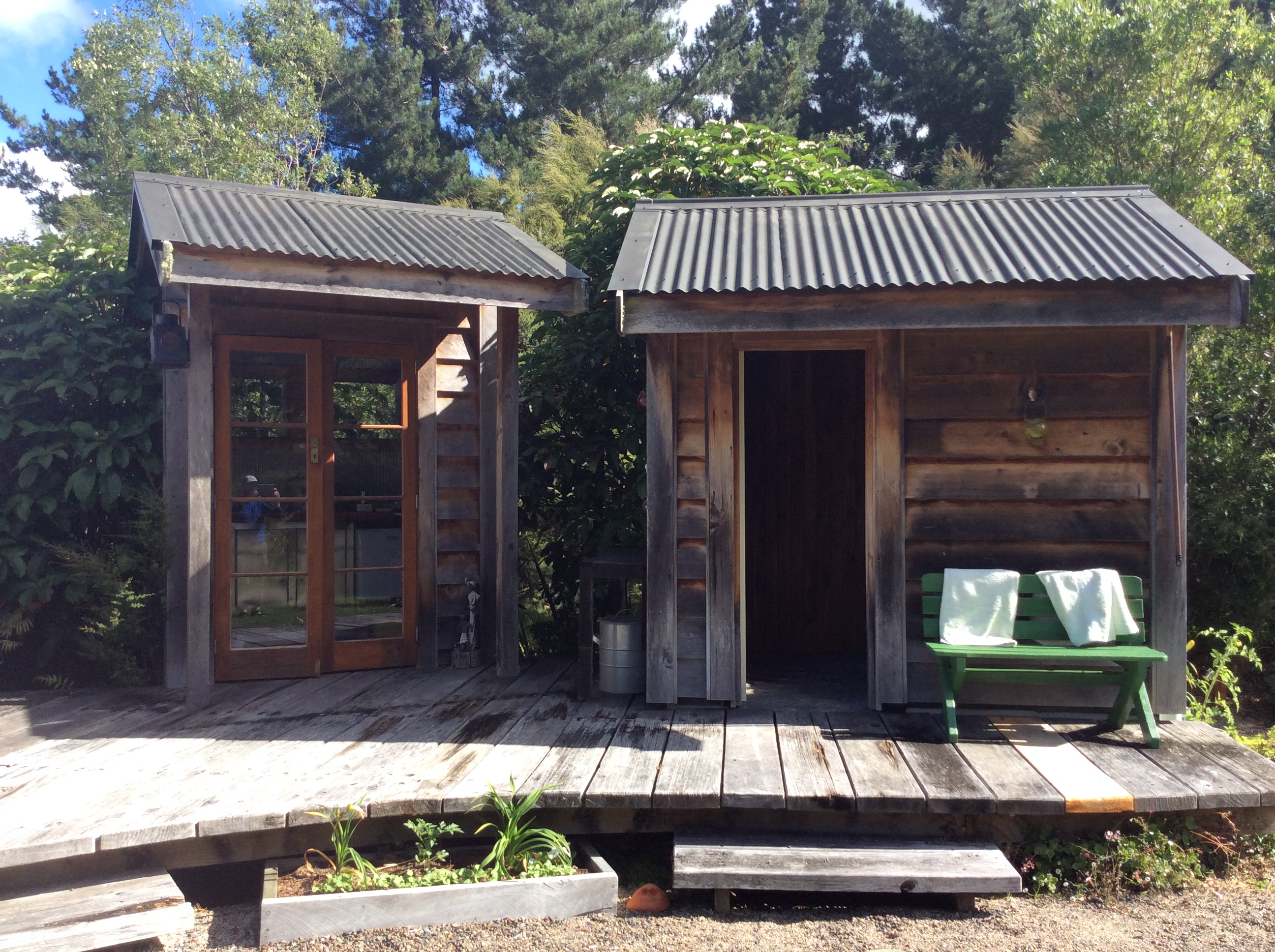
A short ride into Benneydale and I was welcomed at Artdoc by Maurice. Artdoc is a gallery come live music venue for jazz and folk and accommodation place popular with mountain bikers doing the Timber Trail MTB track. I think Maurice has the largest collection of vinyl records I have ever seen. Walls covered. I was tenting outside for the night and found a quiet patch of lawn by a stream to set up. At $10 for a place to pitch a tent and have a hot shower it was a great deal.

Tomorrow I hitch to Pureora Forest and get back onto the Te Araroa.

image

Day 37: Waitomo to Te Kuiti

Distance travelled today: 16 km

Total TA distance covered: 912 km

Today I deliberately kept my options open with what to do. Looking at the forecast last night over dinner the Met was talking about heavy showers around mid day. Waitomo to Te Kuiti was only 14km on the trail and it was going to a relatively quick day so I was thinking wake early, check the weather again and if rain is still predcted get out by 6:30am to make it to town before the rain arrives. As it turned out, on waking, the rain had been put back by 6 hours or so and wasnt due now until the early evening. Nothing for it but to go back to sleep and enjoy a lay in for a change, in a bed at that.

I was out the door by 8 am just in time for the local cafe to open and grab a coffee. I had meant to resuppy for a day in Waitomo but looking around yesterday, options were limited. The Waitomo General Store is not a general store as you or I typically know one to be. It was basically a bar slash cafe with a book case of odds and ends of overpriced really basic foods like a couple of packets of pasta. Not much in the way of breakfast stuff. Knowing this, I ordered a large pizza for dinner last night and retained a third for breakfast. Pizza and coffee – perfect start to the day.

There was no sign of any other TAers about so I hit the road solo around 8:30am. 2 kilometres up the main road and it was into private property and paddocks. Another wet shoe start to the day. This soon entered into a private forested section to climb up a steep hill. For a track on private property I was impressed. The trail had been hand cut from the hill, benched neatly and used swtiched backs instead of going straight up hill like so many tracks do. To top this off there were signs of recent pruning to cut back some gorse and widen some sections of the track. The property owners (I’m assuming) have obvious put in quite a bit of time to create and maintain a sustainable track and must be congratulated as they really have no obligations to the trail at all.

So this climbed up quite a steep hill but with the grade and switchbacks made for fast climbing albeit a little sweaty. The sun was out this morning and did make for humid conditions.

Down the otherside it was back across more paddocks,a little chewed up by stock and into another forested section following a fenceline to the east. Some of this was a little overgrown with gorse but no dramas really.

I then came to a new section of trail opened just this year to divert around a relatively steep descent. Some of this work must literally be days old as the earthy smell from the overturned soil was fresh in the air and the soil friable and bright clayey orange, yet to be affected by rain or compacted by 100 pairs of boots. Rather than following the fence straight down the new trail now meanders on a good grade switch backing it way down slope. It made for easy walking right to near the end. It’s at the bottom of the slope that the new track is yet to fully completed. It’s cleared, open and easy to move on but hasn’t had the final touch up snd benching out just yet. No worries, easier on the knees than straight down. A great little section of track.

So then it was back out into paddocks freshly planted with what looked to be turnips and out along a ridgeline high above farmlands beliw with commandibg views right over ti Te Kuiti. It was here I had to have a break.  Taking 5 sitting out in the morning sun and soaking in the view was awesome. I need to find more time to do this. Very refreshing.

The best was yet to come. From my vantage point it down through more paddocks and onto a farm road for a bit before walking across a swing bridge over the Mangapu River and into the Pehitawa Forest. This small forest reserve was the highlight of my day although way too quick. The 10 min stroll through was not enough. The reserve has been set aside to preserve a type of native cyprus that used to be widespread on marshy lands, now very few ate left. The mature trees were huge and it was such a pleasure to walk through their 500 year old grandure. The reserve is so small though, I wanted the walk to continue through more but no, out into the cattle trodden paddocks again.

image

This continued for the next 5km and must have crossed many multiple properties. There would have been more than 15 stiles to cross. On a couple of occasions there was stock in the paddocks and I’m always a little apprehensive at first. I look to see it they are cows and if so thats all good. The steers can get a bit inquisitive and follow you around or move towards you but its the bulls I fear. Walking througone paddock that was thick with cows the next trail marker couldn’t even be seen. And looking across to the next paddocks there was a bull or two. Luckily the next marker pointed away from the bulls and into the young steers.

It was then upto a trig point high above and over looking Te Kuiti. Great views back out across Pirongia Mountain and down towads town. While I enjoyed the view Chris and Cathi joined me for a few minutes to soak it all in.

image


imageFrom there a quick 1km into town. An early end to the day and a half day really. The trail pops out at a Cafe and I headed in to grab a coffee. It was here I met another TAer from the United States, ‘The Princess of Darkness’. This was a trail name, a nick-name, which form part of the long distance trail walking culture in the States. Knowing this, I figured the POD had walked one or more trails in the US. Turns out she is an accompished thru hiker having completed the triple crown in the states plus more. She was walking with ‘Disco’ and ‘Skitles’ who wete yet to reach town. I like the trail name concept. Much easier to remember all the walkers that you meet instead of first names but it hasn’t quite caught on for the Te Araroa yet. Perhaps it will evolve here over time or some original TA tradition to rival it. But remember you can’t pick your own name, they are given to you by other walkers, usually for doing something really stupid like all good nick-names.

Day 36: TA km 871 to Waitomo 

Distance travelled today: 25 km

Total TA distance covered: 896 km

It rained hard overnight but all my gear remained dry. I think I have by tent tensioning technique down pat so that there is no room for rain to blow in under the awnings. But by the time it came to breaking camp the rain had stopped. This made for a relatively dry pack up other than the tent itself that drys super quick with a few shakes and fives winds in the sun or wind. We got away by 7am for the walk into Waitomo and hopefully a resupply for a day as I’m basically out of food. A couple of pop tarts for breakfast, 2 museli bars and a small amount of scroggin was my food for the whole day, until hitting town.

The trail started out along some really nice farm tracks that were well graded and wide. The views out across the rolling hills in the early morning light were fantastic and remind you why you are out here. The odd cloud lingered about with some darker stuff off in the distance.

image

From the farm track, the trail entered onto an old timber trail, an old tram line or something like that I think. It wasnt maintained but  had a super light grade to it as you would expect with a a track like this previously used to haul timber. The regrowth forest was lush but a cleared path was found the whole way along. The odd muddy patch but notjing to really worry about. Of course shoes were wet anyway from walking through moist vegetation. Just about every day, wet feet at least once.

We talked a bit out along this track. This was Jurgen’s first real bush adventure away from chalets, lodges and hotels he tells me. He is no stranger to hiking and has travelled many routes in Germany, Switerzland and else where in the European Alps but the experience here is very different from what he is use to and he is keen to learn how to approach tramping in New Zealand. All this is very new to him. He is very observant of everything that you do and had lots of questions really about what I eat, how best to respply, what maps I’m using (as he currently relies on GPS with the TA loaded in), what water is safe to drink etc….

At one point the topic of travelling together for a few more days came up. He was very keen to continue with me and would change his plans to whatever I was up to. If it was to be a rest day in Waitomo, he would take a day off, or if it was to continue onto Te Kuiti he would continue. The problem was I really didn’t know what I was up to. I felt like a rest day but it depended a lot of what services were in Waitomo and what the weather was doing. Initially I was thinking a day off was in order, at least my feet tell me so, but the walk Te Kuiti is only 15km, a half day really. It was at this point I said we should split and do our own thing. We would meet up again on the trail at some point like I have with so many other trampers. To be honest I think he has a need to walk with someone else at least for now, to learn more stuff, but I didn’t feel like being that soneone. At some stage you need to branch out and explore Te Araroa on your own terms and there is only one way of learning how to walk the trail, and that is by walking it yourself, discovery what works, what doesn’t and adapting. That is what everyone else who has walked from Cape Reinga to here has done. He is still in that process, Auckland being his Cape Reinga. Don’t get me wrong at all, I like the guy, I honestly do, but I’m walking this trail for me and I don’t really feel like having an apprentice tagging alone. We walked 100km together over 4 days and that is something to be proud of. If you’re reading this mate, well done, really; you will pick the ways of the trail up and it won’t be a problem; in two weeks time you will be a natural. Enough of a confesional from me. At times this blog is difficult. It is like a diary for myself to remember the trip but I’ve chosen to make it public so that people can keep tabs on how I’m going; but I also have to remember that being in the public domain, there is a chance the people I write about will read this, as was the case with Rob Wakelin, the CEO of the Te Araroa trust. Thanks for the email Rob much appreciated.

So back to the trail….the timber trail eventually came out to a farm and led down a farm road. The biggest news along this strectch was a massive white bull sitting in a paddock. Luckily the trail did not take us through here. This guy was huge and competly unfazed by outr presence on the opposite of the fence. The bollocks on this fella where the size of basket balls. I bet if he wanted to have a go the fence was no spotting him.

A couple km’s down the farm road and it was back into paddocks to take on a new section that just opened this year, having been re-routed. This was ok. The way ahead was clear, a straight line up and down along a fence line. The ground was chewed up a little by cattle but no problem. A few creeks with narrows bridges encountered along the way and up onto a rural airstrip. This one must get a bit of use as there were signs indicating getting the site managers attention abd gettingbthe ok to cross if aircraft are operating. None wrte today. From here a 2km section along more farm track and fresh cut track along a fenceline. This was tough ground underfoot and I eyed off the solid track just on the opposite side of the fence but I said on route and followed the marked track. It’s hard enough for the trust to negotiate with landholders for the trail to pass through their property, no point in pissing them off by walking off the route and causing issues in the future. It can understand, it was a working farm with vehicles travelling on the track and they want walkers safe and out the way by routing them along fencelines – fair enough.

Eventually, the trail turned back into the bush. By now the rain was coming down and the jackets came out. But it was one of those days where the rain toys with you. Starts with just a sprinkle and it’s ok to keep going, then gets harder, and harder until the jackets come out, then it spots until it’s too hot to continue walking and sweating in your jacket so you take it off, then it rains solid again…repeat over and over.

image

The trail made up for the rain though. A pleasant section through native bush with tall canopy down to a stream crossing. I showed Jurgen how to approach stream crossings; un buckle pack straps, scout down for obstructions like log jams that could be an issue if you get swept down, survey the water to find the shallows and channels, look at the colour of the water,  pick your crossing point, face up stream, bend forward and take it slow, making sure you have firm footing before lifting the next foot, use your poles for additional traction. No issues in crossing and he was very thankful – another lesson learned. But it was a low stream.

The trail then beat a path along an old track for a couple of kilometres to join with a DOC managed combined mountain bike/walking track. This was awesome. Nicely benched, well constructed and soft under foot with fern fronds fallen from above. A pleasure doing buisness with you unnamed section of track. Sadly all good sections come to an end and it was back onto bitumen into Waitomo.

Wow Waitomo is a busy place and definitely on the tourist path. Hundreds of them. Fresh clothes, cameras swinging around necks, money belts strapped around waists and rent a vans abounded. I’m sure we looked out of place. It didn’t take long to make it to town and head in for a beer and something to eat. On the way we ran in Gareth a Kiwi TAer raising money for foster children. He had previously walked with Jurgen a few weeks ago. We found the general store grabbed a couple of handles and cheers of congratulations for the last four days were had –  down they went. I’d sorted a bed out at a backpacker for the night and Jurgen was off to the holiday park.

Later over a few beers at the pub I met Ian and Hanna from the UK who are also doing the trail, while Chris & Cathi rolled into town meeting up with Jurge and Gareth at the holiday park. It’s always a heap of fun catching up and sharing stories of the trail since we met last. Pizza for tea – yum.

Day 35: Pahautea Hut to kilometre 871

Distance travelled today: 24 km

Total TA distance covered: 871 km

There is nothing like putting on yesterdays wet socks and muddy trail runners in the morning but that was exactly what had to be done. I’d cleaned my runners at the hut as the spread of a soil borne disease that kauri trees don’t really love is a bit issue in NZ. So to start the day I had nice clean shoes. It was cold overnight and with our late arrival at the hut there was no chance to get them dry. And same with the socks. A good hard scrub got them cleanish but no where near dry. But wishing for dry socks and shoes would not have helped.

I imagined the descent down the mountain would be similar to the mud we encountered on the climb up the previous day. It was, if not worse and those nice clean shoes….lasted all of about 10 minutes. A sign directing the way down Hihikiwi Track estimates the descent to take between 3 to 5 hours. They were not wrong. The trail starts with some duck board sections and stairs but only up a look out point. There were no views to be had this morning as the whole range was blanketed in a thick layer of cloud. From the look out it was straight back onto tramping standard track and into the muddy roots. The mud was thicker, stickier and in greater abundance that what we experienced yesterday and the climb down just as hard as the climb up. I did not wish to linger in the mud for five hours and raced down the hill. There is no point in trying to avoid the bogs by skirting around the sides as this only increases the problem for the future. Nothing for it but to plow on through, dodge the tree roots trying to twist ankles and hope that the mud doesn’t reach above the knees. There was the occasional surprise when planting a walking pole ahead to get traction and save the knees to find that yes in deed there are some quite deep holes. The short gaiters I was wearing were no help as they lifted at the back, exposing a gap between shoe and gaiter, perfect for the sticky goo to find it way into my shoes. Sounds awesome hey! It took my a full 3 hours to descent the steep trail.

I was very thankful that the trail exits onto a road besides a fast flowing stream. With my pack off it was straight into the water for me for another thorough shoe and sock cleaning, using bracken as a scrubber. Again, nice and clean but wet. Not to worry I really happy with my shoe choice as they are highly breathable and fast drying. Designed that way, you can actually see the water being squeezed out as you walk. And I’m surprised how well the icebreaker socks have held up given the abuse they have suffered.

I waited on the road side for Jurgen for around 45mins and by this time I was getting a chilled with the wind. He would catch up so a I hiked on. From the end of the trail head off the mountain it was 7km of metalled road walking out to a highway, then 3km of road walking along this before turning off onto another metalled road for another 7km. It was a long way to go on roads. At least the metalled roads were fairly quiet. The odd farmer passing by not very little traffic.

I was surprised to gaze out to the west to see the ocean. The trail maps I carry cover a distance of around 18km x 11km across and it’s often difficult to gauge features outside this space. Looking at another map later I picked up that it was the Kawhia Harbour with its narrow entrance guarded by rocky headlands like book ends, the white caps the surf were noticeable from a quite a distance as they water funnels through the passage.

Off the highway and onto the second metalled road I played tag with a grader and rolling crew who were tickling up the road. They were doing an awesome job but once the grader had scalped the surface and the roller had been through it was like concrete under foot.

I sat down for a break and Jurgen came trotting around the corner all smiles and recollecting his descent down from Pirongia Mountain through the mud hell. Given that he started in Auckland this was his first real exposure to the forest muds and rooting climbs. Poor bugger must have been an eye opener. I think it took him at least 4.5 to the full 5 hours to descend.

But on we kicked for the last few kilometres for the day. We were aiming to get 25km in which put us at a good distance from Waitomo tomorrow. The problem was we really didn’t know where we would end up camping. The last few kilometres down the road dragged on as they do but we made it to the start of a section through farmland and farm roads. By the time we good up to a rural airstrip we had enough an opted to camp in a paddock surrounded by sheep. The views were great.

We made sure we were well out the way of any stock or trafficable route but didn’t see any signs of anyone being within kooee of where we were. I hope the property owners don’t mind. I as assure everyone that it was a case of leave no trace other than a patch of flatten grass where the tents were laid out. The wind had picked up and up high it had a bite to it. I think this is one of the first times I’ve felt the wind chill and had to rug up. I was in my tent cooking dinner shortly after it went up and in bed by 7pm, sound asleep soon after.

Day 34: Old Mountain Road to Pahautea Hut

Distance travelled today: 30 km (TA 24km, geographical embarrassment 6km)

Total TA distance covered: 847km

Lesson of the day – never, EVER, let anyone else navigate other than yourself!

We got off to a good start. We knew there was a 4 to 5 hour climb at the end of the day, climbing to 959m, to the summit of Pirongia Mountain, and we were away from the Lodge just after 7am. It was going to be a big day. The pace was great along Old Mountain Road for the first 3km or so, then things got interesting. Having a quick look at my map along the road I see the trail leaves the road where the road switches back, enters into private farmland and follows a farm road south. Then my map got put away. Jurgen always has his GPS on.

We got to the spot to enter into the farm and I started heading south on a farm road when Jurgen called from behind, “Mick, the trail goes this way.” Pointing to an orange marker heading out the west. “Are you sure?” “Yes. GPS. Trail goes this way.” There was a poled route with orange markers where Jurgen was pointing and we started heading to the west.

Through paddocks we went for 3km until we hit a main road. This was not right. There are no major roads that cross the trail for at least a day. I could hear heavy traffic as we approached the road. This was definitely not right. At the road I pulled out my GPS and consulted the map. I put us out to the north, 2.7km off trail. What went wrong? Just about all trails in NZ are marked with the same orange markers and we had taken a wrong turn following a different walkway.

I looked at the options. We could hitch back around to the south on the main road but we would have to walk about 7km of back roads, back to the trail. Or back track. It was quicker to back track the 3km or so but damn disappointing to know that we had an extra 6km and 2 hours on what would already be a massive day. So we turned right around. Jurgen then mentions, “I notice this on the GPS, that we move away from trail, but I think it’s just a new trail diversion.” ” For fuck sake why didn’t you mention this. Two heads are better than one. If you think it’s wrong lets talk about it and work it out.”

Under the surface I was seething, swearing and cursing in my head. But I had no one to blame but my self. I should have paid better attention to my own navigation and been confident in my decision in heading along the farm track that I started down. For over 800km I had not had a geographical embarrassment, and for the first time relying on someone to point the way, we loose the trail as soon as we are off the road. “Sorry. Mick. Sorry.” No ones fault. Mistakes happen.

I was angry but Jurgen kept saying “What can we do?”  He was right. All we could do was back track and get back on route. There was no alternative and being angry about it was no going to change the situation. We still had to walk the distance. And we walked back. I walked hard, almost at a trot at times. Time and distance were important to me today. While I don’t have a set time frame for Te Araroa. I basically had enough food to get me to Waitomo in a few days and that was it. I needed to get up to Patautea Hut tonight and not spend an additional day out.

We arrived back at the trail junction and it was fairly obvious where we had gone wrong. Time for a break before commencing the actual route for the day, still some 23km to go. At least it was the perfect sort of day for hard walking. Coolish, but warm when walking, and without the blazing sun to contend with, and it wasn’t raining.

And so the trail passed along a series of farm tracks and a few paddocks for the next 4km. The trail was up high and offered fantastic views out across the Piorngia Mountain Range with the ridge line we were to climb on clear display. The views made up for the extra kilometres.

It was then into a forest section for 3km with nice trail. Heading down hill was tough on the knees though. I don’t know how people walk this trail without poles.

Hitting the road I was determined to walk fast the last 3km of road walk to a picnic area to have some lunch before picking up the Kaniwhaniwhai track and onto the Tahuanui trail. I flew down the road. There was very little conversation happening. I was hungry and focused on making a lunch spot at a decent time to ensure there was enough time to reach the hut.

Our lunch spot was great, by a river and in the shade. I had a really quick lunch today, about 20min, enhailing a couple of wraps and some chocolate and filling my water with hydration powder. Now it was onto the big climb for 5 hours or so over 7.5km.

The track to Kaniwhaiwha was awesome. Flat, gravelled and wide for 3km, basically a vehicle track close to traffic. Easy to follow. The start of the Tahuanui Track was perfect as well, at least for the first 4.5km km. Well graded, a bit of mud but nothing major and very few roots. Then it got interesting. The final 3km is where the trail kicks up steeply, the mud starts and the roots. The climb was arduous and took every bit of time.

I don’t recall too much detail or anything of note on the way up as I was fully focused on just putting one foot in front of the other to get to the top. Continual thick mud for mud of the way reminded me of Tassie. One thing I still don’t understand is the NZ geography. How can a climb up through a valley be devoid of muddy sections and yet all the ridge lines retain the water and pool pockets of mud? Shouldn’t water flow down hill? This ridge line basically took at long to climb as it does to drive from home to Melbourne – puts a different perspective on things.

image

After what seemed like a time I reached the summit of Pirongia and let out an almighty – wohoo!! Climbing the small tower on the summit to get a view above the trees I got off a few quick pics across the 360 degree view. It would be amazing on a clear day. Unfortunately the cloud was starting to roll in. And the wind was picking up.

image

Nothing for it now other than to walk the remaining 1km to the hut.

I was hoping there would be room in the hut and we didn’t have to tent it. It was mid week and the weather wasn’t the best. Fingers crossed. On approach to the hut all looked quiet. Then I sighted them. The first pair of shoes out the front, then another, and another. Over a dozen pairs of shoes out the front. I wasn’t sure how big the hut was. Arriving on verandah and peering in through the window a large group of year 12’s on holidays plus a few other trampers out for an over nighter. But there was room. Great.

Straight into the hut I threw the kettle on, had a cup of tea and made dinner. Jurgen arrived around a half hour later. It will be an early night for me. Hope the kids don’t party too hard.

Day 33: Hamilton to Old Mountain Road

Distance travelled today: 24km
Total TA distance covered: 823km

Wohoo! 800 big ones.

The rain poured down during the morning. Over 10mm in an hour or so. I checked the met website which has been fairly accurate to date and they predicted after 8am it would ease off and fine up into a nice day. A few other trampers decided the rain was too much but I was confident in the prediction. So I had a bit of a sleep in (until 7:30) and was ready to hit the road by 9am.

While I started with my rain jacket on and there was a light drizzle, the big rains had gone and by the time I got into Central Hamilton, the rain had all but disappeared and the jacket came off. The trail took me right into the heart of Hamilton and follows a route through a shopping centre. Given it was Sunday most shops were shut as they open at 10am. Not to worry, I didn’t need anything and do not need to be carrying any more weight. I have everything I need strapped to my back.

The trail then follows around the Rotora Lake for a short distance. It was at the turn off from the lake back into housing areas that I met Jurgan from Germany. He was standing on the corner reviewing his GPS. Introductions over it was decided we would walk together for the day.

For 24km the walking was fairly easy. Following roads through housing areas and into a walk-cycle way for a couple of kilometres took us through the Totora Arboretum. Just before the arboretum I clocked up 800 kilometres into this trip. For Jurgan it was 200 as he has travelled from Auckland. The arboretum was A lovely park with mature plant specimens from around the world and shaded tracks that meandered between small brooks. There were plenty of chickens and rosters about. I’m assuming they just roam free through the park. Coming into a stand of familiar blue gums the smell of eucalyptus in the air was sweet and put me back home for a moment. We took a short break here and continued on.

image

Our paces matched really well and it was good to be walking and talking with someone for a change. I like walking alone as you set your own rules; break times, toilet stops or just take 5 to chill in a nice spot and absorb the world; but it was good to break this up a bit and walk with someone else. Besides, with my attitude of saying yes on this trip, I couldn’t really refuse to say no to the request to walk together.

From the arboretum it was onto a few country back roads, into paddocks for a good distance, more backroads and a few short sections on more main roads/highways. We set a cracking pace and found a place to stop in the shade for lunch at Whatawhata (thats pronounced farta farta). And just after picking up packs and walking 5 minutes we found a cafe. Of course we had to spot for coffee, these things are compulsory given the days between good cups of brew. I miss my Fab coffee and caramel slice.

From there it was back onto a main road for a few kilometres with not a lot of walking room but the traffic was good and would pull right out where they could. Following the trail directions and notes we soon found ourselves in a corn field. We weren’t sure this was the right way to go but both my maps and Jurgan’s GPS confirmed it was. It was easy walking through the rows of head high corn but I kept expecting to hear the crack of a gun over our heads from a farmer if they they spied the two heads and packs bobbing up and down through the corn – it never came, phew!!! But we were in the right location as at the end of the corn field we came across the standard orange directional marker confirming we were on track.

It was only then another 2km to the Karamu Lodge on Old Mountain Road. A good distance covered for the day at 24km and set up nicely for possibly a big climb tomorrow onto Pirongia. We managed to score some space in the back yard of the lodge for the evening with a mini kitchen and bathroom and towels surplied. The ambience surrounding this place is awesome and provides a great spot to rest for the night. A nice little retreat from the hustle and bustle I’ll have to remember if ever back in the Hamilton area.

image

Day 32: Ringiriri to Hamilton

Distance travelled today: 40km, plus 14 km hitch

Total TA distance covered: 799 km

Massive day today – smashed out 40 big ones!

Staying in Ringiriri meant an early start for me this morning. I was out the door just after 6am ready to hit the highway to hitch to Hunley (I haven’t included this hitch in the distance travelled today), expecting to catch a ride with people going to work. The problem is I don’t really know what day it is at the moment and after waiting for a while I realised it was Saturday and there would not be a huge amount of traffic.

I hung around the outside of the pub waiting for local traffic heading south but not much really came through and those that did, didn’t feel like giving me a ride – fair enough, I wouldn’t either. After a half hour the motor way construction crew started arriving for work. One of them came over and said there won’t be much traffic through and I’d have better luck if I walk the 1km or so around the construction area onto the SH1. He was right. Within five minutes of waiting on the highway at a suitable location for cars to pull off I had a ride from a Kiwi fella off to visit his grandkids for the weekend. Perfect.

I was able to make Huntly by 7am and hit up a bakery for some lunch for the day. From Huntly central it was an hours walk to the start of the Hakarimata Range and a walkway that would take me to Ngaruawahia.

What an introduction to the day. The start of the trail starts with stairs. And more stairs, and more. Straight up from about 10 metres elevation to over 300 over a one kilometre distance. The morning was a bit drizzly to start with but I didn’t really have to worry about that as I was drenched before reaching the top of the stairs. The track was particularly well constructed, well benched and gravelled but only up until a viewing platform. The views were good but a little overcast. On a clear day you would be able to see a long way.

From the viewing area the track naturally turned to tramping standard for the next 7 km across the spine of the Hakarimata Range. But it wasn’t too bad for tramping standard. The notice board at the start of the hike claimed it would take 7 hours to complete but I think this meant for weekend warriors or standard run of the mill family day walkers. The recommended time does not account for super tramps who have covered over 700km. It took me just over 4 hours to the highest point and viewing platform at the southern end of the range.

image

The trail was constantly chaning righ through the day from well formed sections to roots and the odd muddy patch. Across the range the vegetation and trees changed as well. I reckon the best bits of trail were through canopy dominated by huge tree ferns. These sections made for soft footing underneath with no roots.

Around halfway I came across a little friend in the forest Blue M&M. A geocache in the middle of no-where.

image

image

On crossing the range, the weather had improved a bit, not quite full sun but the drizzle had gone. This made for OK views out over Ngaruawahia town. One thing I could imagine was the number of people climbing to the viewing platform from the town. Obviously a very, very popular training run for all the towns folk. But that’s all good as I got my fix of eye candy with all the young women in their active wear.

image

I got talking to a few people from the top as everyone was commenting on me carrying a pack. They thought I had climbed from the stairs from where they had started and thought I was made, but thought I was madder when I told them what I was undertaking. Surprising many had never heard of Te Araroa, despite the trail signs stating that this section of the walk was part of the long pathway. It also got me thinking that the section down to  the town is obviously littered with stairs and is quite steep. It was. Probably more stairs here than there were down to Peach Cove. Really well constructed and nicley spaced stairs so I fell down, planting tramping poles on the lower steps to save my knees. The climb down was similar to the climb up only quicker.

image

From the bottom it was a short walk into town for a cold coke and sugar hit.

The remainder of the day was long and uneventful really, along main roads including a 5km section of SH1, through a golf course ( oh how good was the grass to walk on), and constructed walking-cycling way to Hamilton. Towards the end I was zonked and just needed to get the day over with. 40kms is too much. Headphones in with my favourite pumped up music, feet pounding and everything hurting I made it Hamilton. One of the aims for this trip was to do a 50km day but I honestly don’t think  it cane be done with a heacy pack – maybe it is possible by slackpacking and on roads, but not with a pack or on off road sections.


Day 31: Mercer to Rangiriri

Distance travelled today: 26km
Total TA distance covered: 745km

One month on the trail!

The hospitality at Podges Place in Mercer was great. With free camping in the back yard of the tavern & a hot shower you can’t really complain. Lovely hosts in Podge and Sandra. Always up for a good conversation and friendly aussie, kiwi banter about the cricket and rugby. Who won the rugby? I never did see the game but I know we smashed them in the cricket 

Being a tavern and all in a small town the place was lively right through to about 11pm. We all joined in the fun and enjoyed many a beer. For our foreign friends the locals were for them to sample the local brews and their were many free shouts. 

A bit of rain overnight didn’t dampen spirits in the morning. With the rain shaken off tents it was on the road again, and while starting the day with dry socks and clothes these were soon drenched as the trail entered into thick head high grassland that retained the over night moisture. Walking through, my shoes, socks and clothing constantly brushed against the wet vegetation and was saturated in minutes. Lucky it wasn’t actually raining or a cold wind blowing. The breeze was actually quite warm. 

On another positive note, because when your saturated you need to think positively, my trail runners were the cleanest they have been for a long while; the wet grass scrubbing the caked on mud off. Along with the moisture the grass also deposited copious amounts of seeds on to my lower half. Good dispersal strategy for the grass but a mess for me.   

A few kilometres of grassland and it was over highway one onto the banks of the mighty Waikato River for the rest of the day. Before crossing the highway I lost the trail for a bit. It left a road and pointed me down through a swampy area before hitting a wall of gorse. I think it is meant to take trampers under a rail line and the highway. I found it easier to back track 5 minutes, following the road and crossing straight over the highway. I wasn’t going to walk through a wall of gorse above my head in short sleeves and shorts, and by the look of things most take the road option here.

Over the highway it was difficult to make the trail out along the banks of the river. I cut in several times but there didn’t seem to be much of a track. Again it was easier walking on the nice wide grassed verge along the highway itself. The directional arrows soon pointed me in the right direction back to the river as the highway swings away from the Waikato. 

By now the my clothes were drier and the trail followed along stop banks on the true right of the river. This continued for much of the day. Once out into the open along the edge of young corn fields, the sun was out and I took the opportunity to dry my tent out. 

The trailed continued along stop banks for the rest of the day and climbed over a few high points with great views across the river. It’s fairly mighty. You could clearly see a strong current and many swirling eddies close to the banks. There were also a few spots where the trail had actually been washed away by the river and you had to pick your way up and around. 

Right at the end of the day the trail was a little weird. The actual route follows for about 5 or 6 kilometres through paddocks with a stile to cross at every fence, and there were quite a few, but a gravel road was right next door. It looks like just about all trampers chose the road over the paddocks, as it makes for difficult walking over ground cut up by cattle, and I chose the same. The road open was much quicker, easier on the feet and you didn’t have to worry about twisting an ankle on the uneven ground. 

At the start of the day I was aiming for Huntly. Once the trail comes out at Rangiriri I planned to hitch into Huntly along with Chris, Cathi, Emma and Jay but I didn’t make it that far. At the junction of the SH1 and Rangiriri they are building a new motor way and while walking through some of the construction, a digger operator on his way home for the day stopped and rolled his window down. He told me that you can’t access the SH1 on foot to hitch and that the trail cuts across to the east over the river on another bridge, which it did. The plan to hitch to Huntly from where I was, was thwarted for the day, he gave me a lift for the last 500m to the Rangiriri Pub where he was also staying. I met up with Chris and Cathi who were out the front trying to score a ride from there. By the time I walked into the pub and had a beer in my hand, my decision was made. Stay here tonight and hitch out tomorrow morning. It was getting latish in the day and with 25km under the belt I was satisfied with the progress made. By the time I found a room Chris and Cathi had disappeared so I’m assuming they managed a lift into town. I lost sight of Jay and Emma after a rest break before the construction and I’m assuming they managed to do the same. The rest as they say is history. Tonight I have a bed, cold beer and a pub meal. I’m happy.

So the plan is now to hitch to Huntly tomorrow morning. We all thought about hitching the next section from Rangiriri to Huntly as it is a repeat of today, along non formed tracks and stop banks for the whole day to the next forest section. It is really difficult on the feet and just a little bit boring. Tomorrow the Hakarimata Range and onto Hamilton for me. 

Day 30: Mangatawhiri Swing Bridge to Mercer

Distance travelled today: 18km

Total TA distance covered: 719km

Easy half day today.

After pushing big kilometres for two days I decided to have a shorter day. Job was done by 1pm and the rest of the day is kicking back.

I’d heard of the Mercer Tavern and Podges Place putting TA trampers up inthe back of the pub for free. Podge is a truck driver and frequently pulls up on the side of the road on the way to the quarry to hand out business cards ad he sees trampers, just to let them know of the hospitality that is on offer. Sounded good to me and it’s at a good distance from the next destnation. I’d heard about Podges place through word of mouth.

So it was an easy day really. 2km of benched track out to a country metalled road. Dawdling along this for about 6 km, singing songs out loud with no-one about. From there it was crossing a highway and following a stop bank or a levee babk for a good 6 or 7 kilometres. This was nice. You could see where you were headed and the turns in the levee made it easy to see where you were on the map. It was flat going through grass, some quite high grass in spots. I was just thankful that it wasn’t wet otherwise my lower half would have aturated just from collectng moisture from the vegetation. I played leap frog with Emma and Jay along the bank. As one would stop for a break the others would continue of their way taking the lead.

image

A little more country road for a few more kilometres before passing over a rail line, under the SH1, the main state highway, and following along side the highway on a rough grass track into Mercer. As you cone into Mercer there was a highway stop with petrol, McDonalds and sone other shops. I pulled into to grab a coffee and met up with Emma and Jay again.

Now we are relaxing in the back yard of Podges Place, essentially the Tavern and looking forward to pzza and beer for dinner. Rest of the afternoon to lounge about. There isn’t much to see or do in Mercer so here’s hoping I don’t make my way into the Tavern too early – I have a long day ahead tomorrow. Might try to push for a 40km day.

Day 29: Hunua Falls to Mangatawhiri Swing Bridge

Distance travelled today: 28km

Total TA distance covered: 701km

Mixed bag today.

We got away with it. No-one came to check the park or even close the gates by the look of it. We had to wait until right on dark, just before 9pm to pitch tents. Even then there were still tourists coming into the park to view the falls. But after dark, all was good. No more tourists. We had the place to ourselves.

Falling to sleep with the sound of the falls rushing down in the back ground was easy. Can’t say that I’ve slept near a water fall before. The constant hum of the tumbling water was very similar wind blowing through the trees or the ocean surf without the crashing of big waves.

Easy going at first this morning, with the best constructed track I’ve walked on to date – go Auckland Council! Perfectly graded, climbing but easily and using the slope to switchback where necessary; great surface and well drained. Perfect way to start the day.

image

This all changed of course, as I’ve come to expect from the TA, as the trail turned off from the perfect track to a tramping standard track, to head towards the Wairoa Reservoir. This was a real mixed bag type of track with muddy, rooty sections at the start, some formed track and steps in the middle and everything in between.

The council really need to do a clean up run along this track though. Scattered right along are the remnants of track construction or maintenance materials – big bags used to sling in equipment by helicopter littered the track as did buckets and old tarpaulins.

I reached the dam by 11am and had a small break before continuing over the wall and up another well graded track to a repeater station and access road. At the end of the road a gate blocks access to vehicles. It was near enough to lunch time when I got here and smashed down some energy.

From here I had a decision to make. I was using last years maps and trail notes but did have access to the 2015 maps as well. Problem was both sets of maps do not match the trail notes or some of the directional arrows. I knew this and had researched a little before coming across to NZ. The 2015 maps follow several MTB tracks in the area while my 2014 maps showed the route heading along side pines in a direct southerly line to the junction of the Lower Mangatawhiri Track. Do I trust the maps and instructions I have researched; follow the arrows as displayed in the field or follow the 2015 maps without trail notes?

I was getting low on water and really needed a top up. Following the 2015 maps would bring me to the Mangatawhiri Lower Camp and water while the 2014 maps would keep my up high on ridgelines for the rest of the day, away from water. Staying high also committed me to completing another 10k before reaching a camp or water.

I went with what I knew and stuck to last years 2014 maps and trail notes. This turned out to be easily enough to follow. I was thinking without the traffic of this years walkers the route would be hard to see and I had no idea with the map updates if the trail markings had been altered or changed in the field. They hadn’t. Directional arrows were still in place. The only thing obscuring the track was an occasional tree over the track from recent harvesting adjacent to the track.

image

There was a solid forestry road just on the other side of a fenced that parallels the TA which would have made for easier walking but I never knew if the trail would divert from the road and so stayed on the marked trail. It was heavy going in places. Lots of out-sloped, sidle sections, rooty and much leaf cover. Luckily without the bulk of the 2015 tramping traffic coming this way it was mud free.

Up until now I had been moving through the forested sections all through the day relatively quickly, anywhere from 3km to 5km an hour. This was great and boosted my confidence for the next section, the Mangatawhiri Track. The sign at the start showed the distance to be 7km and I knew it was more like 5km to a camp site near a swing bridge towards the end of the track, but someone had scrubbed the time out. Distance isn’t always the best guide to travel time as it changes so much based on track condition, time is often the better guide for what to expect from the trail.

It was around 2:30pm. Based on todays walking speeds/times and my understanding of this being a tramping standard track, I estimated it should take 1.5 hours to cover the distance. Boy was I wrong. This turned out to be the longest 5km in memory, taking a full 3 and a bit hours. I can only describe this forest as a tangled mess. Vines and roots everywhere waiting to grab hold of you and keep you. This is more of a route than a trail or track of any description. Very steep in sections and really only orange markers and footprints to indicate the presence of a way through at all. To look off the trail is to look into an impenetrable jungle. Why anyone would place a trail here other than to link up the Te Araroa is beyond me. No-one in their right mind is tramping this section of bush as a day walk for recreation. It is only because of TA that it is walked.

image

Reaching the end of this section of trail couldn’t have come soon enough. It was much longer than anticipated and I was completely out of water, having rationed my 500ml over the last 3 hour stint. I knew there was a river at the bottom and I desperately needed to hydrate to replace the blood, sweat and tears lost and spilt across the Mangatawhiri Forest.

700km in, now thet tell us!!!

700km in, now thet tell us!!!

Just before 6pm I made it! Another very long day. Close to 11 hours of walking for not much distance really. 28km? Should have been able to smash out 30 plus with 11 hours. Not to worry. I expect a short day tomorrow, only 17km or so to Mercer and cold beer and pizza at Podges Place.

As I reached the end of the trail for today I came upon two other TAers camped by the swing bridge. Emma from Denmark and Jay McArthur from Canada who also has a blog publicised on the main TA web page. I mad contact with Jay before I left for the trail as we had start dates only a day apart but have only managed to catch him now.

Think I will sleep well tonight and hopefully be able to sleep in – problem is. I’m waking with the sun at the moment which is quite early.

Um…silly me. Just reading the track notes the Hunua Ranges are meant to take 1.5 days and are over 30km. Not sure where either piece of information has been sourced but I don’t think they are quite right. Today was long but not 30km and unless your standard tramping day is 6 hours then yes I will take 1.5 days but it’s easily done in a single long day.